As we mentioned in the previous post, this May the ANR-DFG ATLAS project planned a training workshop for our WebGIS in La Rochelle. Thanks to strict compliance with all the relevant health measures, this meeting was able to take place in person between 17th and 21st May at the University of La Rochelle. Laurent Brassous generously welcomed Sabine Panzram, Pieter Houten and Ada Lasheras at the train station. Without a doubt, this workshop has been a success and has allowed us to give an important boost not only to WebGIS, but also to the development of the project in general.
The workshop started on Tuesday 18th with a detailed presentation of the functioning of the WebGIS website by Frédéric Pouget. During this presentation, he also showed us the ins and outs of the WebGIS database. Interestingly, students of Frédéric Pouget have developed our database as part of a university course. And they did a great job! Frédéric’s explanation has been fundamental for our understanding of the wide range of possibilities offered by these digital techniques, but also for the optimal incorporation of historical and archaeological data. But what is a WebGIS?
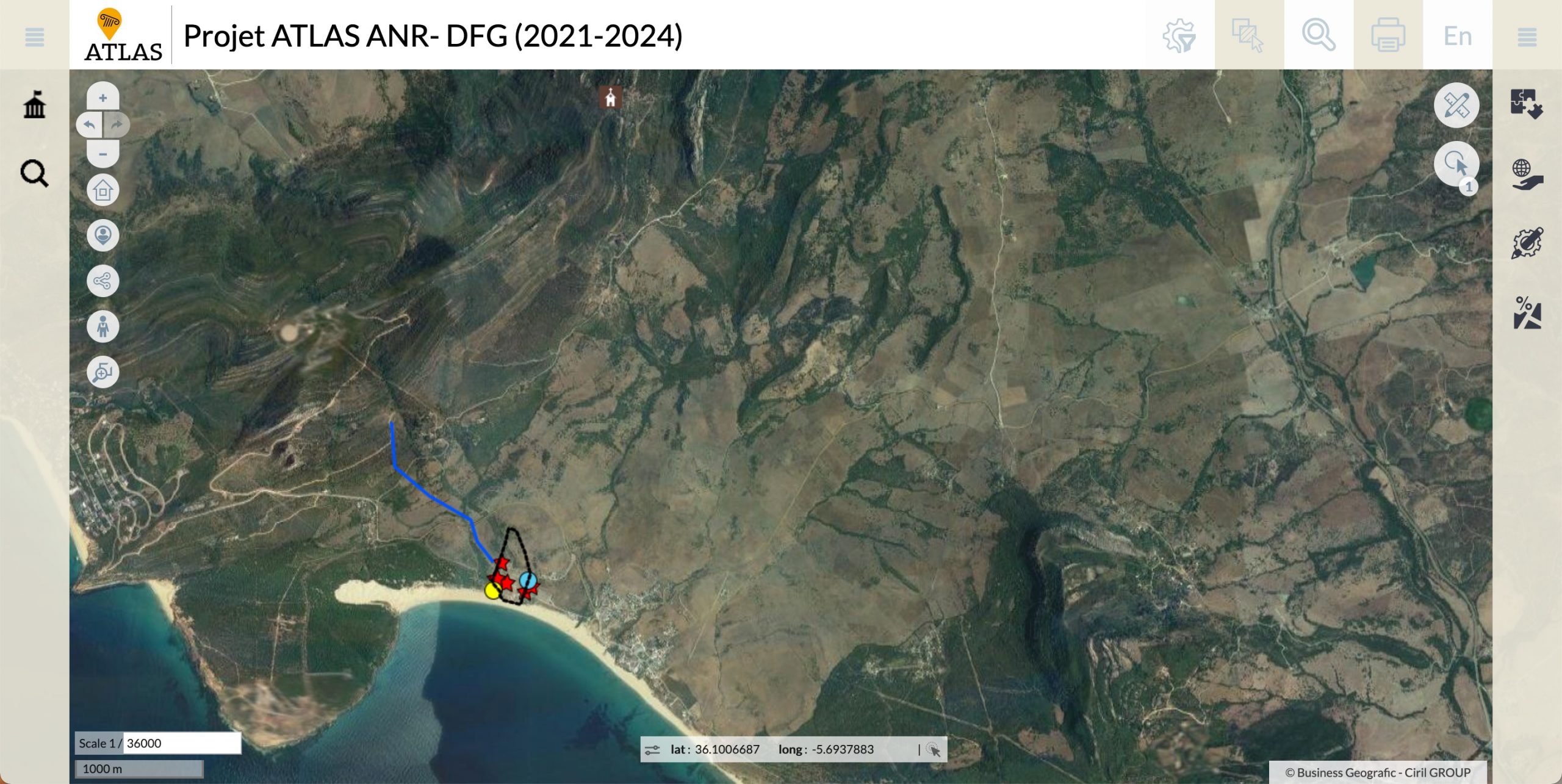 Screenshot of the web interface of the GIS – as you can see, we started with Baelo.
The acronym GIS stands for “Geographic Information System”, which refers to a set of digital applications that allow the storage, integration and analysis of geographically referenced data (See here for an online course organised by Toletum). Their application in archaeological and historical studies has grown exponentially in recent decades, to the point of becoming essential tools for managing and visualising large volumes of data in the geographical plane, in turn aiding a more complex analysis of the data. In the specific case of our project, this GIS is presented in a web interface hosted on the Huma-Num server, a research infrastructure for the human sciences developed by the CNRS, the Campus Condorcet and the Université d’Aix-Marseille.
 Part of the team at work during the WebGIS workshop. From left to right: Ada Lasheras, Pieter Houten, Frédéric Pouget y Laurent Brassous.
But, of course, this training workshop was not all theory, we also put it into practice! From Tuesday 18th to Friday 21st we have been incorporating all the information gathered on Baelo Claudia which, as you know, is the case study we decided to start with last April. The workshop allowed us to share and debate ideas with the La Rochelle members Laurence Tranoy and Stephanie Guédon to improve the database in its earliest days. Thus, in parallel to the debate on the names and organisation of the different elements or on the way of presenting the information, we have been able to implement new improvements in the database and WebGIS itself.
As you can imagine the course and discussions at La Rochelle university have been a linguistic challenge for those less well-versed in French. For Ada and Pieter this was a deep immersion into French. The WebGIS training incorporated a French class, as all was explained in French, but by a very patient Frédéric, speaking slowly and kindly repeating when needed. Where we went completely astray, Laurent was so kind as to provide a translation in Spanish. As this is the language we all have in common, we decided to use this language for our discussions. Admittedly, we also used German and English just to complicate matters a bit more. In practice we have no problems representing the multilingual nature of our project. Nonetheless, one of our discussions is how to represent the trilingual nature of our project in WebGIS. Well that needs some thought and discussion, we will return to this in another blog. Follow us on this page, or even better via Twitter: @ATLAS_cities