Categories
Nicht kategorisiert

Post-docs say goodbye

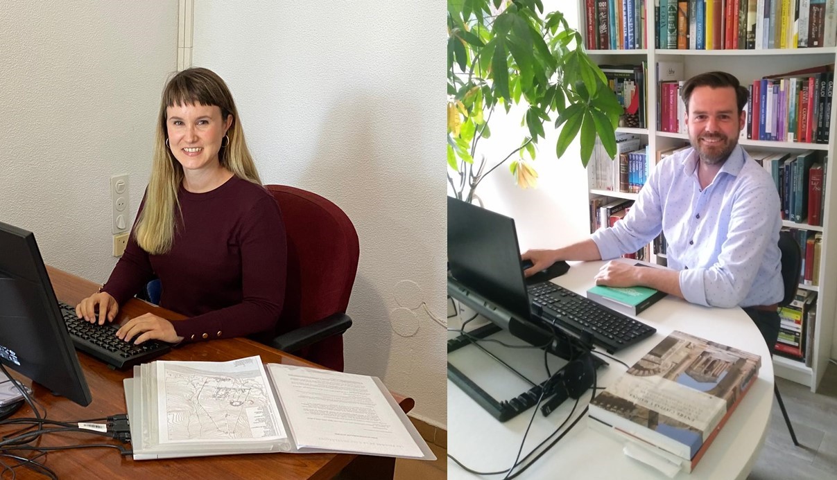
Three years ago we started as post-docs in the ATLAS project. One of our tasks was writing this blog, and now we are writing our penultimate post about our experiences in the project and the plans for the future.

Team meetings, visits to cities and sites
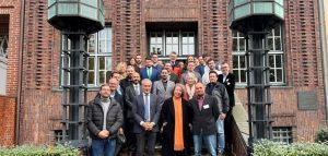
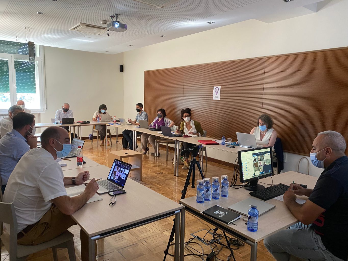
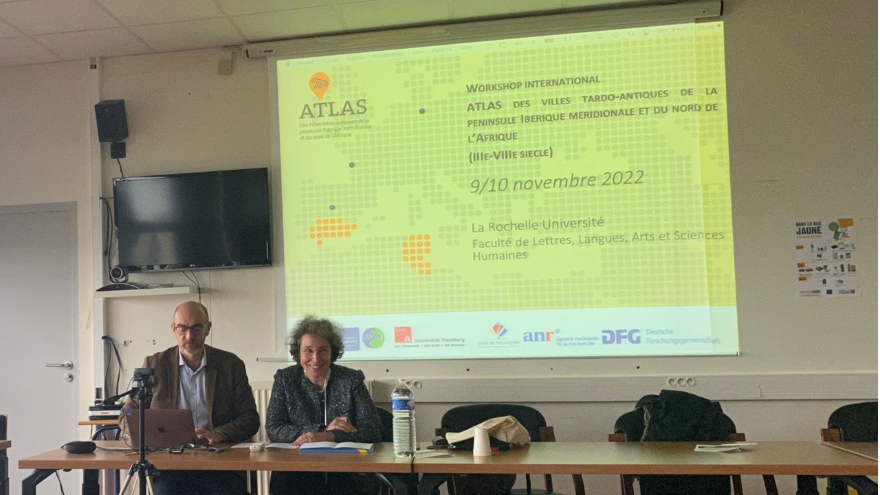
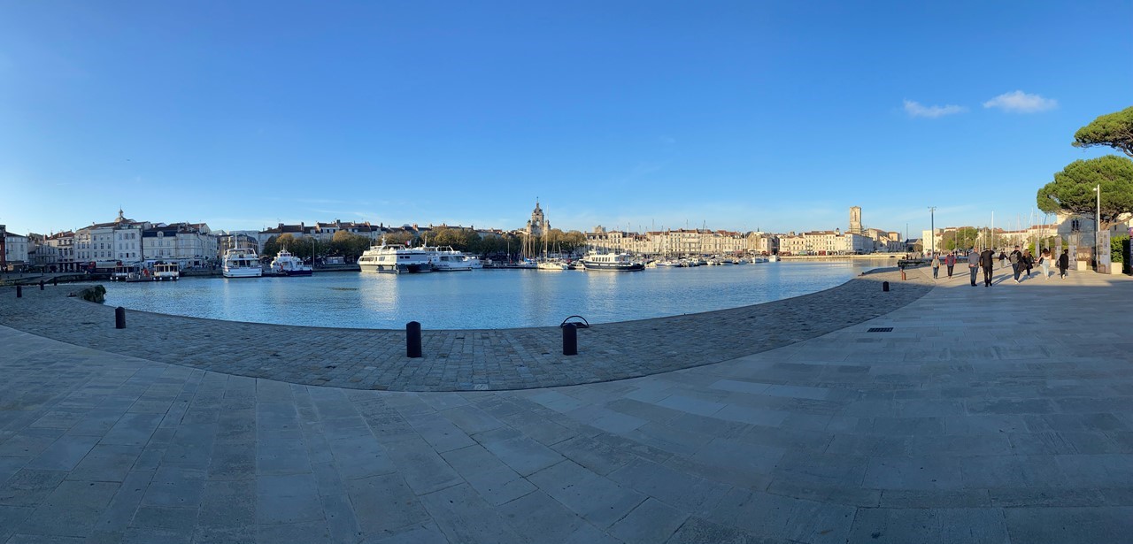
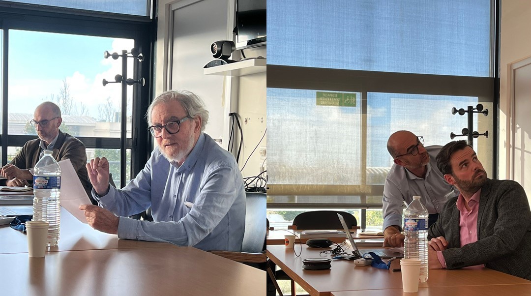
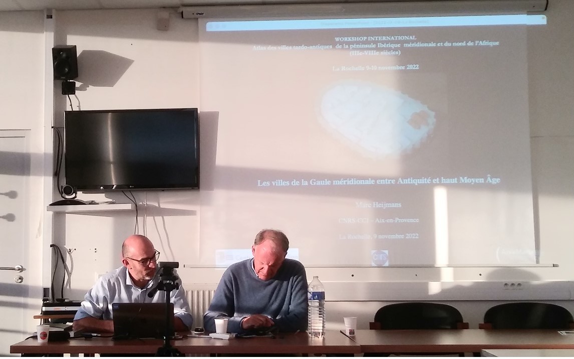
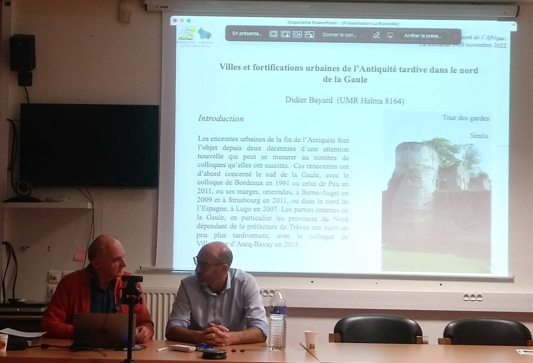
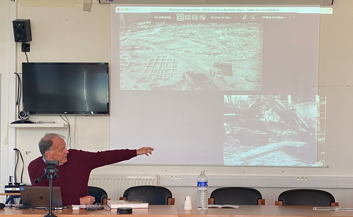
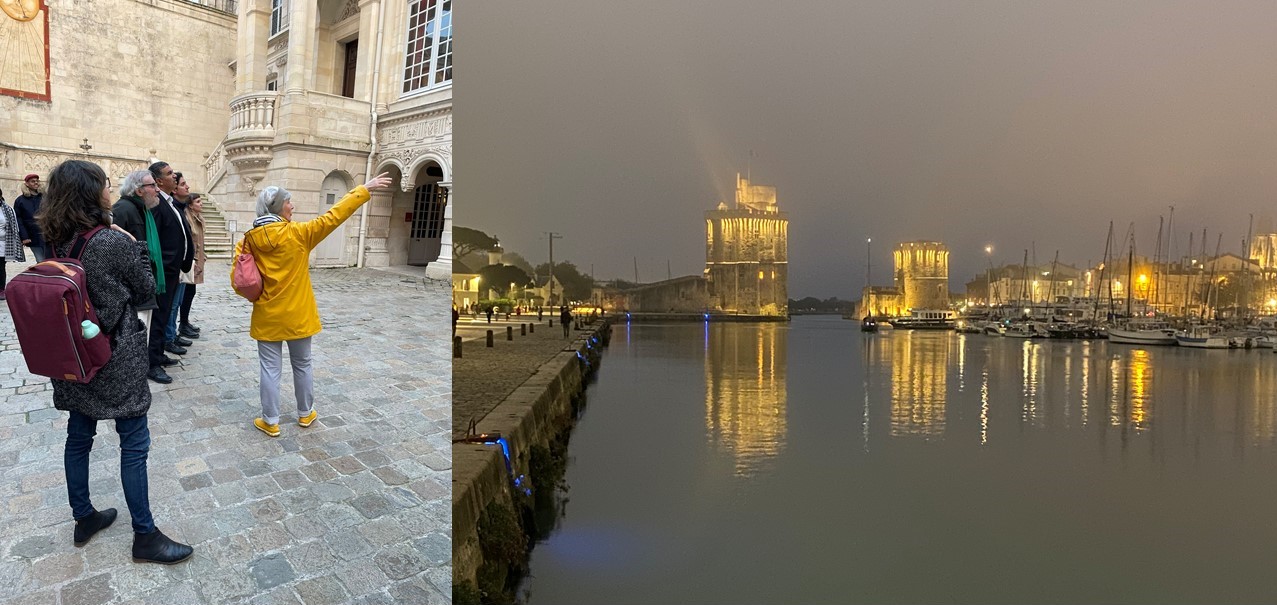
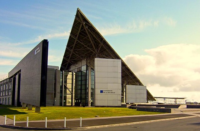
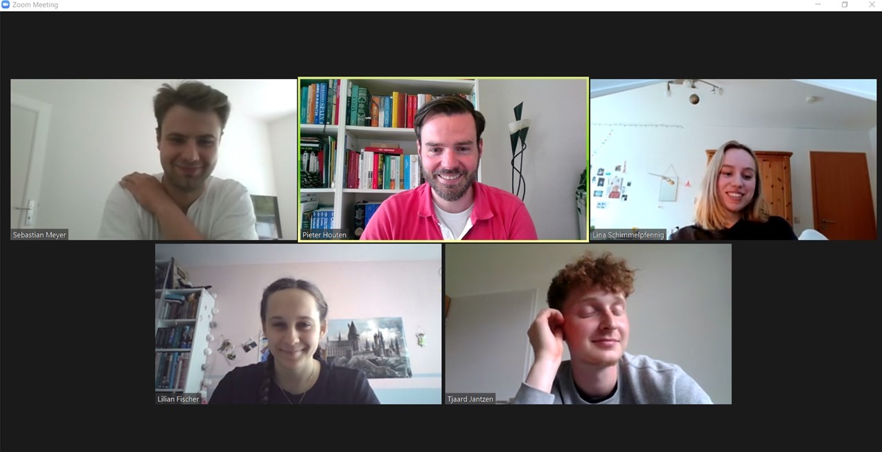
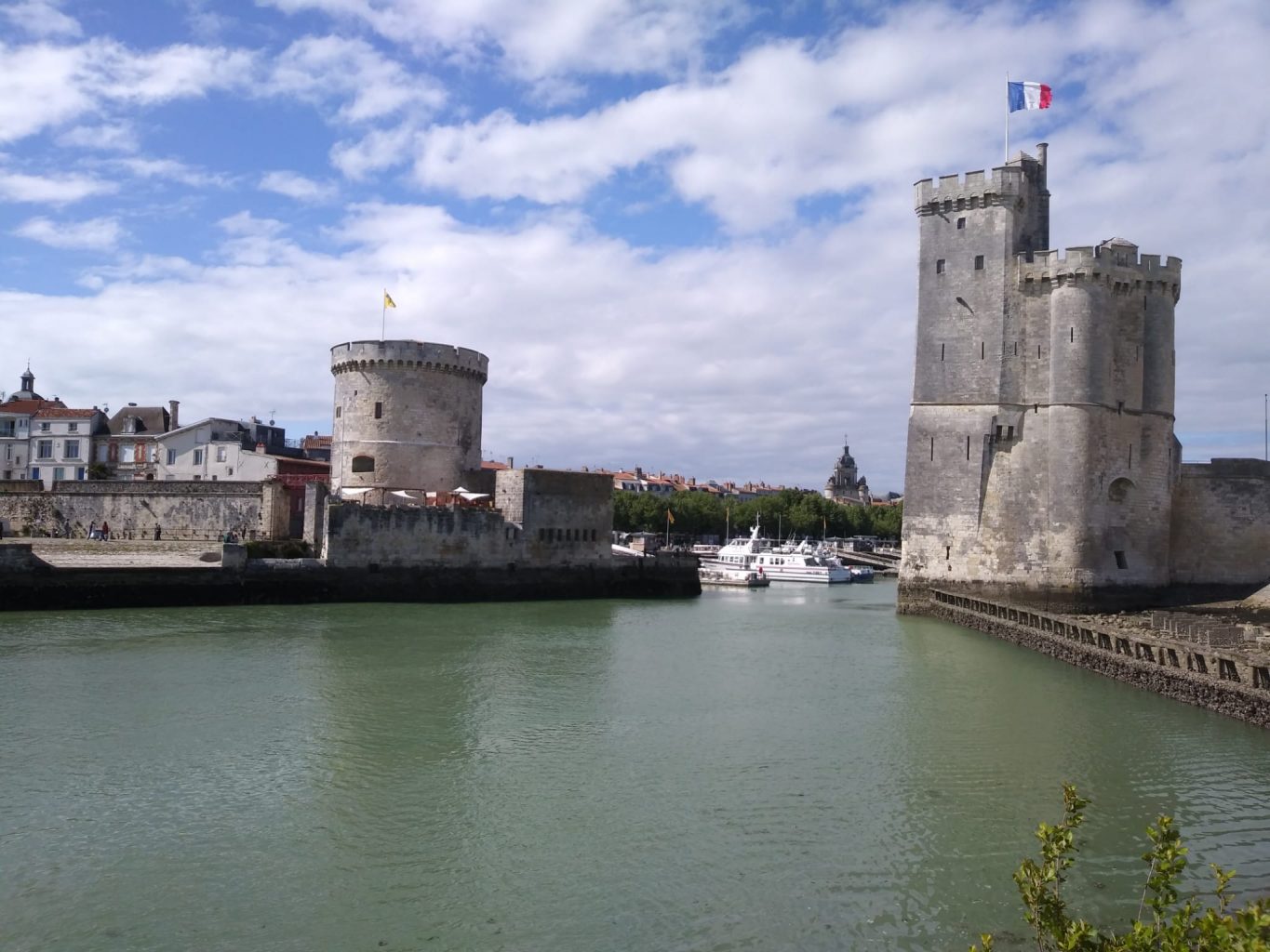
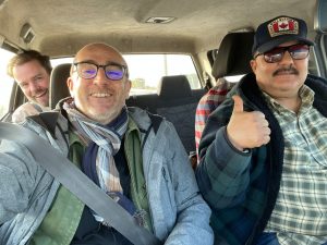
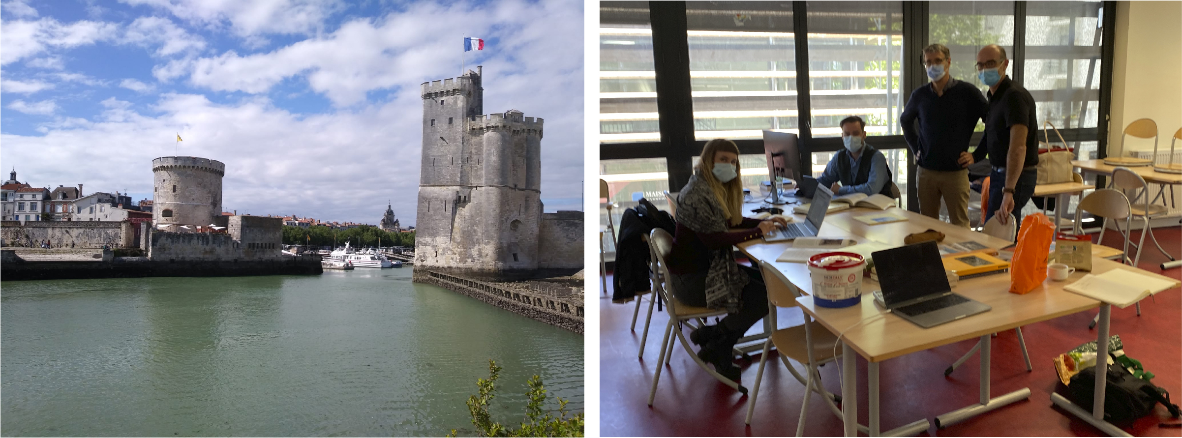
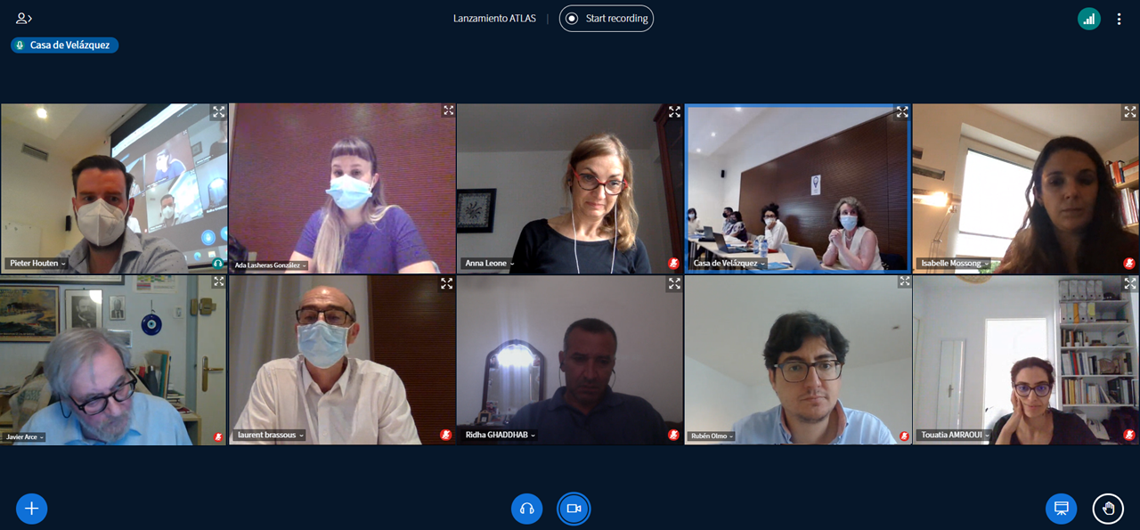
So let’s start with the beginning in April 2021. As we all remember, this was still within the pandemic and it was impossible to travel. So our first meeting as the core ATLAS team was digital. We both remember being a bit anxious, one of the things was the language used in the project. Was the meeting going to be in French or in Spanish? And how are the new colleagues? We had met before in the academic world of conferences, but working together is a real different thing. The meeting, in Spanish, went really well and the plans for a real meeting in La Rochelle were made. As we wrote earlier, this meeting in La Rochelle was a great and weird opportunity to get to know each other better. The sushi dinner in a hotel room and the copious meal at Laurent’s, restaurants in la Rochelle were closed, were very good social events to get the team together and break the ice. Within a month we were already off on a good start.
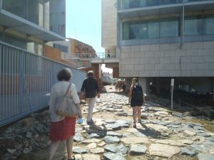
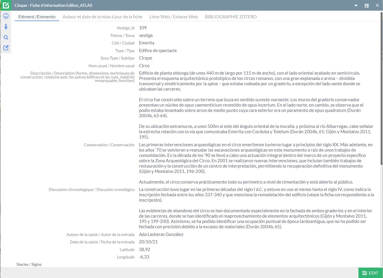
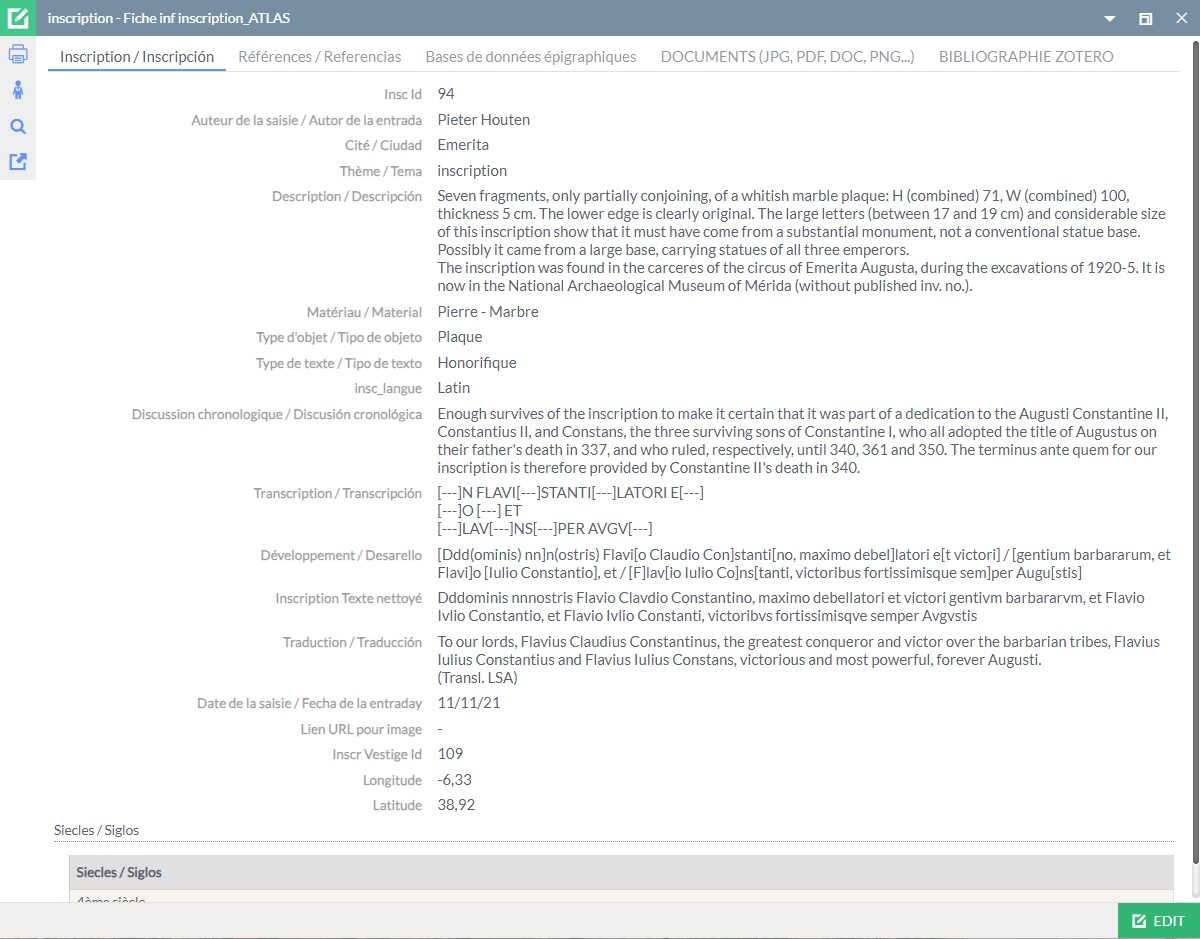
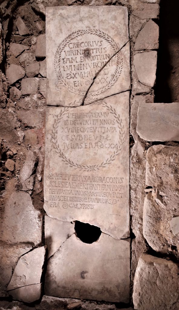
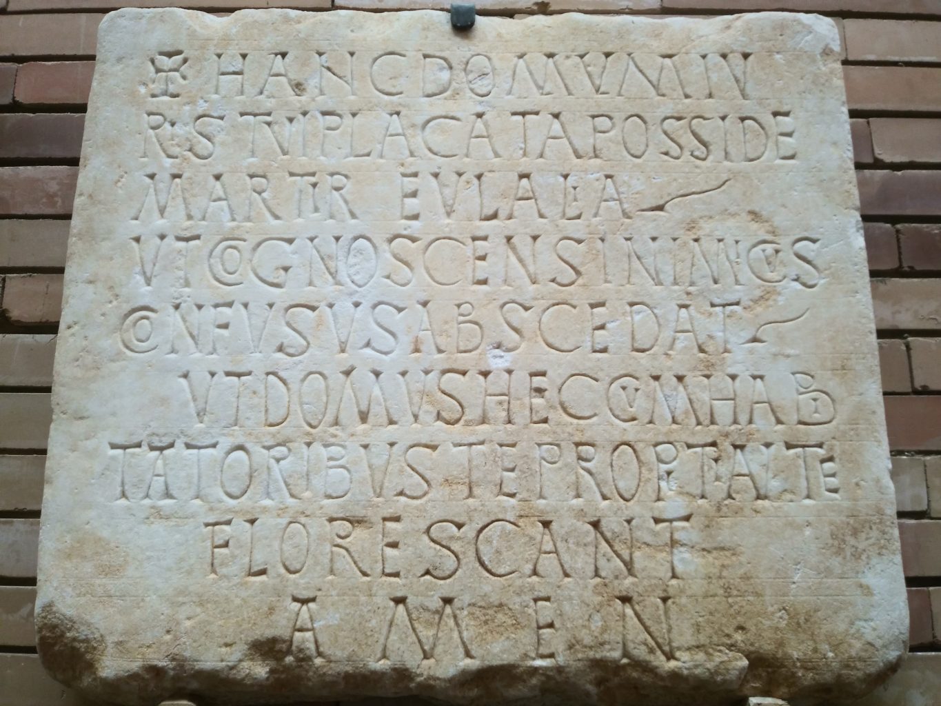
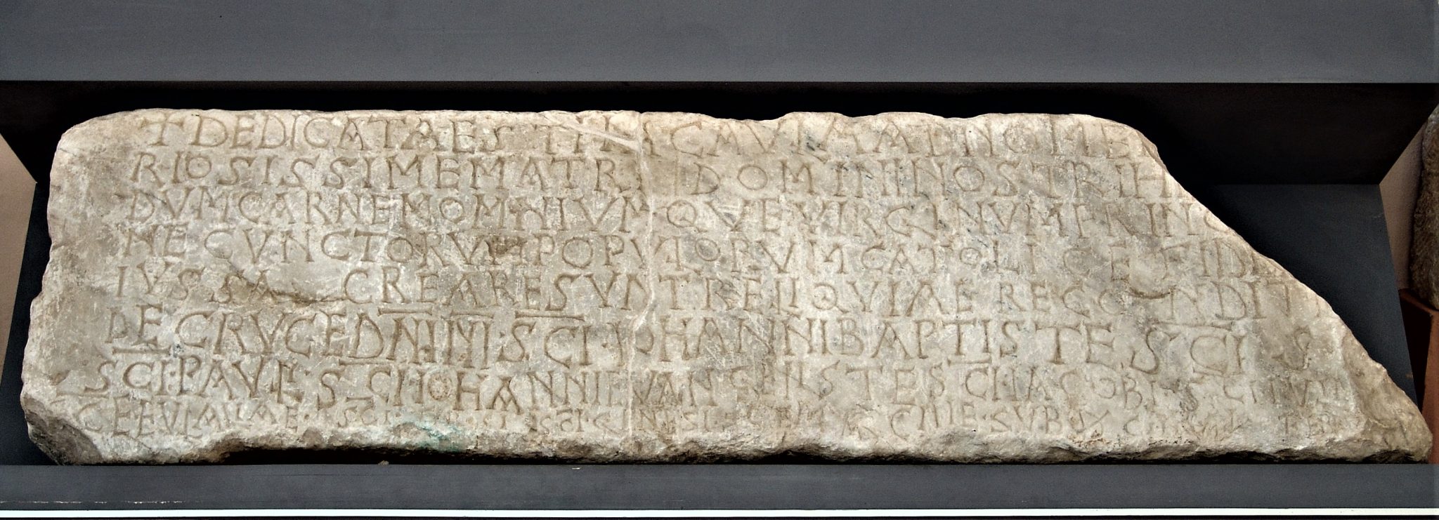
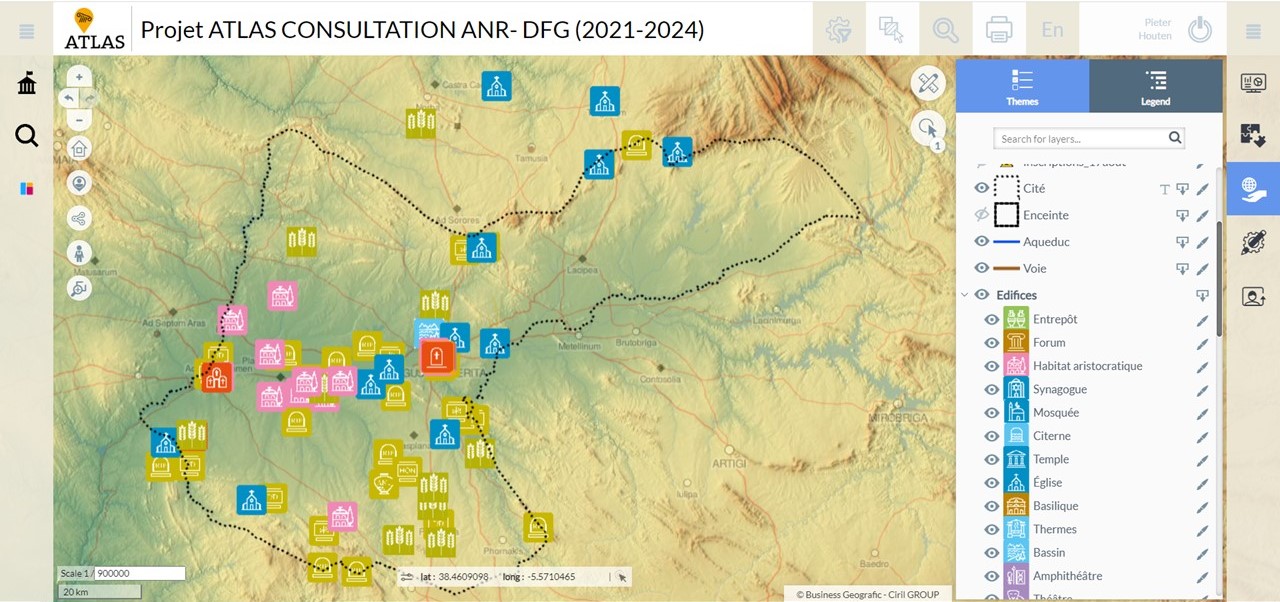
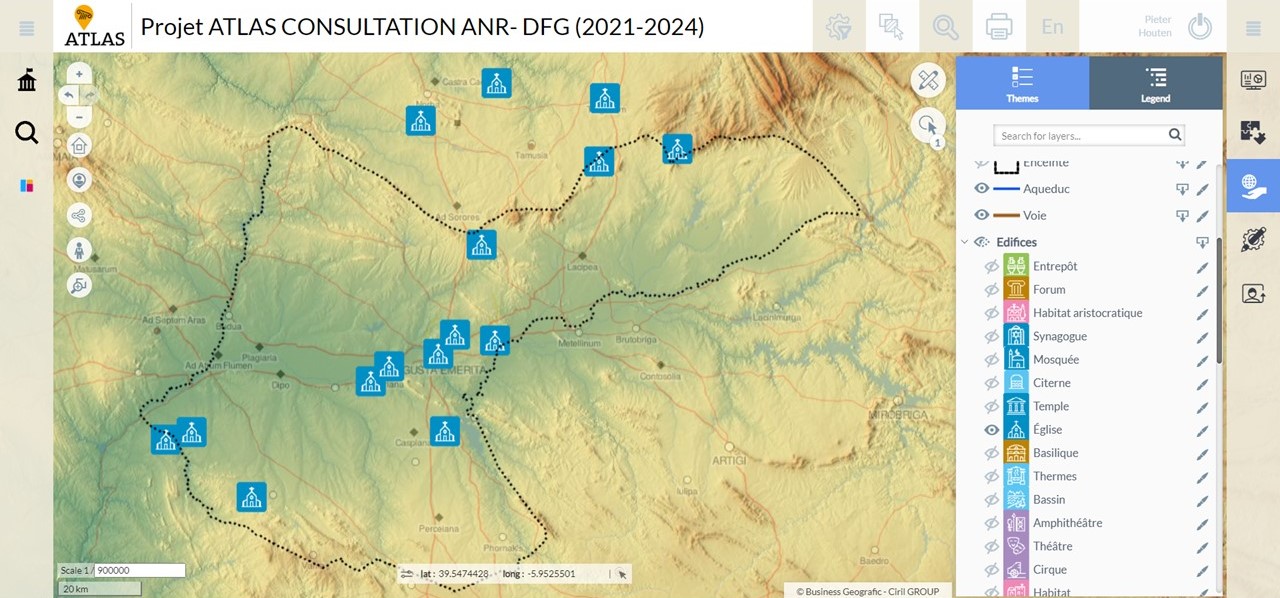
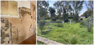
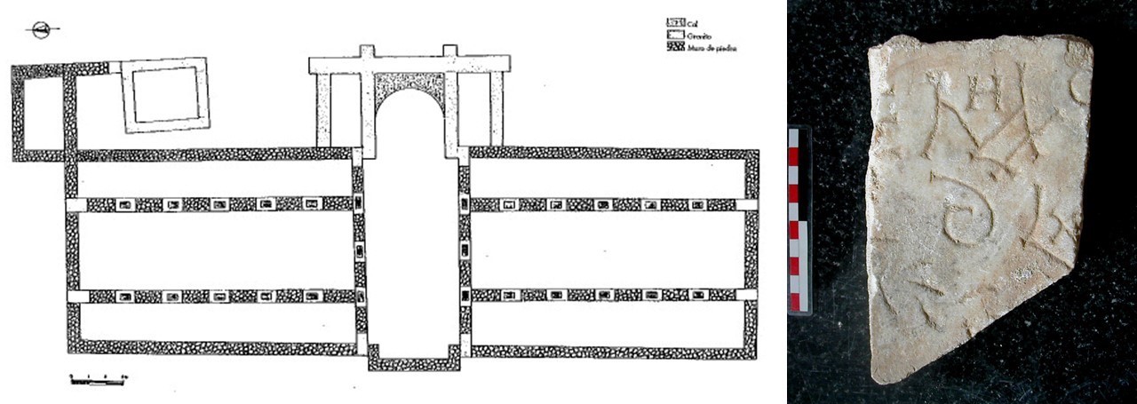
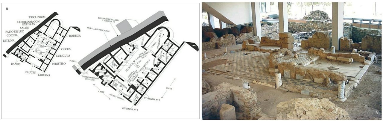
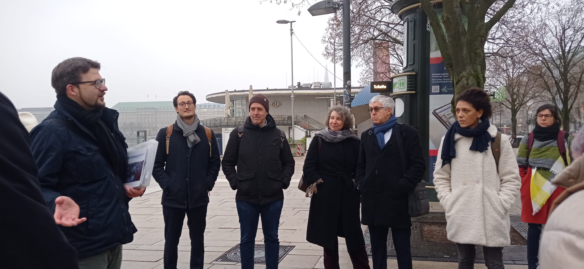
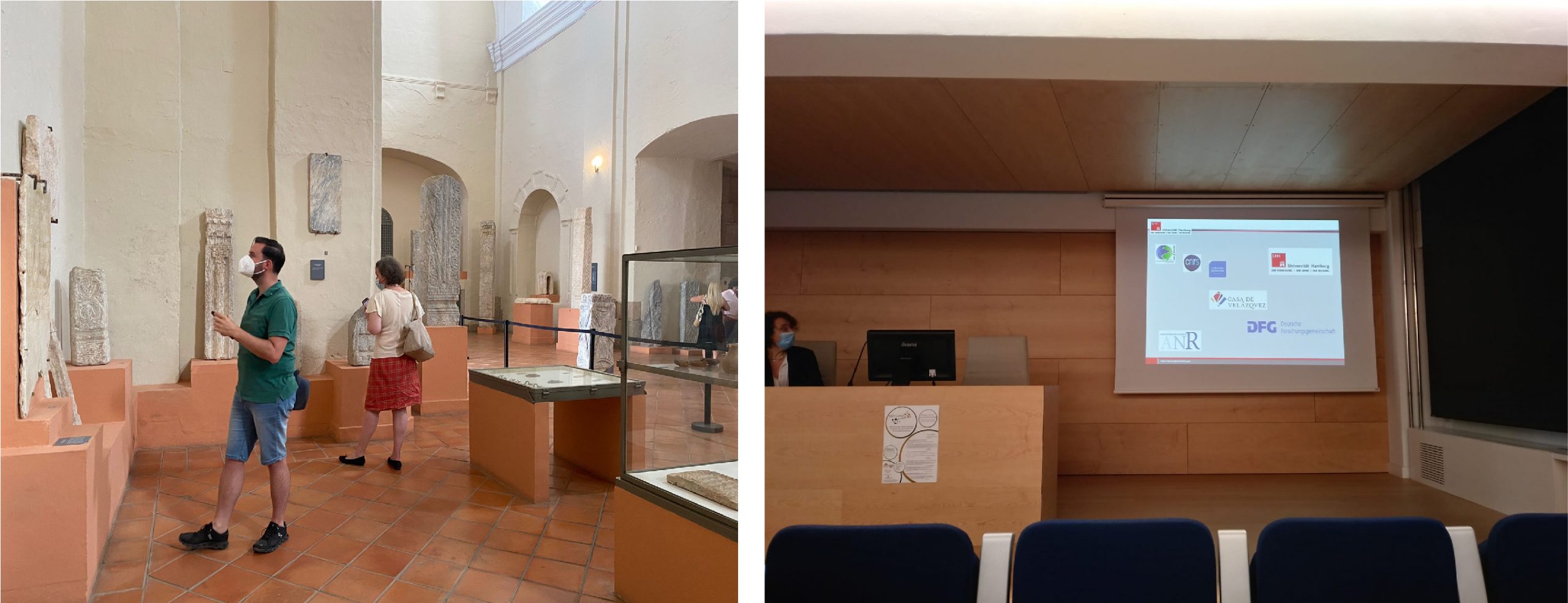
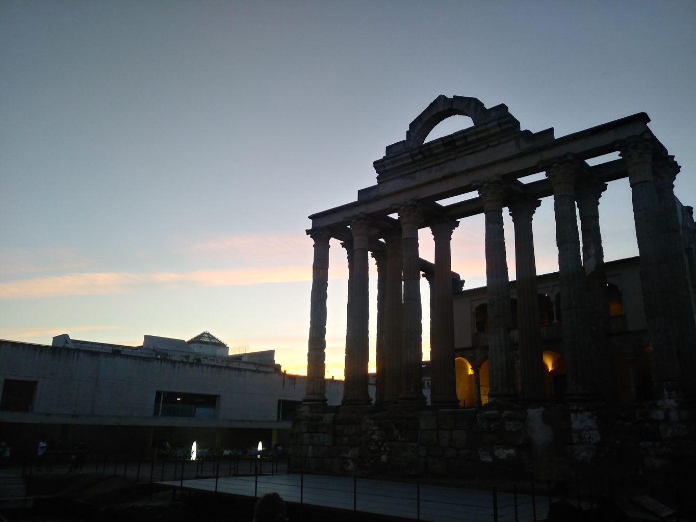
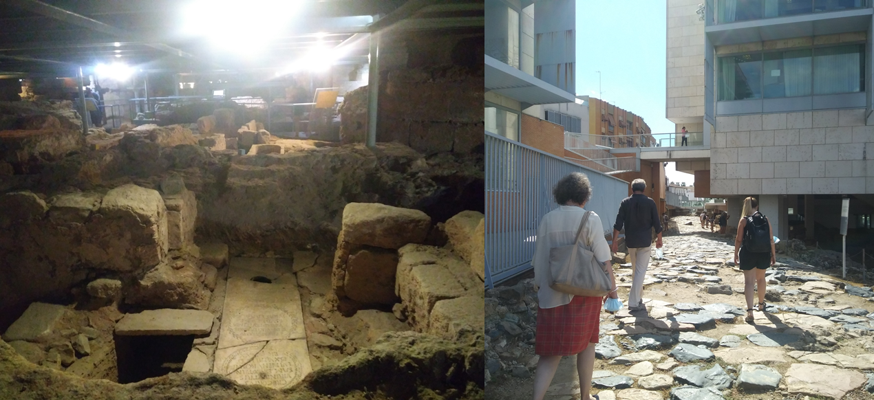
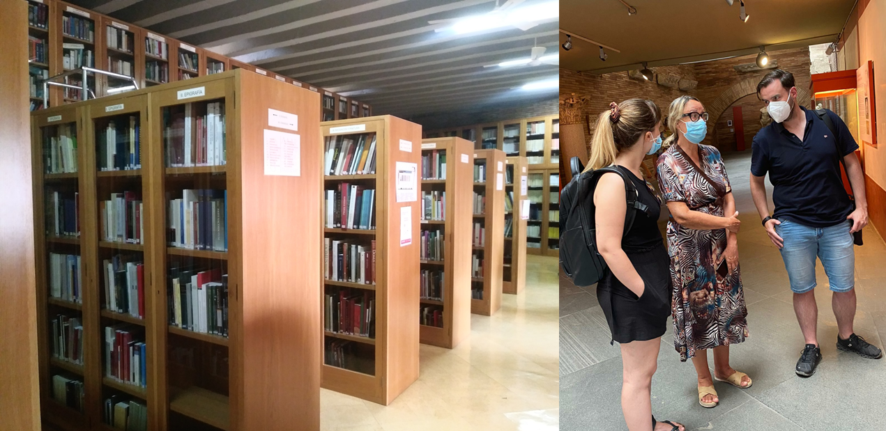
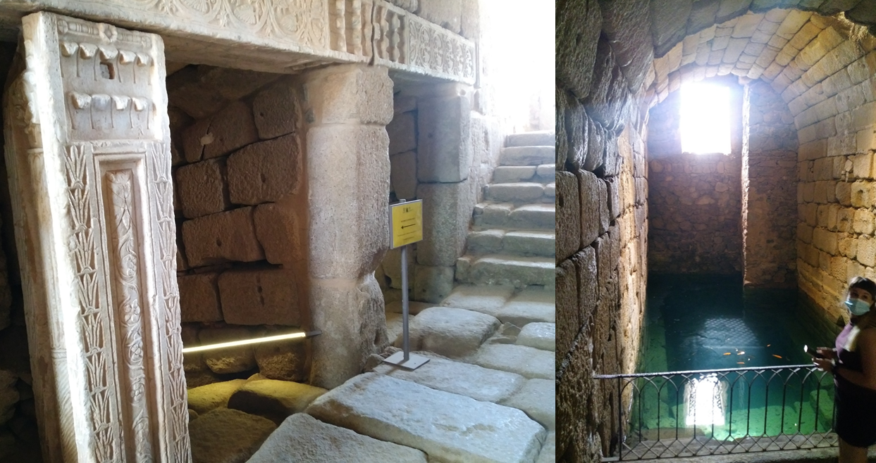
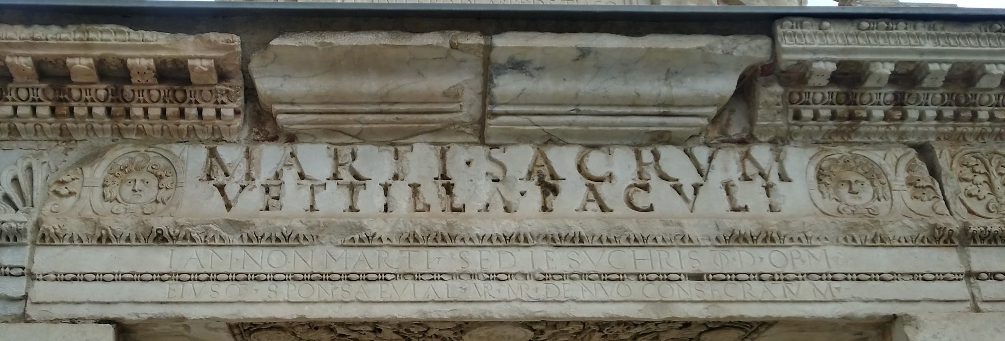
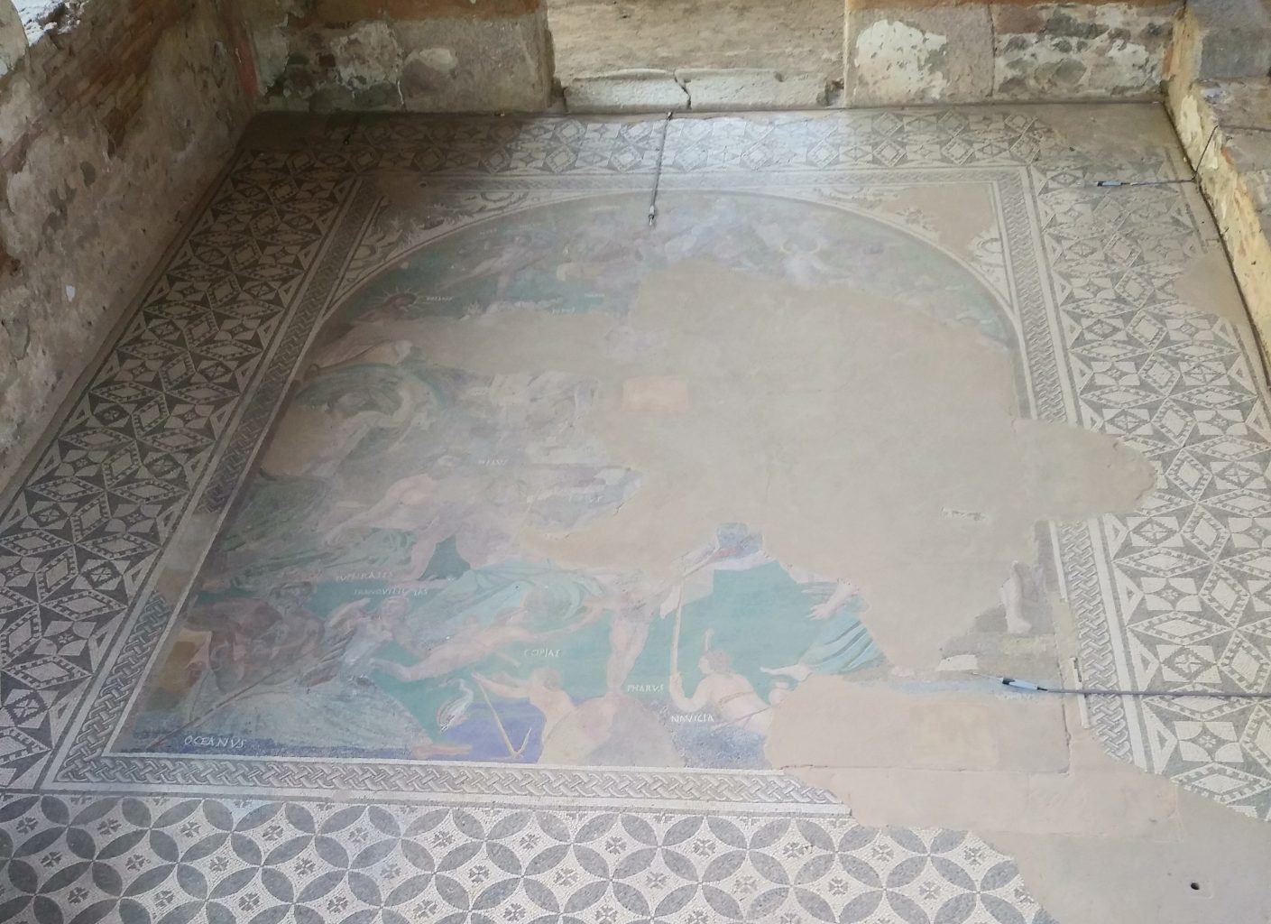
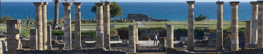
In addition to La Rochelle, the ATLAS core team has been meeting in various parts of the Mediterranean, especially to get first-hand knowledge of some of our case study cities. Thus, in September of the same year, we were able to organise a visit to Mérida, also to meet with some of our project colleagues, renowned specialists in the history and archaeology of this city. This meeting was essential to request and obtain the necessary permits and data to produce the 3D reconstructions for our exhibition. And, at the same time, thanks to our colleagues from Emerita, we were able to enjoy detailed explanations of some of the most outstanding buildings of the late-antique city, as well as the magnificent pieces and inscriptions preserved in the Museo Nacional de Arte Romano.

Visit to Mérida in September 2021.

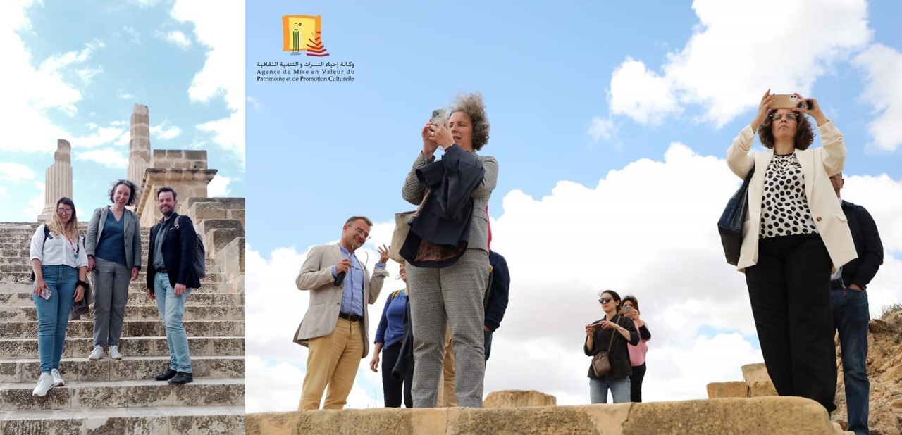
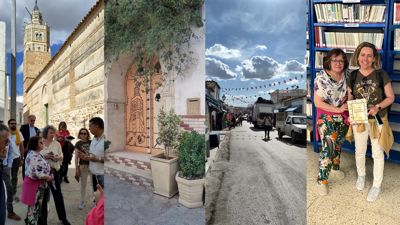
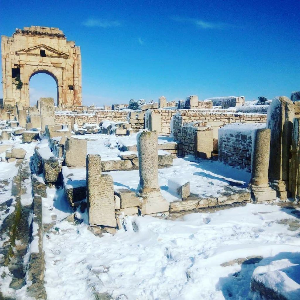
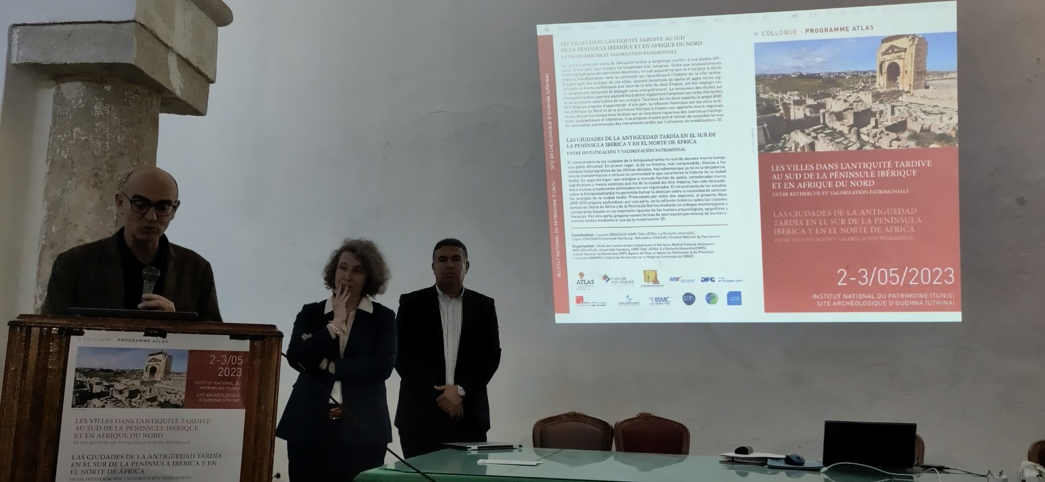
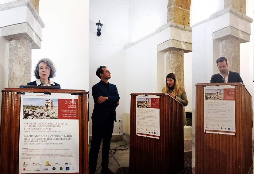
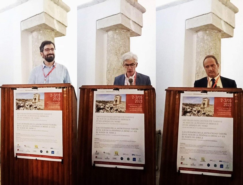
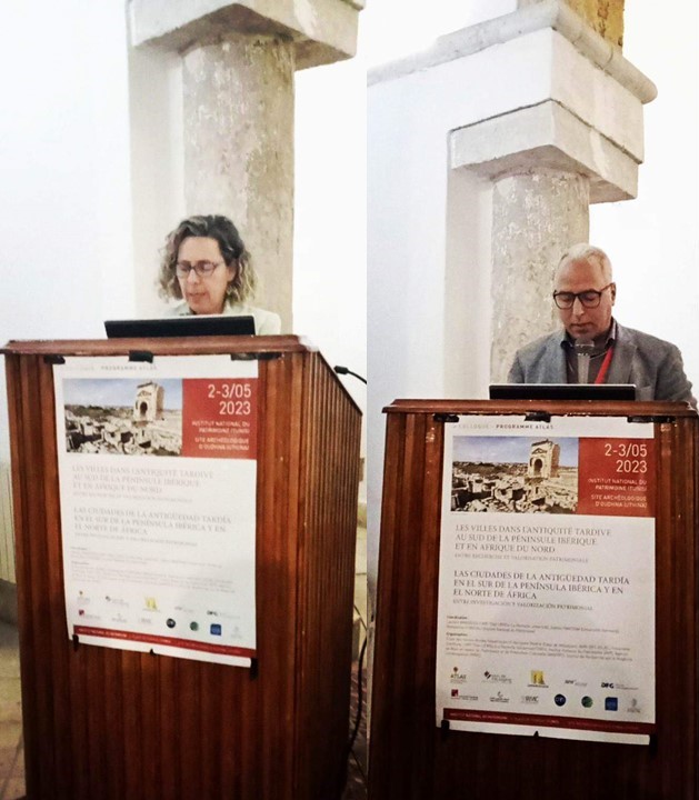
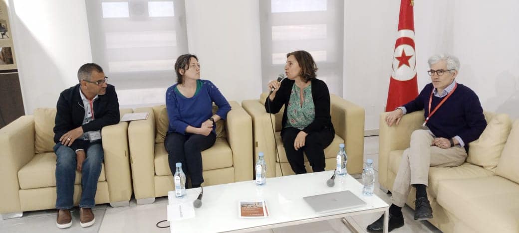
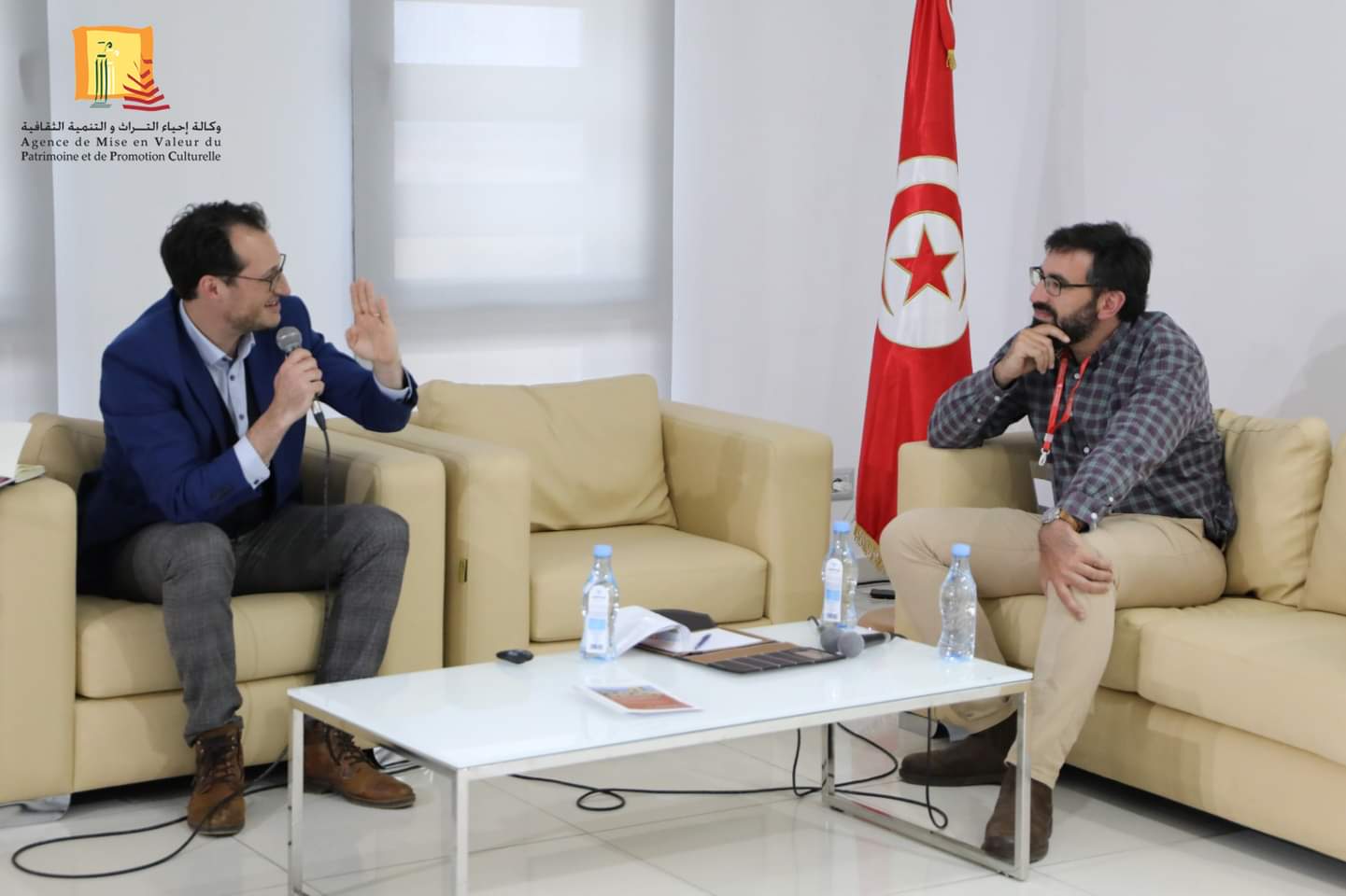
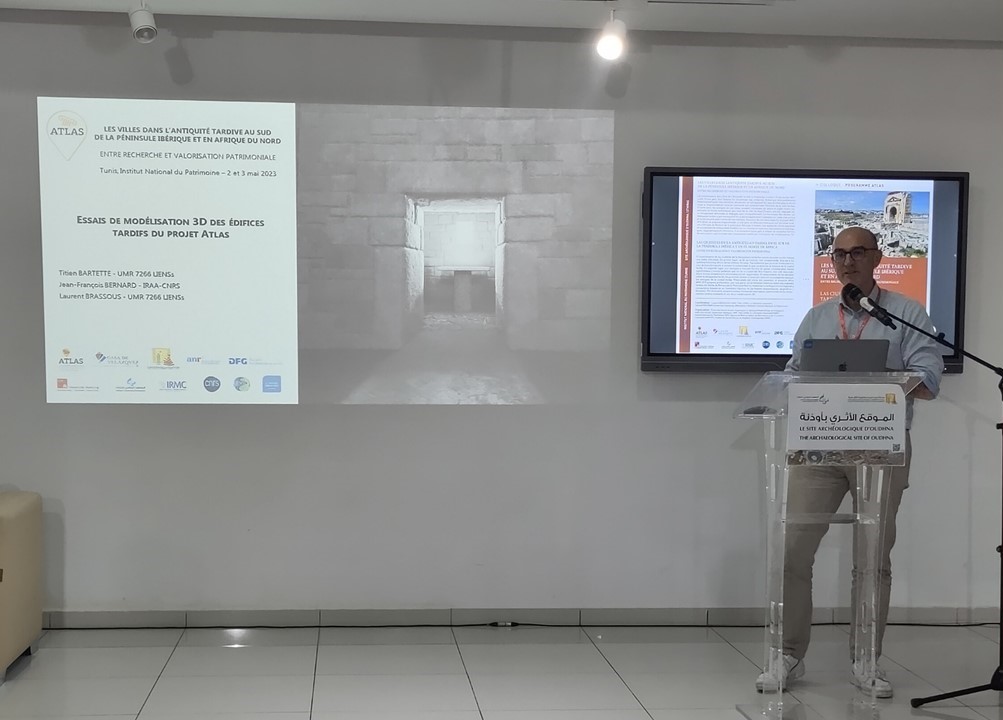
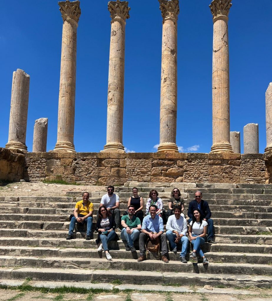
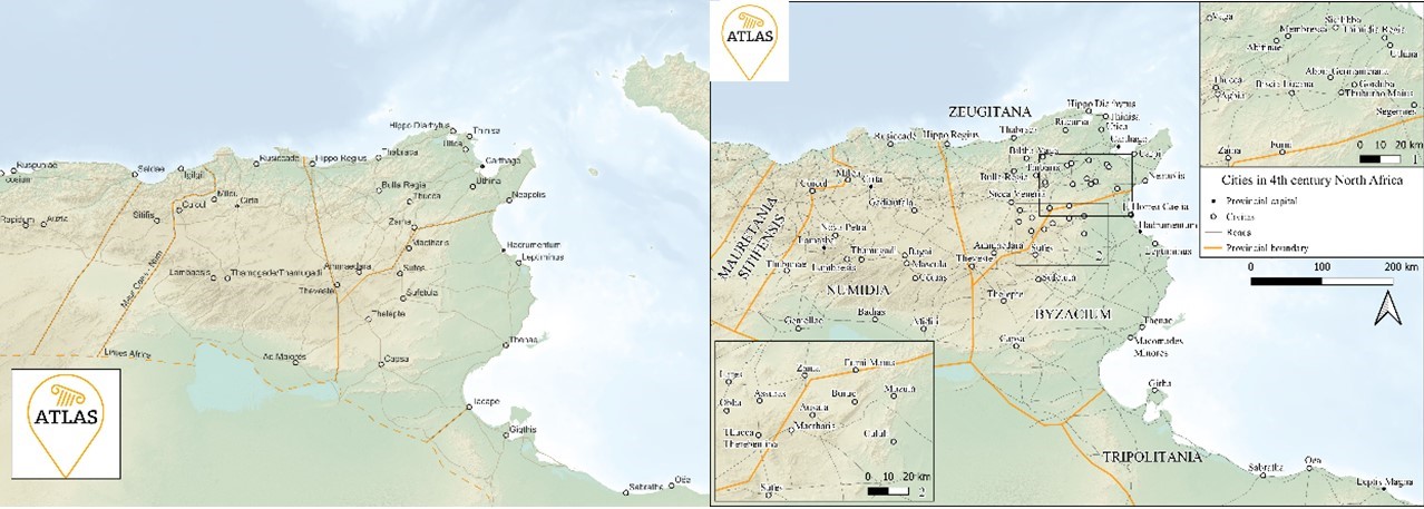
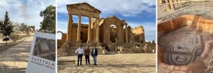
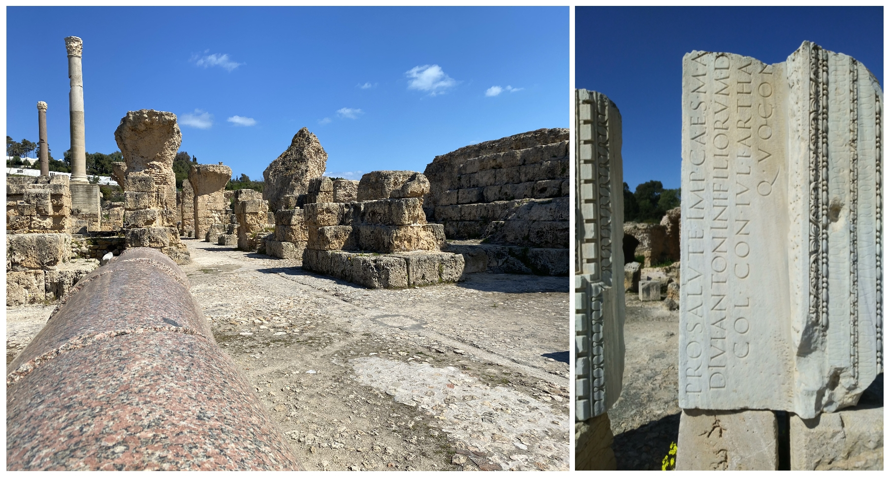
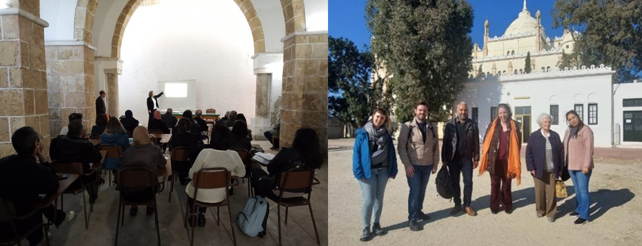
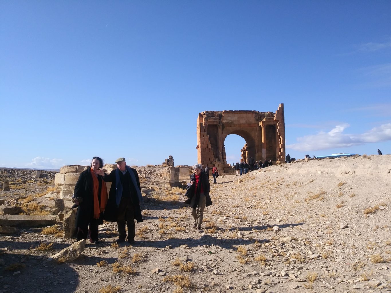
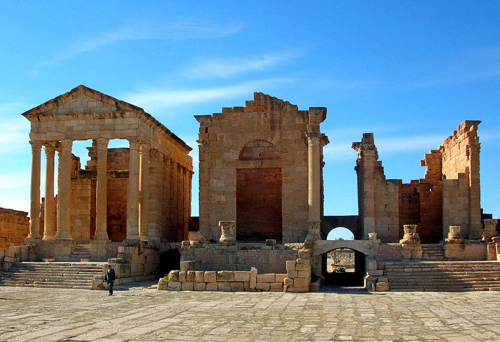
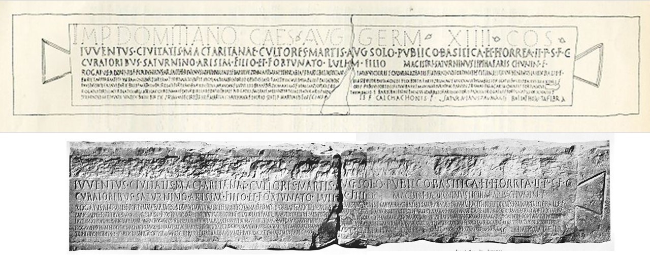
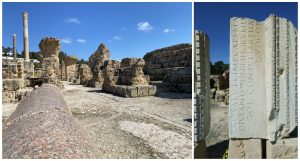
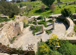
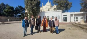
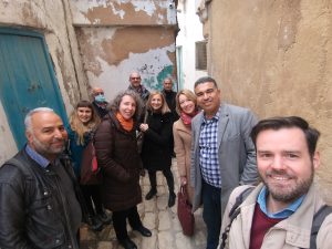
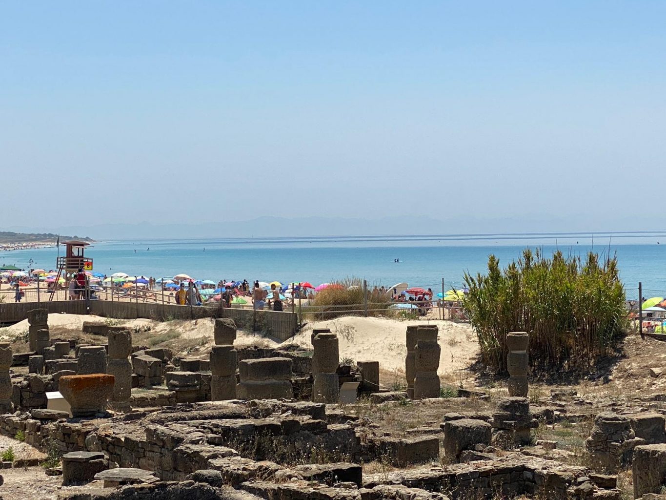
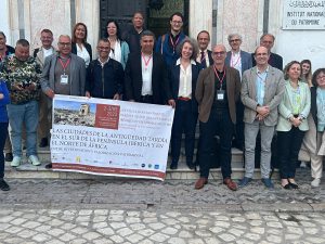
Our next team meeting was already in March 2022, and on the southern shore of the Mediterranean. This time the four of us travelled to Tunisia, where we met our colleagues from the Institut National du Patrimoine, with whom we also agreed on permissions and data transmission to continue working on our travelling exhibition. There we were able to walk among the fascinating archaeological remains of ancient Carthage, but also to visit other sites such as Mactaris, included in the case studies of the project, or other sites of great interest, such as Zama Regia. Our Tunisian colleagues were certainly excellent hosts and guides, and even took us to taste the real local gastronomy in the heart of the Tunisian medina.

Visit to Carthage in March 2022.

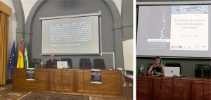
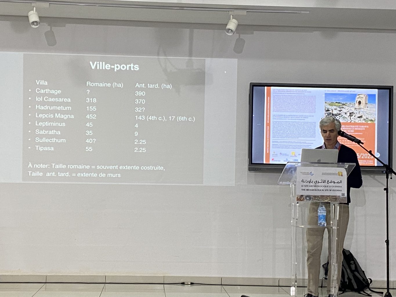
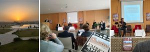
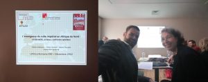
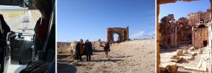
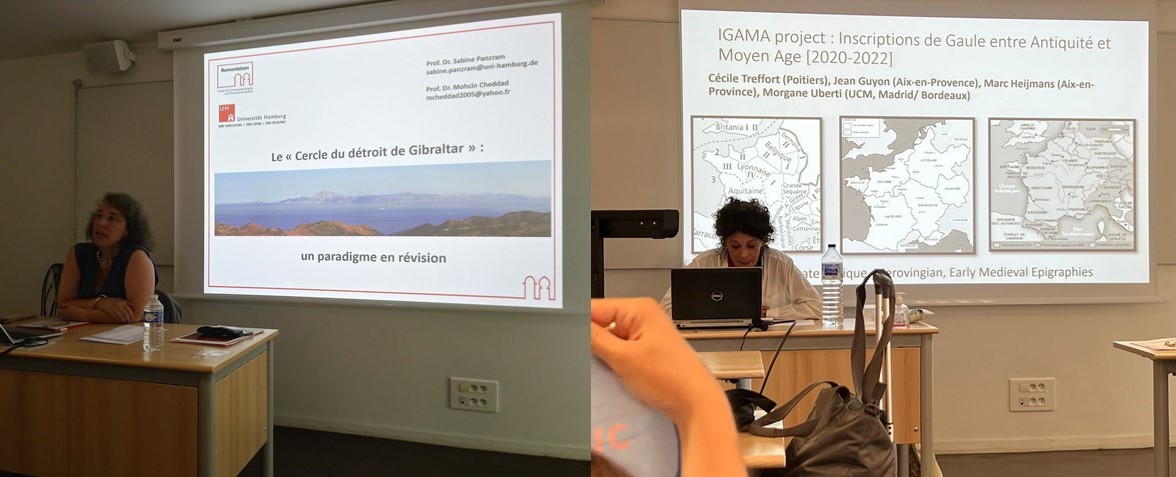
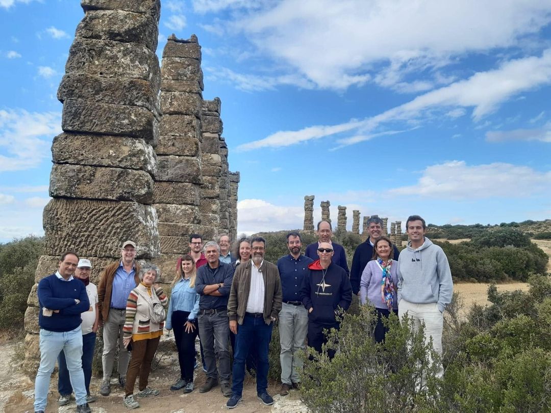
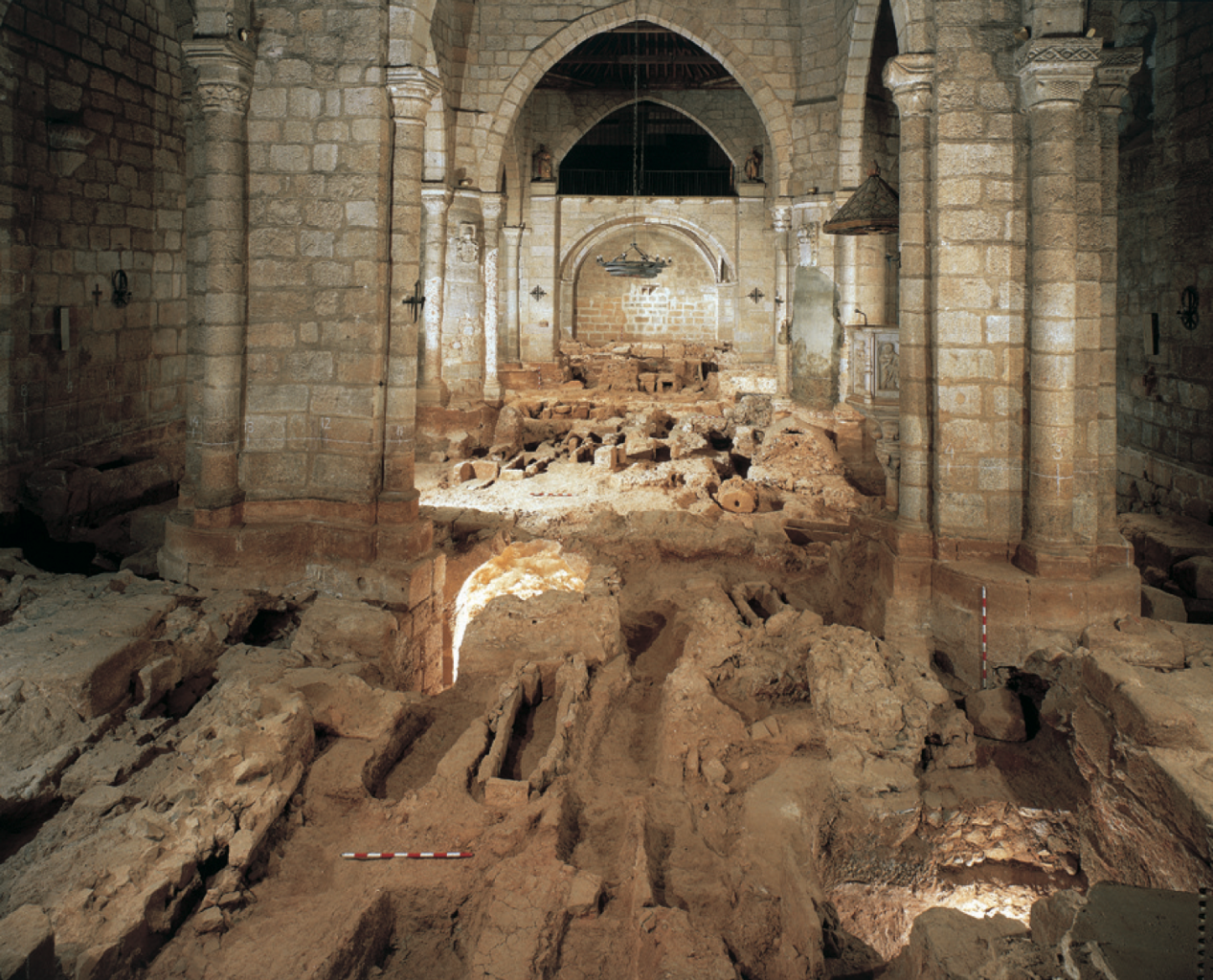
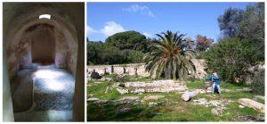
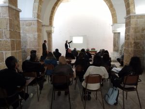
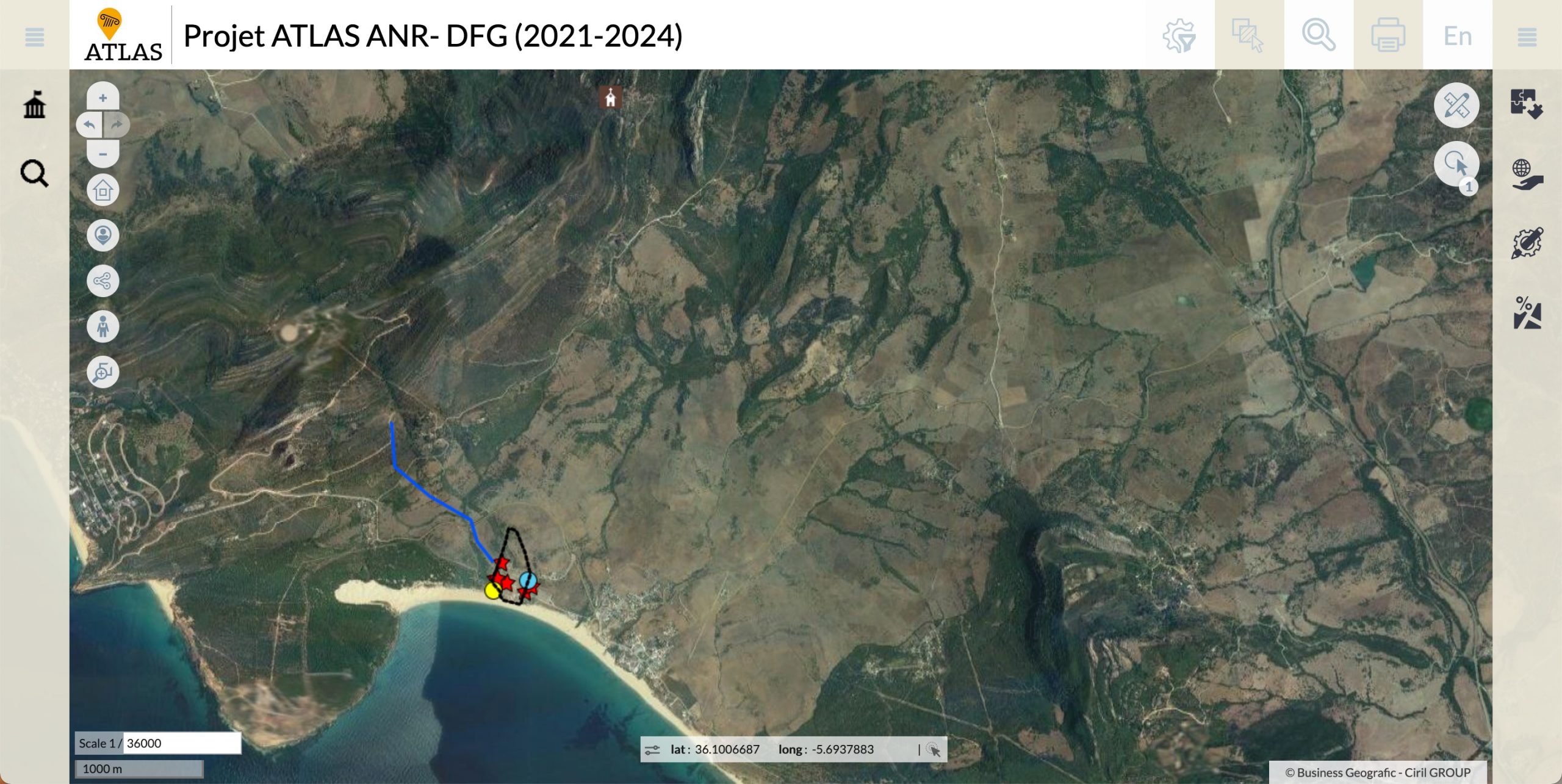
In December 2022, Sabine and Pieter presented a paper at the Africa Romana conference, the paper co-authored with Stefan Ardeleanu should be out soon! This conference took place at Sbeitla, what was once the Roman city of Sufetula. Visiting this amazing site gave us the opportunity to get a grasp of another African city, unfortunately not one of our case studies. Luckily we were able to do an autopsy of a case study city during this visit. As part of the conference programme a  visit to Ammaedara was planned. This visit did not only allow us to see Ammaedara, but also gave the opportunity to speak to the two most relevant researchers of this site: François Baratte and Mohamed ben Nejma. Sabine took the chance to ask François Baratte her pressing questions on the site. The contact with Mohamed ben Nejma led to his visit at the RomanIslam Center at Hamburg where he and Pieter collaborated to create the map for Ammaedara.

Sabine Panzram and François Baratte at Ammaedara in December 2022.

Studying Late Antiquity
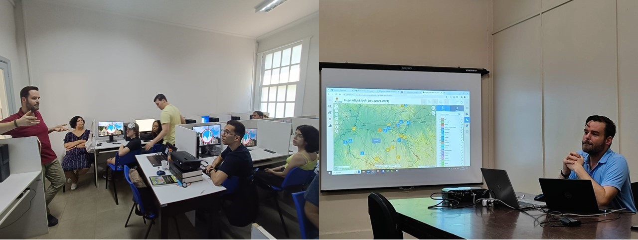
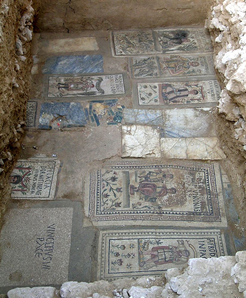
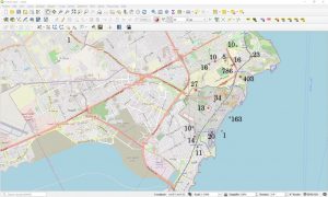
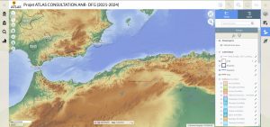
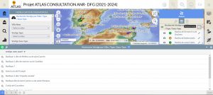
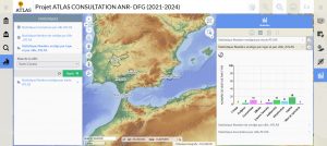
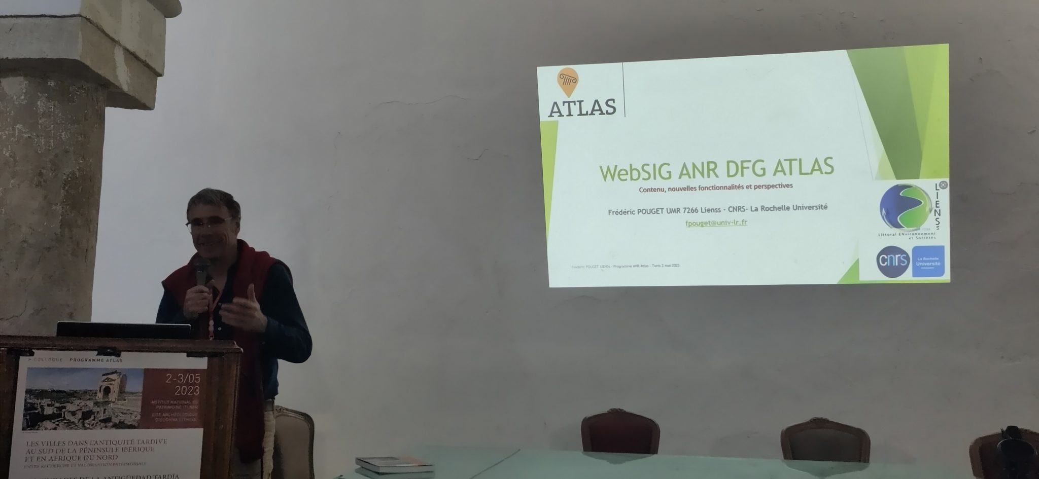
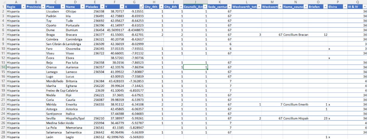
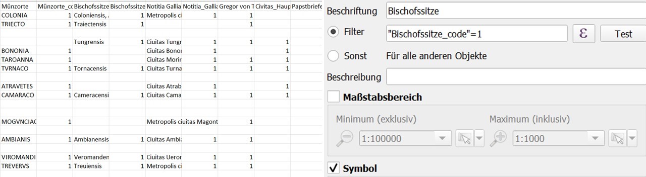
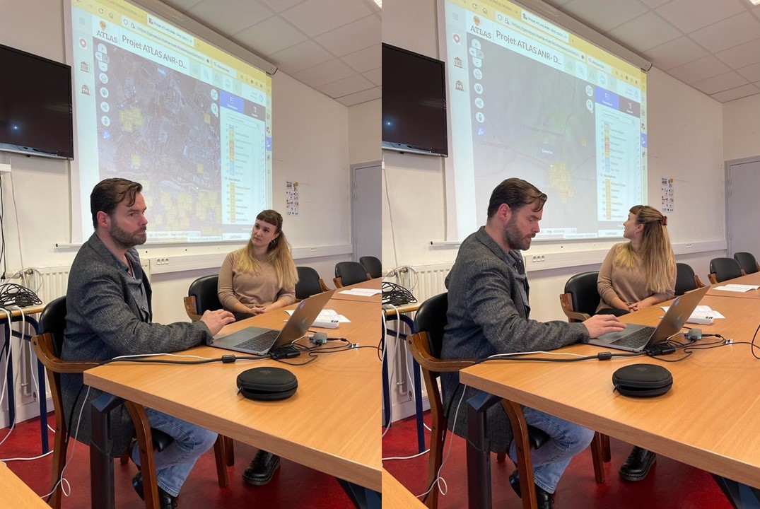
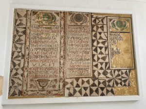
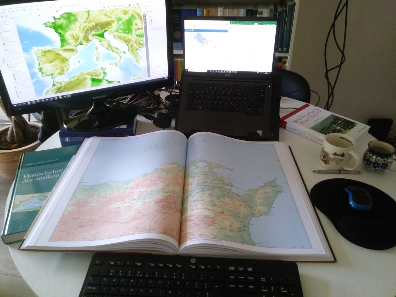
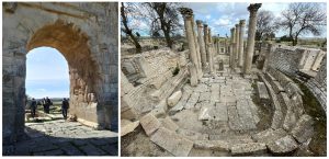
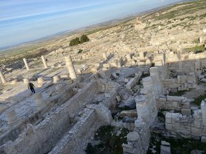
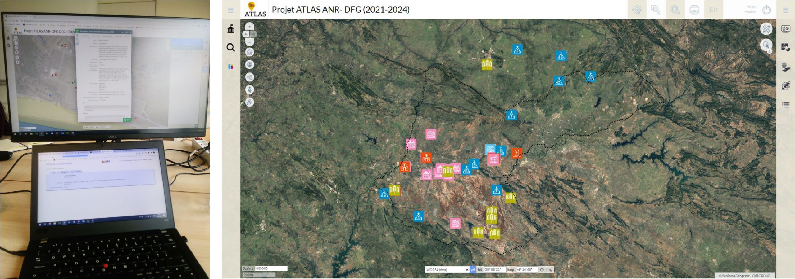
But beyond these visits and team meetings, obviously our main focus has been studying urban phenomena in Late Antiquity through our ten case studies. We have already explained in other blogs how we work and how we incorporate the enormous amount of epigraphic and archaeological information in our particular Geographic Information System in web format and open access (WebSIG). This exhaustive work has undoubtedly allowed us to exponentially expand our knowledge of this complex and interesting period, and also to broaden our geographical focus to regions that we had not had the opportunity to work on directly before. We can now say that we have a good command of the existing bibliography and a good knowledge of the historiography and the state of the art of our cases and regions of study. Moreover, by working together with a specialist in archaeology and a specialist in epigraphy, we have been able to combine these two fields and bring them together in WebSIG in a way that has never been done before. While this interdisciplinary approach is the aim of most projects, it often goes no further than one specialist reading sources from other disciplines. In this case, Ada and Pieter have not only worked together but also discussed issues from different points of view, which has led to new perspectives and raised questions that, for the moment, seem unsolvable (e.g. dating issues in archaeology and epigraphy; i.e. the swamp of circular argumentation…).

The Epigraphy group during one of their meetings.

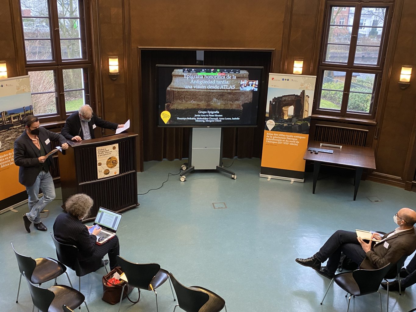
As such the postdocs have indeed brought interdisciplinary work on another level, but this has not been the only teamwork we have done, as we also have the different research groups. These groups, made up of people from many different backgrounds and with different specialisations, have met regularly to discuss and deepen the study of specific topics. Admittedly, the epigraphy group is not so interdisciplinary, since it is simply made up of the project’s epigraphers, but here lies the other novelty of the project: bringing together Hispanists and Africanists. By studying these two regions together we can see some striking similarities and exciting differences. Obviously, the combination of people with different knowledge and backgrounds has also led to interesting intercultural exchanges. It has opened our eyes to new perspectives and changing points of view, as well as triggering discussions resulting from our different ways of working. Sometimes a certain diplomacy has been necessary to keep going. However, this international, intercultural and interdisciplinary way of working is very rewarding and we look forward to continuing to collaborate with our colleagues.
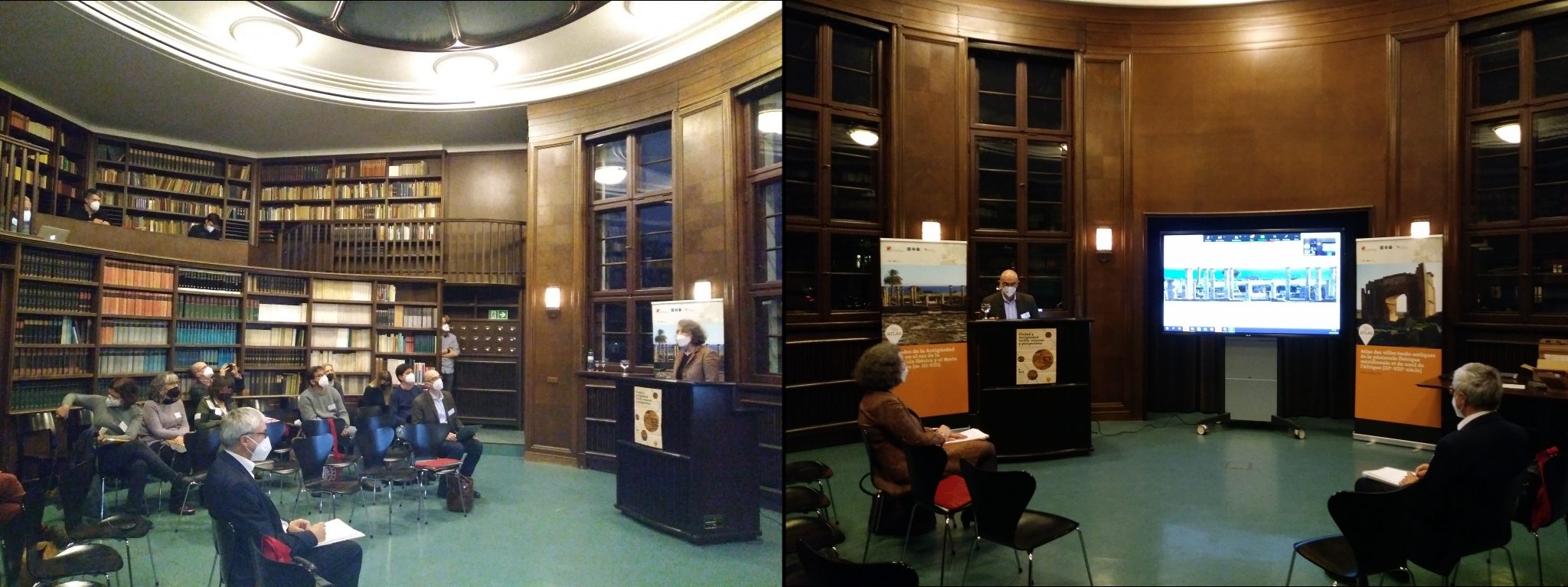
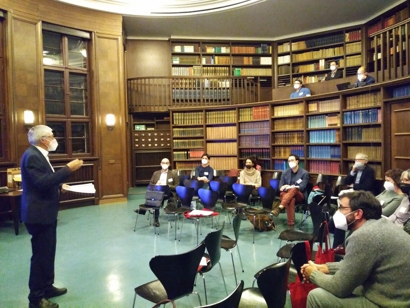
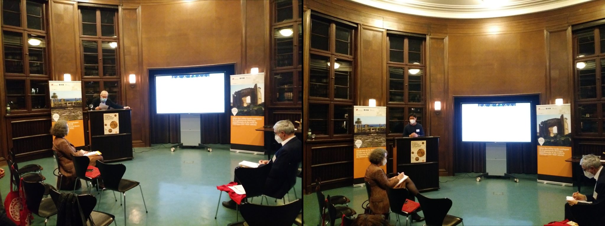
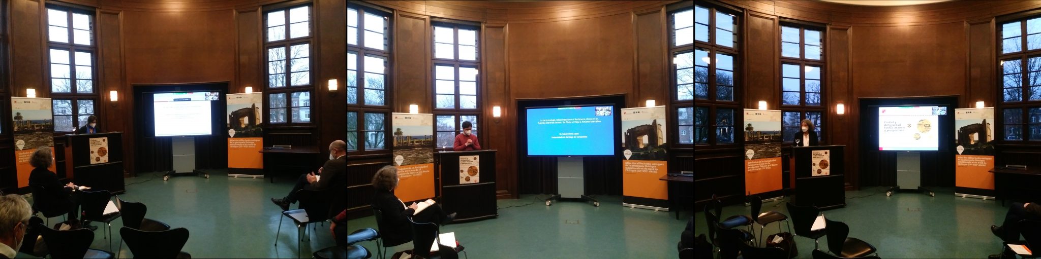
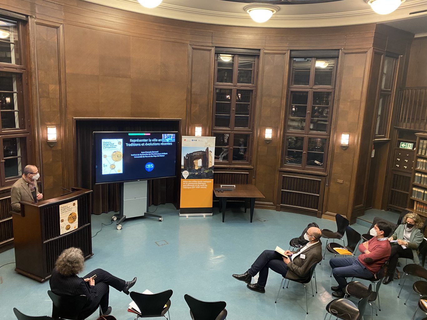
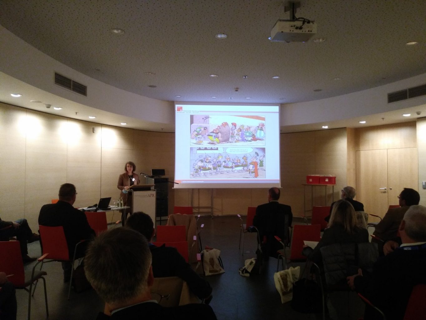
Yearly workshops
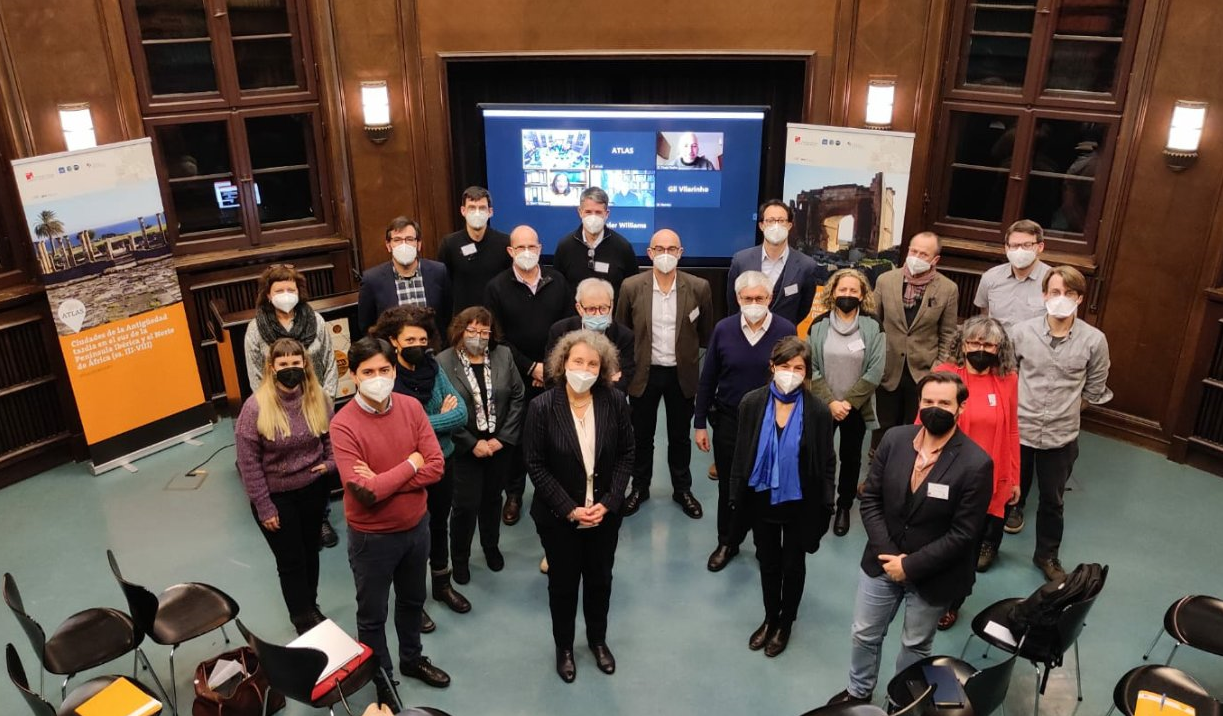
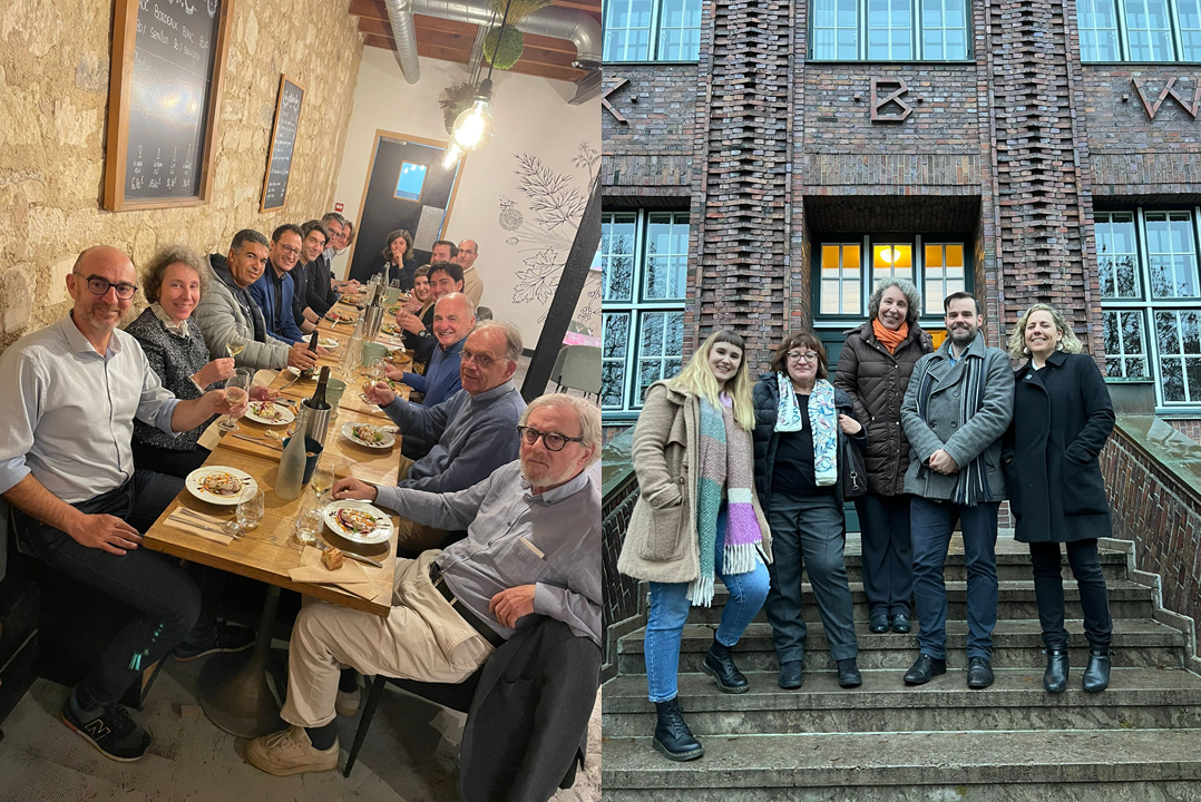
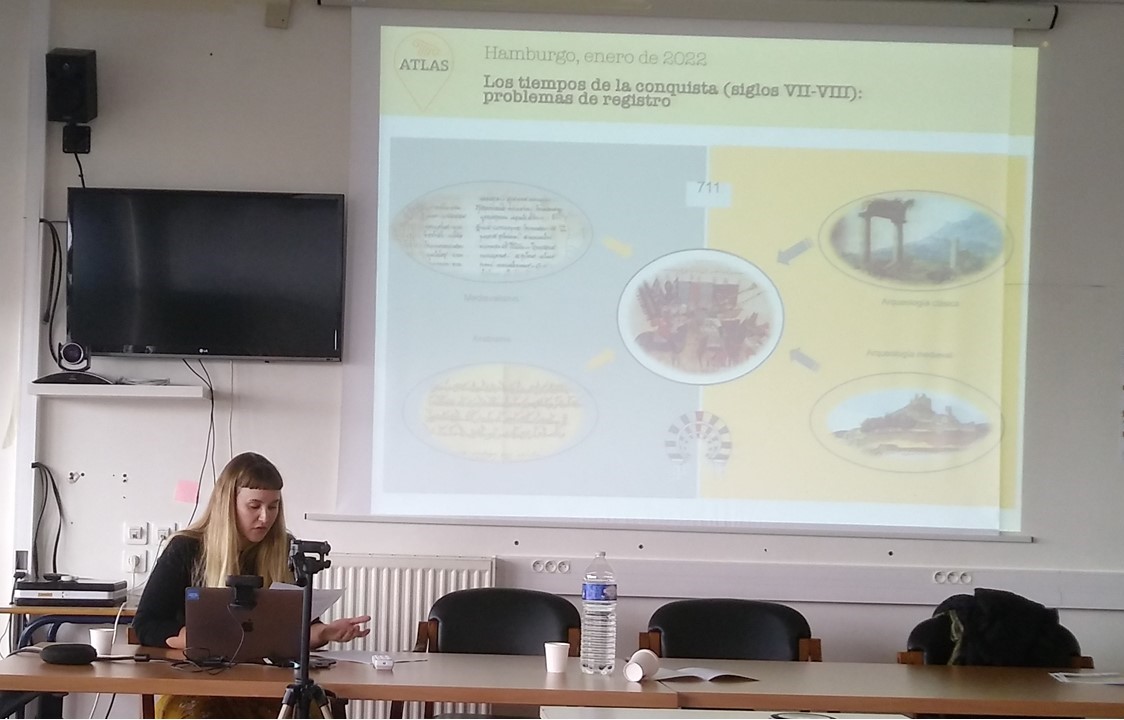
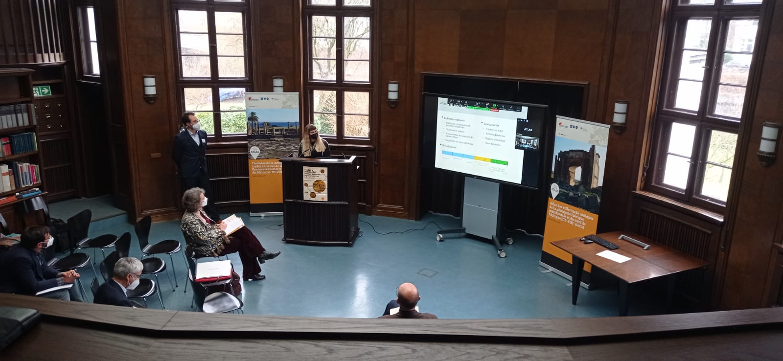
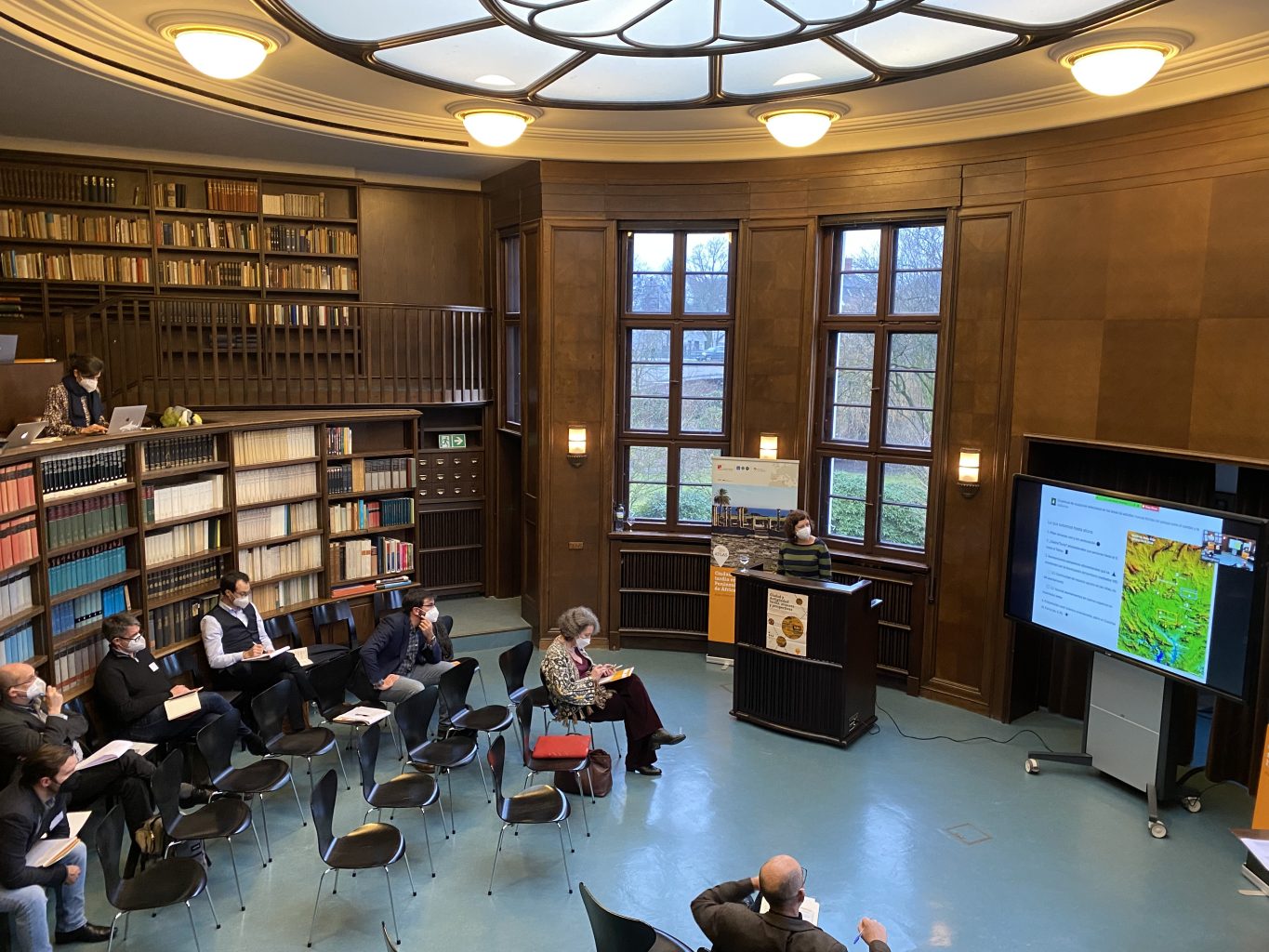
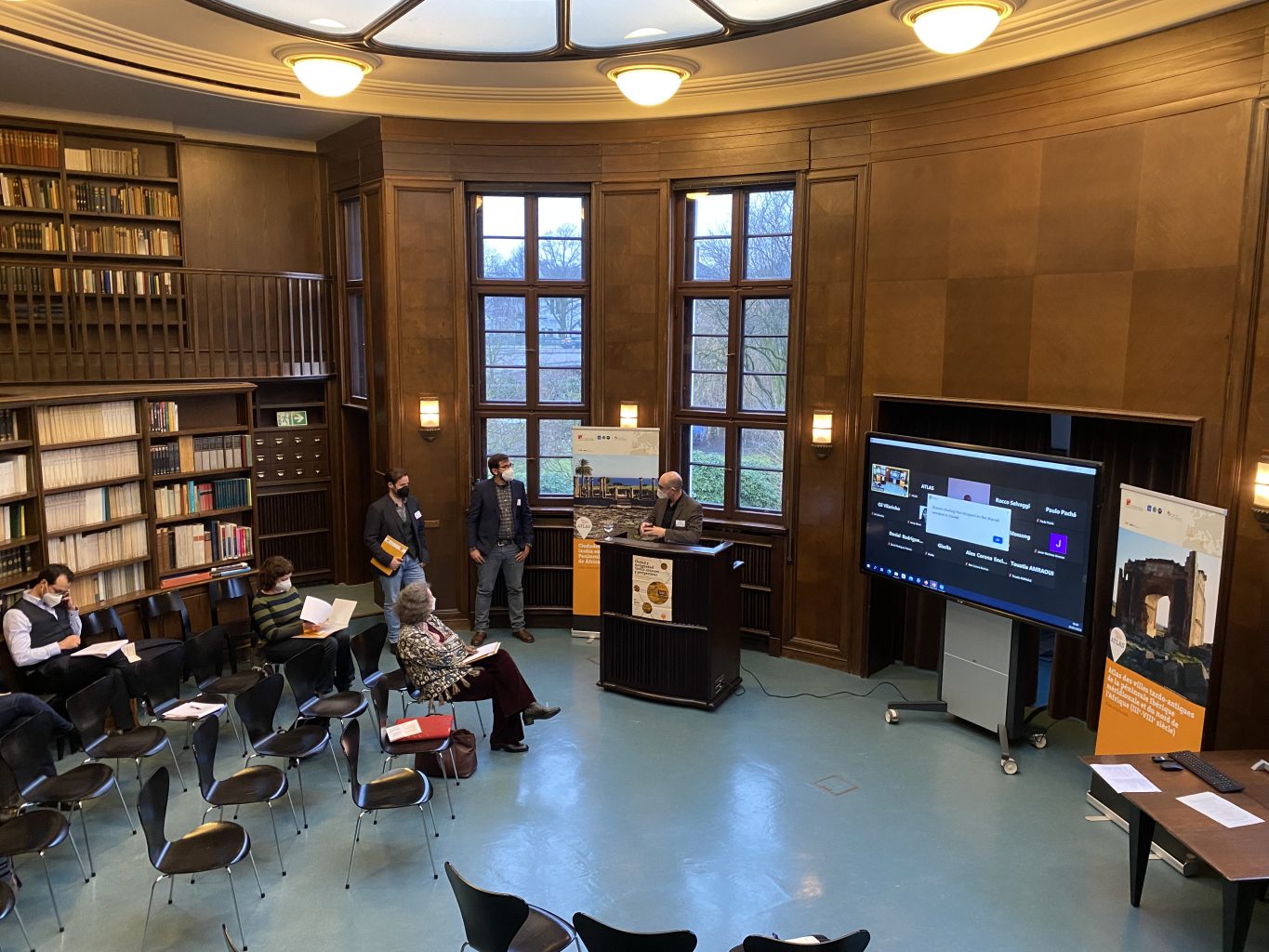
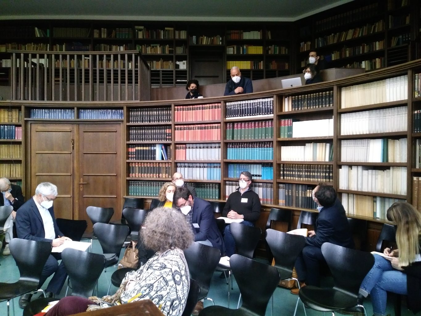
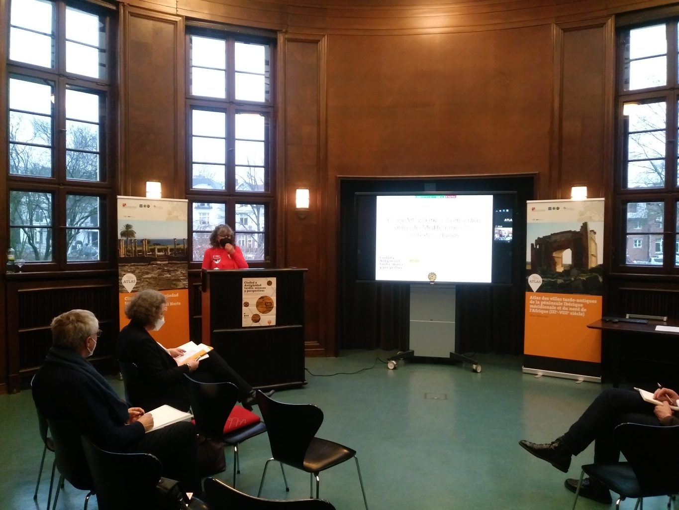
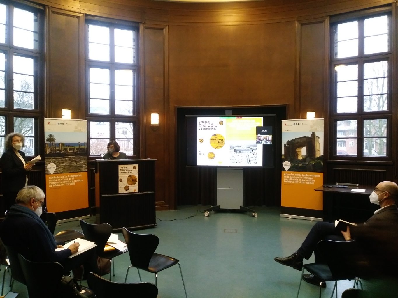
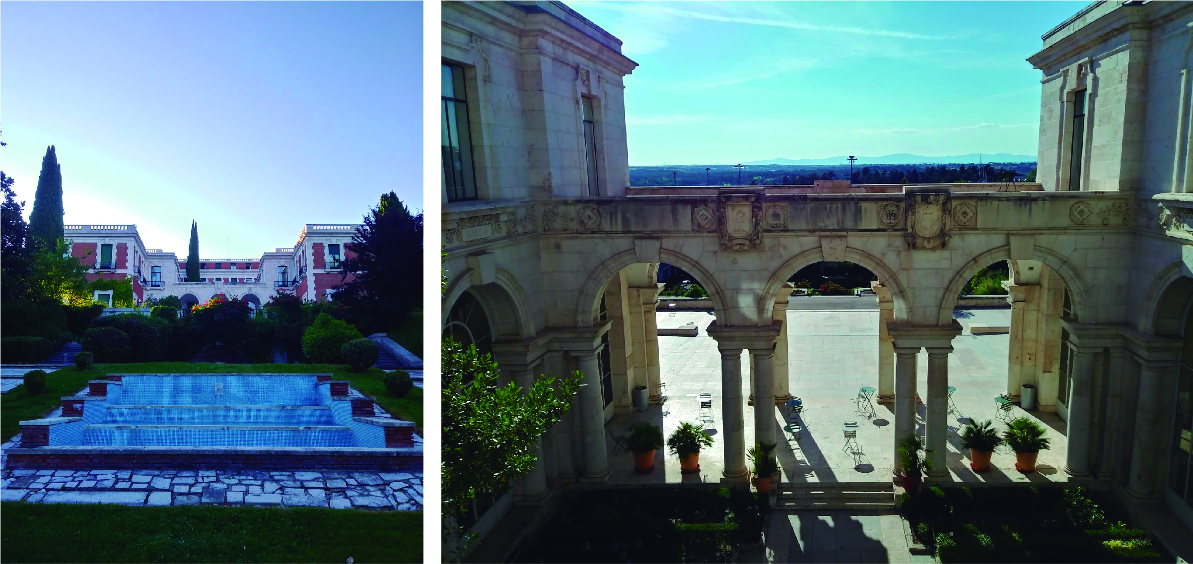
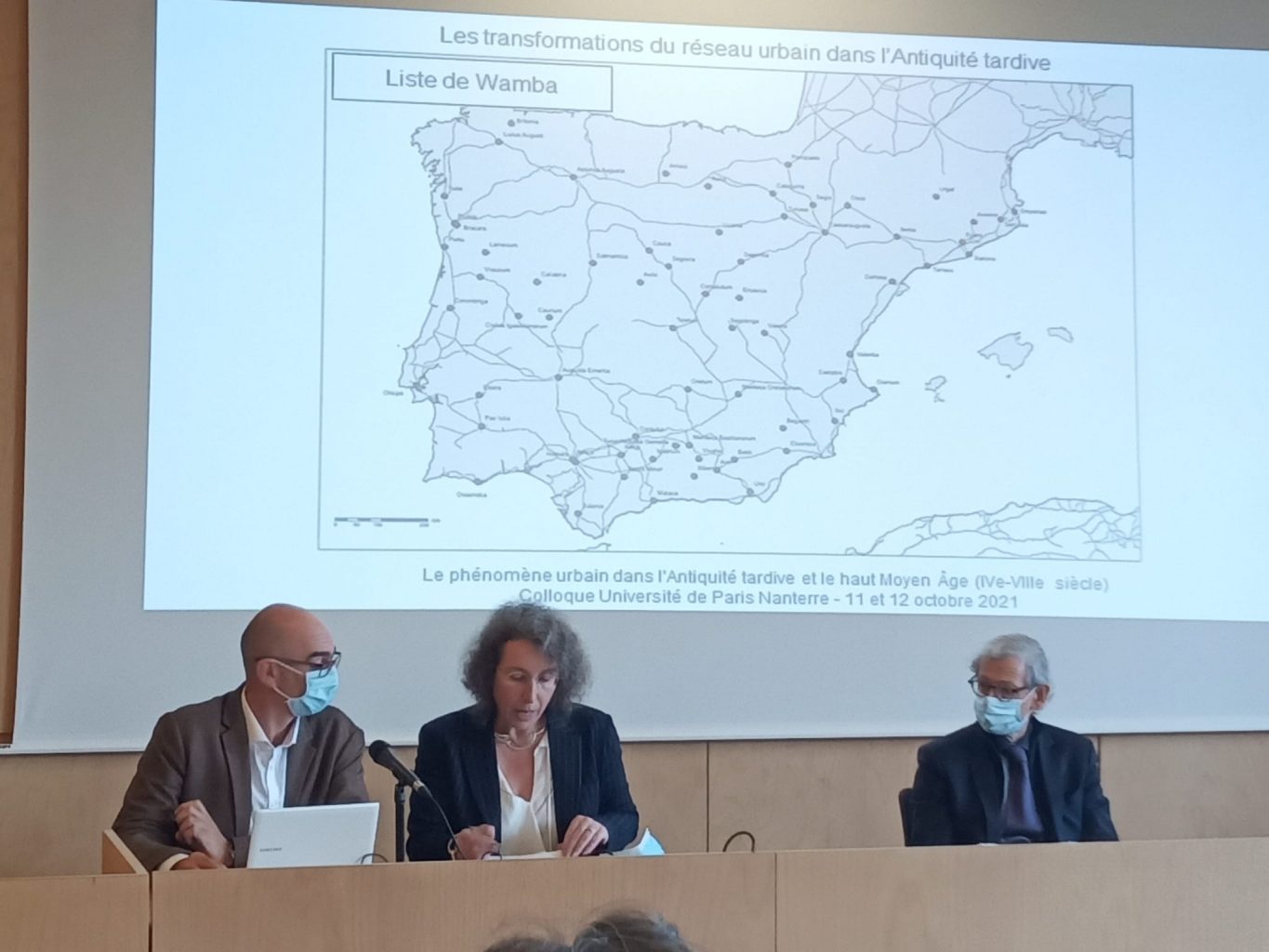
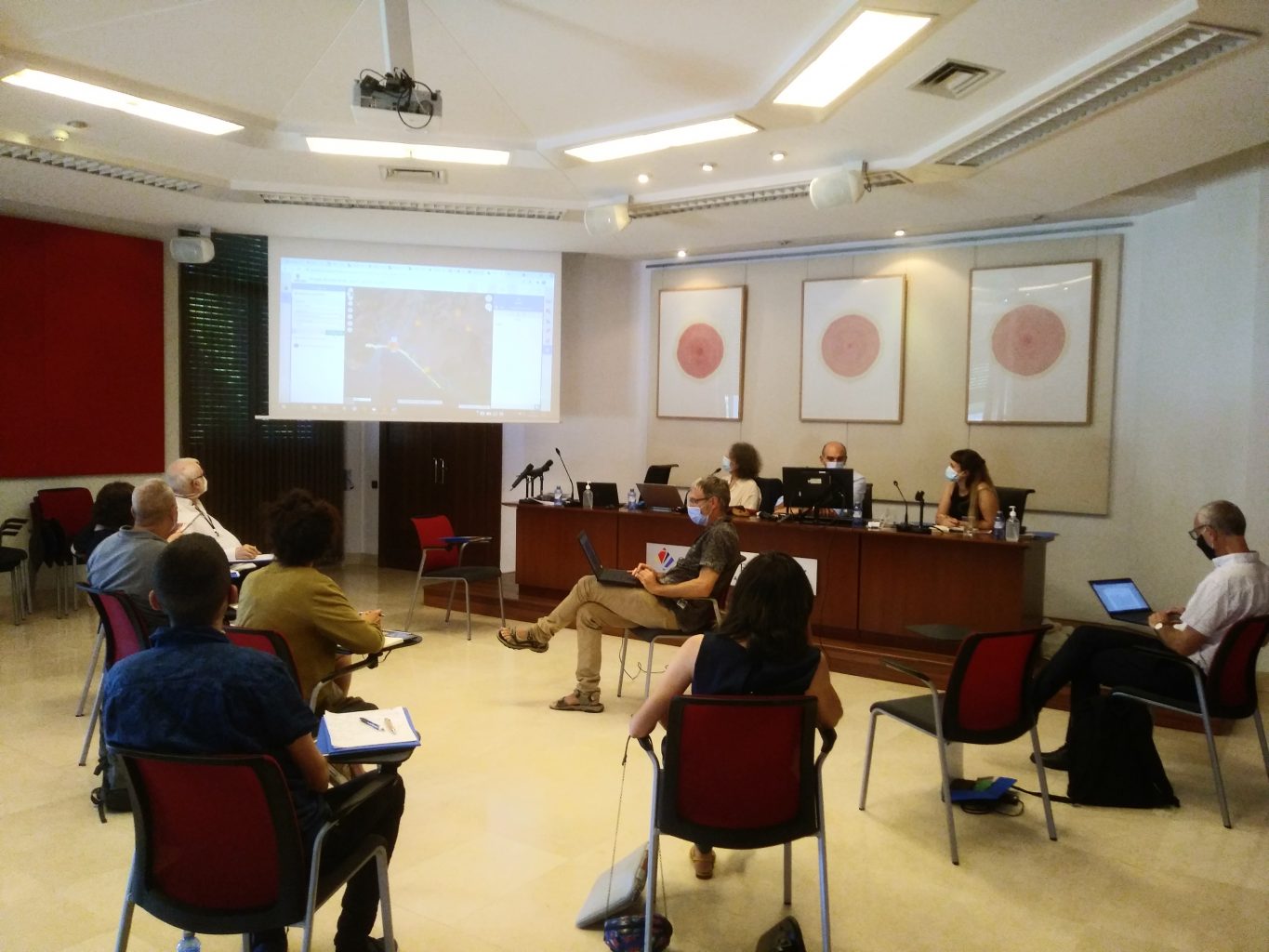
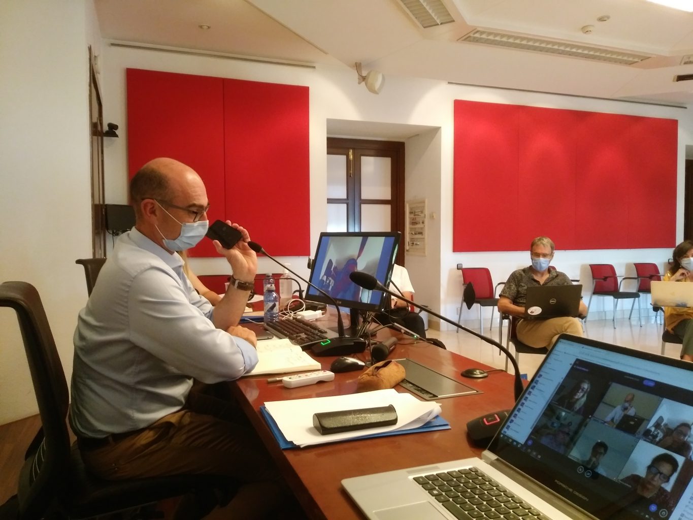
The key to these collaborations has undoubtedly been the research groups we formed after our first colloquium in Madrid. With eight groups of different sizes, depending on the popularity of each topic, we have had around thirty researchers participating in our project. But as most of them have their own projects on the case study cities, or on the topics of the research groups, it has not always been easy to find time to meet in their busy schedules. So a good way to organise this has been the annual workshops, which have set a strict deadline while giving each group the opportunity to present and discuss work in progress. It is true that, despite the tight deadlines, we have not always managed to organise ourselves in the most efficient way, but still the groups presented novel angles of study and questions at each annual colloquium that have opened discussion for the whole group. We are sure that our next colloquium in Madrid will also open up fascinating exchanges on Late Antique cities!

Group picture of our last workshop at Tunis.

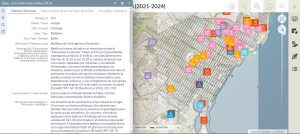
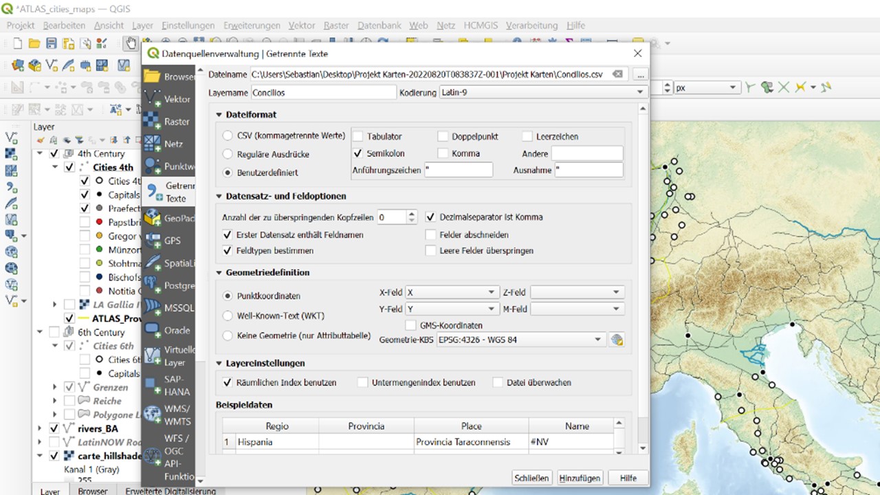
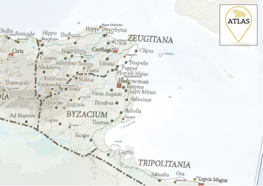
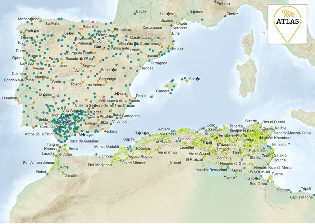
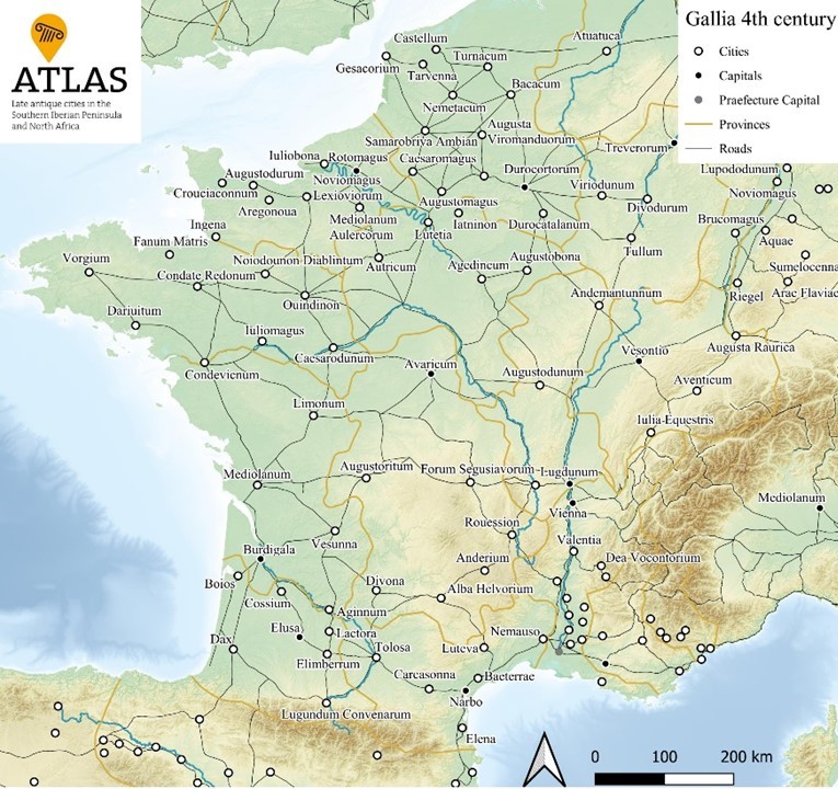
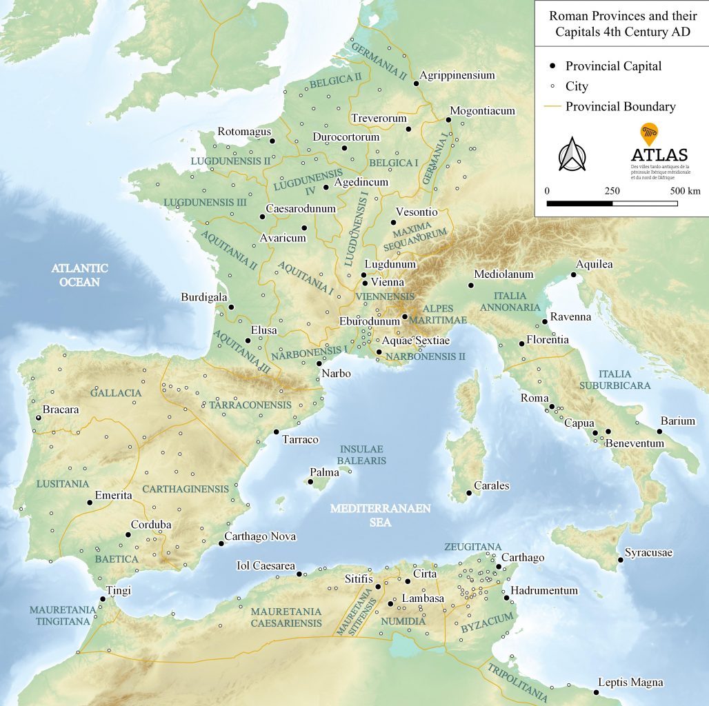
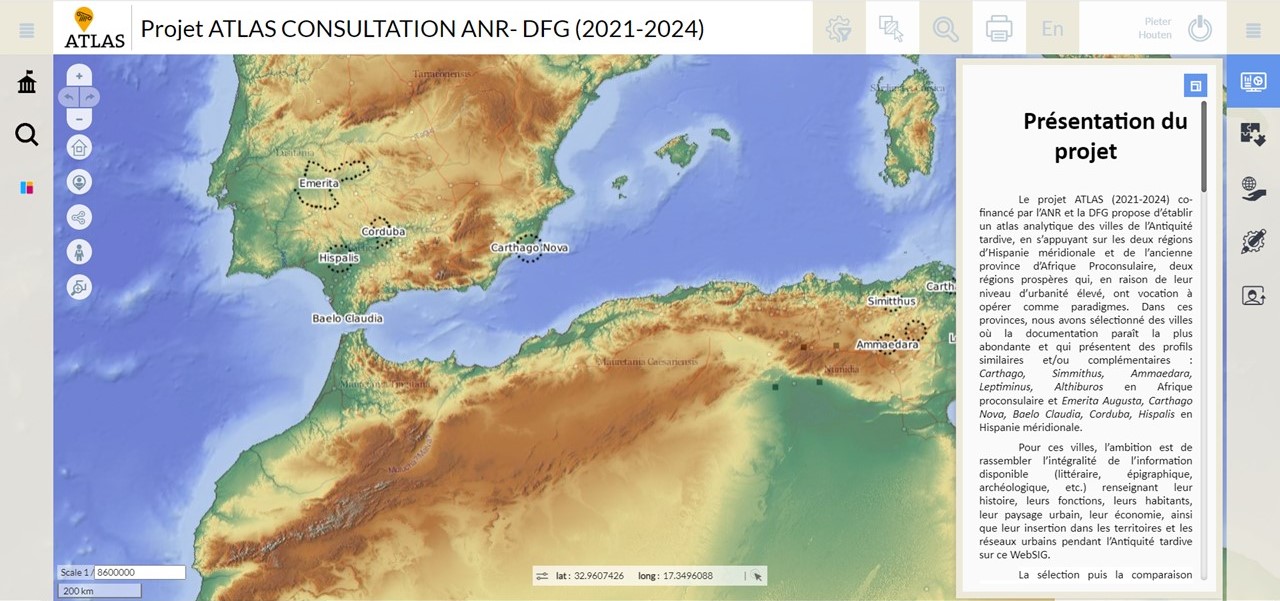
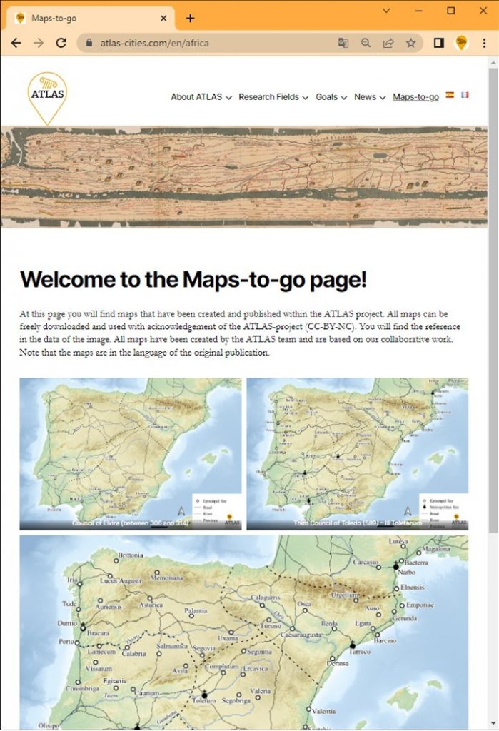
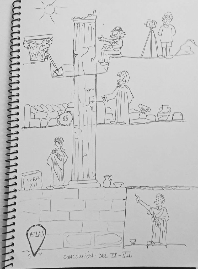
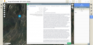
All these group meetings and annual colloquia have been a slow-burning process that will soon bear fruit. As we have already explained, these collaborations and collective debates will be collected in a publication, the ATLAS Companion. In the last few months the work has been intense and the groups have been more active than ever in drafting the different chapters that will make up this volume. In addition, Pieter has been elaborating, advised by our specialists and helped by the Hamburg students, the many maps that will accompany the texts and that will undoubtedly be one of the main outputs of our project. If you are curious, you can already find some interesting maps in our Maps-to-go section. And we will keep you informed about the development of our Companion through our social media, so don’t hesitate to follow us if you haven’t already done so!

Coffee and blogs
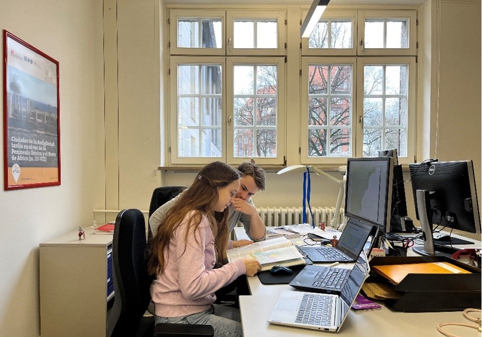
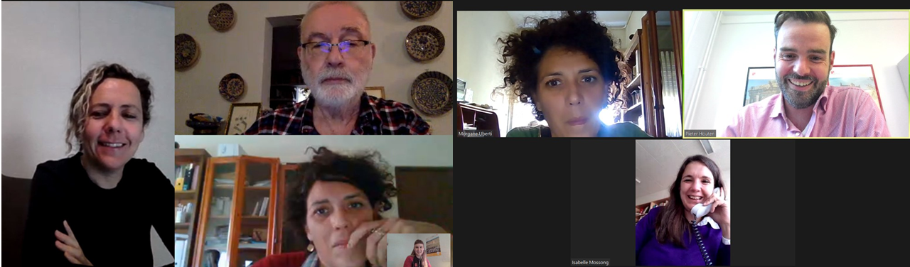
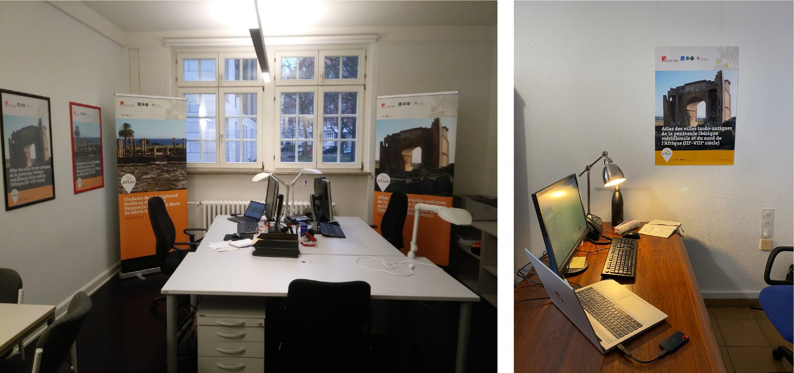
Along with all this, Pieter and Ada decided already at the beginning of the project that it would be a good idea to meet on a weekly basis, especially since ATLAS has different headquarters and each of us works in a different one. So every week since the start we have organised what we call “online coffees”, during which we have mainly planned and prepared the content for our social media and blog. Organisation in this sense has been key and of course there has been no shortage of extensive shared spreadsheets where we have been adding week by week the ideas for X (at the time still Twitter) or our website. And while it is true that the amount of work required for these forms of scientific dissemination is quite high, it is equally fun to think about how we can reach you, our readers and project members. In addition, these weekly coffees have allowed us to chat in a more relaxed way, with a coffee (or tea) in our hands, about the project and also about our plans for the future.

Pieter and Ada during their presentation in the workshop at La Rochelle.

Future plans
Working in this international project has taught us quite a bit. Of course a load on Late Antiquity, but a lot more on cultural interactions and people skills. It was a really nice experience to see four different academic traditions (Spanish, French, Tunisian and German) come together and bring forth the best they all have to offer. With this new baggage we have been and are looking for future opportunities. Ada has some scolding hot irons in the fire, fingers crossed this will work out. Pieter will leave academia to teach Latin at the school in the Dutch town where he lives with his family. However, one does not simply leave ATLAS… We guess you might see some publications or maps focussing on Late Antiquity in Spain and Tunisia by our hands in the future. And there is rumour of an ATLAS 2.0, as such it is not “fare well”, but “see you soon”!


Categories
Nicht kategorisiert

Recap of 2023 and plans 2024

As the saying goes, “it’s never too late to start”. Our usual annual retrospective comes a little later this time, but we simply had too much to tell! 2023 has been an intense year at ATLAS, during which we have not only continued work on our WebSIG and participated in multiple colloquia and conferences, but also focused to a greater degree on our other goals: the companion and the touring exhibition.

Last year January started with a conference in Xanten on one of our case study cities: Emerita. The conference “Nuevas investigaciones sobre Emerita Augusta” brought together the experts on the city, including our own Sabine and Pieter to discuss the latest on the city. The results of this conference will be published as the catalogue belonging to the exposition planned in the summer later in 2024. Keep an eye out on the museum website for the official announcement of the expo.

As you see, our involvement in the study of our cities goes beyond the work on the database and WebSIG (by the way, if you haven’t already done so, we recommend you take a look at this post on how to use it). An example of our commitment to the work is Ada, in April she participated in a new excavation campaign at Baelo Claudia, carried out in the framework of the CircE project. In October, this same project took Laurent and Ada to another of our cities: Seville. Here they held the workshop “¡Qué desastre!”, which focused on the analysis of traumatic phenomena in antiquity, a subject on which Baelo Claudia had, as always, a lot to contribute.

Laurent and Ada at the workshop

This year also saw the last work-in-progress meeting of ATLAS: Les Villes dans l’Antiquité Tardive au sud de la péninsule Ibérique et en Afrique du Nord: entre recherche et valorisation patrimoniale. Last May our members had the joy of visiting Tunisia for this meeting. We had two days of presentations and discussions by the members of the research groups on the topics that are so close to our hearts. The first day of our meeting was hosted by the INP in Tunis. The second day we were invited by the AVMPPC to come to Uthina for our meeting. In addition to our discussions we had the chance to visit some sites. Clearly we visited Carthago and Uthina, where we were meeting, but the programme included an additional cultural day to visit Thuburbo Maius and Testour! 

Some pictures of our visits to Uthina and Testour in May.

As the project was in high gear racing towards the final publication of the companion, more on this later, the student assistants in Hamburg were more and more involved with the cartographic element of our project. They followed the QGIS course and over time learned a lot more by creating maps for the project. As always you can find some of the results on our Maps-to-go page

The year ended in December with two major outreach activities. First our directors participated in the large ATEG conference: “ATEG VIII Les villes de l’Antiquité tardive en Gaule et dans les régions mitoyennes”. This conference takes place once each two years and was a great opportunity for our directors to present the preliminary results of the ATLAS project. Later in December our post-doc Pieter went to Rio de Janeiro as part of a future exchange programme between the Universidade Federal do Rio de Janeiro and the Universität Hamburg. Pieter gave a lecture on the epigraphic studies within the ATLAS project. In addition, he taught the QGIS course to a group of engaged students. We hope to spread the love for spatial analyses and cartography.

Pieter in Rio de Janeiro

What are the plans for 2024? The largest part is the closing workshop in Madrid March 20/21. This final workshop for the ATLAS project will be the final meeting of the members within the frame of the ATLAS project. However, these are not farewells, but just see you laters. We are certain that many of our members will continue to collaborate, and while we will reap the fruits of the project, we are already preparing ATLAS 2.0, of course. 

Nonetheless, now is no time for goodbye, we are full throttle working on the project. The workshop must be prepared. As we have written before, the deadline for the companion has kept us quite busy the past few months. With the deadline made, the work for others starts. All manuscripts have to be checked and corrected (style guides are there to be ignored 😉 ) before it can be sent to the publishers at Casa de Velázquez. Moreover, at the moment we are also preparing the ATLAS exposition that will have its kick-off at the workshop in Madrid. Thereafter it will go around our research area and institutions. Keep an eye on our blog to see when and where you can visit the ATLAS expo near your home town!


Categories
Nicht kategorisiert

Merry Christmas and Happy New Year 2024!

The ATLAS team wishes you a merry Christmas and all best for 2024!
We will take, and wish you, a well-deserved break until the 7th of January.

The Arch of Trajan in Mactaris

Categories
Nicht kategorisiert

Full speed ahead: presenting and writing

We have done it again, for yet another year we are continuing our long-established tradition and this autumn is another autumn full of congresses from one end of the world to the other. And this time, in addition, we are combining it with the preparation and writing of the different chapters for our Companion. The year has started off strong, but we come back with our batteries charged!

The season of scientific meetings started in September with the conference The Global and Local Economies of the Early Middle Ages, which took place in Tübingen and in which Sabine participated with an interesting paper on imperial and post-imperial economies in the Strait of Gibraltar. This month also saw the start of the QGIS workshop given by Pieter for the Federal University of Rio de Janeiro, which we have been telling you about through our social networks. The last session was at the beginning of October and the feedback has been so positive that the next edition is already being organised. Pieter also closed the month of September with his participation at a conference in Limoges, where he presented the the idea of small monumental cities as mere representation centres without inhabitation.

Laurent and Ada during their presentations in the workshop in Seville.

At the beginning of October, Laurent and Ada coincided in an interesting workshop in Seville on traumatic phenomena and crisis in antiquity. Their presentations were complementary, as each analysed the concept of crisis from two different perspectives, that of written sources and that of archaeology. Later, Sabine participated in the conference From Ctesiphon to Toledo: A Comparative View on Early Church Councils in East and West in Vienna. And, as we could not miss our traditional autumn of congresses, at the end of October the XIV workshop Toletum took place, this time dedicated to Hispanic diplomacy between the Republic and al-Andalus. As always Sabine took the lead in organising the Workshop. ATLAS was represented twice by Isabelle Mossung, presenting on the ‘tabula patronatus’, and our post-doc Pieter presenting the development of the urban system seen as a form of diplomatic dialogue.

Group photo with the participants in the XIV Toletum workshop.

But don’t think that the autumn of congresses ends here – there are still a few months to go before winter arrives! So in both November and December we have a few colloquia and conferences coming up that we are looking forward to participating in. In November Pieter will present a paper on Latinization of the Iberian Peninsula. Later that month Sabine presents a very ATLAS topic at the colloquium Crises et résiliences urbaines: «Résister au changement ? Le fait urbain de la péninsule ibérique pendant l’Antiquité tardive». December starts with Pieter participating in the Roman Youth University at the Thermenmuseum in Heerlen (NL).  Sabine and Laurent will participate in the colloque ATEG VIII in Bordeaux to present work from the ATLAS project. Thereafter if all goes well ATLAS will close 2023 with a bang: Sabine and  Pieter have been invited to go to Rio de Janeiro to formalise a collaboration between the universities of Hamburg and Rio de Janeiro. Fingers crossed the bureaucratic systems work like clockwork and they get to go. As always, we will keep you informed in more detail through our social media, so don’t hesitate to follow us!

And, in parallel, ATLAS as a whole is still at full speed preparing the final publication in the form of the Companion. Our research groups have returned to their regular meetings after the summer, to pool ideas and establish the lines of work for the writing of the corresponding chapters. We are looking forward to seeing the fruits of all these years of work!


Categories
Nicht kategorisiert

Working in Spain and Tunisia

Carrying out a research project in and about two different countries is both a challenge and a stimulating experience. It helps us to get to know the history of two places with different cultures and to get closer to their own idiosyncrasies, which undoubtedly enriches our professional and personal background. In fact, as you have seen over the years, ATLAS is allowing us to work not only in two different countries, but also with a number of different institutions, research teams and specialists.

Researching in two different countries

As you know, a large part of our research deals with the analysis of historical and archaeological heritage, including architectural remains and infrastructures, and topographical elements of late antique cities. For this reason, especially when we need direct information on these elements, we must turn to the different administrations and institutions responsible for the management and preservation, as well as the dissemination of this heritage. And, of course, each country (and each region) has its own institutions and ways of functioning. Therefore, knowledge of the procedures of each one of them is fundamental in an international project like ours, as it not only speeds up the necessary procedures but also allows us to establish reciprocal links by returning the knowledge generated to the institutions and society of origin.

In our specific case, in Tunisia we have worked hand in hand with the Institut National du Patrimoine, the main body responsible for looking after the country’s historical and archaeological heritage. In Spain, on the other hand, management is less centralised and in each region and city we have approached the corresponding institutions. Some cities even have more than one organisation working in the field of heritage, such as Mérida, where the Instituto Arqueológico de Mérida, the Consorcio Ciudad Monumental de Mérida and the Museo Nacional de Arte Romano converge.

Group photo at the INP during our last meeting in Tunis.

Moreover, many of the archaeological sites examined in our project have also been the subject of campaigns and studies by different international teams. Probably the most obvious case is that of Carthage, where the international Save Carthage campaign launched in the 1970s brought with it the arrival of research groups from many different countries. These teams not only carried out archaeological excavations in different parts of the ancient city, but many also published the results of their studies. Consequently, these results are collected in a large number of monographs, chapters and articles, often scattered, which we must gather together for our own research. A similar case can be found at Baelo Claudia. This site in Cádiz has a close link with France and the Casa de Velázquez, since the founder of the École des hautes études hispaniques, Pierre Paris, initiated the first archaeological campaigns at this site. But since then, many other teams have worked in this coastal Roman city, such as the University of Cadiz, the University of Seville and the University of Aachen.

That is why, in addition to contacting the different institutions in charge of heritage, on other occasions we have also contacted the teams and researchers who have led the excavations and studies of those elements for which we need more specific data. This is the case of the magnificent church of Damous-el-Karita, which was recently excavated by the Austrian team of Heimo Dolenz, the Christian epigraphy of Carthage studied exhaustively by Liliane Ennabli and Sihem Aloui, the multiple campaigns carried out in Leptiminus by the University of Michigan, or the excavations of the archaeological area of Morería directed by Miguel Alba.

Archaeological Reality

Another interesting difference that we, coincidentally, find in our case study cities is the continuity of habitation. Cartagena, Cordoba, Merida and Seville have developed on top of the original Roman cities; in other words, they are urban centres with a centuries-old occupational continuity. However, we only have a very partial knowledge of the ancient remains, which complicates archaeological research. Excavations are often only carried out when construction or repair work is being carried out on the buildings of the present-day city. So we end up with small windows of archaeological knowledge within the urban fabric, in some cases with the remains preserved and visible and in others simply documented and covered again by contemporary constructions. On the positive side, excavations tend to be of relatively small areas that allow us to document centuries of urban evolution. Of course, this means that archaeological remains are often found in complex stratigraphies, metres in extent, due to the use and reuse of preceding structures.

Part of the ATLAS team walking around the archaeological area of Morería in Mérida.

That said, one might think that the Tunisian sites in our project, which do not have contemporary cities above them, are easier to analyse. And indeed, we often have a more complete picture of the urban fabric of these ancient cities. Moreover, we can visit them and get a good idea of the buildings and the relationships between them and the rest of the urban infrastructures.
Fotografía del foro de Mactaris durante nuestra visita en marzo de 2022.
However, these sites present their own challenges. First of all, they are not completely abandoned, as new cities are often located in close proximity to the site in question. This is the case of Carthage, located between Tunis and Sidi Bou Saïd; Ammaedara, located east of modern-day Haïdra; or Lamta, next to ancient Leptiminus. Perhaps Mactaris is more similar to the Spanish cases of habitational continuity, given that it is enclosed by modern Makthar. Still, this proximity to modern cities is not always good for the preservation of archaeological sites. As an obvious matter of minimisation of effort and resources, it is very common for abandoned settlements to be used as quarries, resulting in the presence of numerous ancient materials (spolia) in the surrounding cities. So, for example, epigraphic information from these sites is very problematic. Indeed, a large number of inscriptions have been preserved, but their context is rarely known.

Another disadvantage of uninhabited sites is that they are more exposed to the weather and the passage of time. Thus, erosion affects not only the preservation of the buildings but also the stratigraphy, especially of the upper layers where the remains of more recent periods are found (and that includes our beloved Late Antiquity!). To this must be added, both on uninhabited sites and in living cities, the carrying out of interventions without archaeological methodology. However, the problem at uninhabited sites is that this type of intervention, which dates back to times when archaeology had not developed as a discipline, can affect a larger area of the ancient city. For example, in Baelo Claudia, our only depopulated case study in Spain, we have old excavation diaries that explain that dozens trucks loads with of earth that were removed during the excavations at the forum. The reason for this abundant extraction of earth is the interest in bringing to light the monumental buildings of the Early Imperial Roman period, to the detriment of other historical periods. Fortunately, however, this practice is now obsolete and today we have a large amount of information on late-antique urban evolution even in the most monumental areas of the city.

Plan of the late antique occupation of the Temple of Isis at Baelo Claudia (Dardaine et al. 2008, fig. 27).

Despite the differences, or perhaps because of them, we have an interesting job. It is fun and intellectually stimulating to consider how the differences between our case studies impact on the representation of Late Antiquity. Moreover, it is certainly an important exercise for a project like ATLAS, as it allows us to better understand the development of historiographical narratives about our period of study.


Categories
Nicht kategorisiert

Have a great summer!

A bird’s eye view on Carthago

… to rest and enjoy! Good holidays to all and we will meet again in September…


Categories
Nicht kategorisiert

Starting Leptiminus

As we announced a few weeks ago, we are currently working on our fourth case study in Tunisia, Leptiminus. This is a coastal city located in the Sahel region, south of the Gulf of Hammamet, which covered an area of approximately 45 ha between the 2nd and 4th centuries A.D. This is certainly a somewhat different case study to those we have been analysing to date, because Leptiminus is not known for the preservation of large public buildings, unlike many of the Roman cities of the Maghreb. It does, however, offer the possibility of studying many other interesting aspects that have often been overlooked in those North African cities whose monumental remains have been better preserved. In fact, thanks in particular to the “Leptiminus Archaeological Project” directed by John Humphrey, Hedi Slim, Nejib Ben Lazreg, Lea Stirling, David Stone and David Mattingly, the city has been exhaustively analysed from multiple perspectives and using a wide variety of methodologies. This is why today Leptiminus is a fantastic example for understanding the economic side of a relatively modest port city (its fishing and craft activities, mainly dedicated to pottery production), but also the occupation and evolution of the suburban areas (where these craft activities were located, but also domestic, funerary and religious spaces) or its relationship with its immediate hinterland.

Archaeological plan of Leptiminus (Mattingly et al. 2001, fig. 4.03)

We had the luck that David Stone visited the RomanIslam Center in November 2022, at the same time we were participating in the Shifting Cities conference. This serendipitous meeting allowed us to discuss Leptiminus with one of its experts. David is a survey archaeologist working in both Greece and North Africa whose research addresses current questions about ancient cities, empires, and landscapes. At Leptiminus, David worked mainly on the field survey, which was presented in Leptiminus 3 (Journal of Roman Archaeology Supplementary Series 87, 2011). This book considers the “urban biography” of the city over 1200 years of Punic, Roman, Vandal, and Byzantine rule. The tale of Leptiminus included a remarkable period from about 100 to 300 CE, during which investment in agriculture, fishing, shipping, and ceramic manufacture were all documented. The city continued to import and export products until the seventh century while also maintaining a significant population. It is in the late-antique phase that the slow but perceptible changes to the diets, occupations, burial customs, and physical spaces and other aspects of the lifestyles of inhabitants may indeed be most visible.

Garum tanks on the sea shore (©Leptiminus Project)
Underwater remains of the jetty (©Leptiminus Project)

Besides being very helpful discussing this case study, David was eager to join the ATLAS team and since then has been an active member of the Territory and Economy groups, even presenting three times in Tunis! He will contribute in the Companion as a co-author to the chapters of the groups, and even deliver one single author chapter on Leptiminus. 

David’s last presentation at the last ATLAS meeting in Tunisia

Moreover, David was so kind to offer us the needed data in usable formats. That means, rather than having to go through the many good publications to find and locate archaeological remains for our WebGIS, we received excel tables of site numbers, coordinates and descriptions. This means that for this city we can finally try out the bulk upload for archaeology. As we already mentioned before for epigraphy we have been using this approach of uploading thousands of entries in one go. The only task left is to curate the data and make it fit our webGIS format. One of the main tasks was to associate the find types of the Leptiminus project with the ATLAS types. Ada created a correspondence list of the English types from the Leptiminus and the French of our WebGIS, so the student assistants could do this task. In some cases the correspondence is rather straightforward: cistern is citerne, however, sometimes they can be a bit harder like amphora burials being Espace funeraire, another example of our multilingual project.

As you might know, we use a similar approach to work on the epigraphy, we collect the data from a multitude of dataset and then curate it for our database. Again this is partially the hard labour done by our Hilfskräfte, who have slowly become experts in epigraphy. Admittedly, the role of Leptiminus is very limited in our understanding of the epigraphic culture in Late Antiquity. There is just a handful of epigraphy dated to this period. Nonetheless, there are some beautiful examples of mosaic inscriptions found in the Christian cemetery.

Some of the Christian mosaics located in the catacombs next to the eastern cemetery of the city (Stevens et al. 2007, fig. 4)
René Cagnat and Henri Saladin’s excavation of a Christian cemetery  (R. Cagnat and H. Saladin, Voyage en Tunisie, 1894)

Working on Leptiminus for the past few weeks has given us some new insights. First to learn about this small port city of the Sahel at the Mediterranean coast in Late Antiquity. Moreover, the first time we were able to work with the archaeological material in a different way, is an interesting experiment. It raises the question and option to share archaeological data more effectively. As always, to follow our work you can check our WebGIS and follow our twitter account!


Categories
Nicht kategorisiert

Working in a multilingual project

As you might have noticed, our blogs are published in three languages: Spanish, French and English. This has all to do with the multilingual nature of our project. You might wonder why we opt to make our project multilingual and not just limit it to the ‘international’ language English. Well, there are several reasons for our project to be multilingual. The most obvious are the origins of the project and the funding, which comes from France with the Agence nationale de la recherche (ANR) and Germany with the Deutsche Forschungsgemeinschaft (DFG). Here we already have two languages with a long history in academic research. German has been a language of importance to the Altertumswissenschaften since the beginning of the field. It is not without reason scholars joke that every topic has been published by a 19th century German. As an academic language German continues to hold an important place. Although German is of such importance for the field of Antiquity, we use Spanish for our outreach. This has its raison d’être in an equally fundamental part of the project: the valorisation and outreach of the project disseminating the results.

Facilitating outreach

The images of academia in its ivory tower are often a harsh truth and difficult to overcome. We can get so submerged into our topic that we lose sight of what is of interest to the general public and why we are doing it beyond the idea of l’art pour l’art. As most projects are, like ours, funded with public money, valorisation and outreach are necessary elements. We are convinced that part of our work is also to return and offer the knowledge generated to society. This is where Spanish enters. Since we are researching the south of Spain and the north of Tunisia we have opted to write our blogs in Spanish and French. Two languages widely used in the academic world of our project. In an ideal world we would have added Arabic to our website, whereby we would be able to reach out to the wider public in Tunisia and the whole Arabic speaking world. However, since none of the core team has sufficient knowledge of the Arabic language this means we can’t do it ourselves. Instead we opted for English as the ‘international’ language, thereby we hope to reach out to more people beyond our research focus and get people interested in the history of the Iberian Peninsula and the Maghreb. In future projects we might have to consider earmarking part of the outreach funding for translations of our texts to Arabic so we can reach out to more people.

WebGIS Multilingual

Another outreach element of our project is the WebGIS. Last month we wrote a blog explaining the WebGIS and how it works. Again we find that this is a multilingual element of our project. But here we find a mix of languages. The webGIS itself uses French, where the archaeology is written in Spanish and the epigraphy in English…

Examples of an archaeological and epigraphic sheet, where different languages are used.

During our meeting in La Rochelle at the start of the project we discussed the possibilities of creating a trilingual database. Soon we realised that this meant that we would have three databases running alongside each other. So each entry had to be done three times, one for each language. With the planning to finish the database entry phase before March 2024, this was not a feasible option. As a result we decided that we would use French, Spanish and English as the academic languages of the project and use these in the database. You can see that most archaeological entries are in Spanish as these are done by Ada, whereas the epigraphy is entered by Pieter in English. Both opted for these languages as these are the languages they are most comfortable with. Though we ask for your understanding if you come across any small linguistic errors, these are the hazards of this multilingual profession!

Multilingual Meetings

You may find this mixing of three languages a bit cumbersome and, again, wonder why we don’t just use English. In fact, you’ve probably already noticed that we don’t use English in the programmes of our annual meetings either. But it’s not really necessary, because the vast majority of ATLAS members have a very good level of Spanish or French, which allows us to exchange ideas without any problems.

Snapshot of one of our multilingual discussions during the first ATLAS meeting at the Casa de Velázquez.

So our discussions often take place in two languages at the same time, or one of the speakers decides to express himself or herself in the other’s language. Naturally, this means that we must all make an effort to communicate and to listen patiently to others, especially those who are encouraged to use a language that is not their own. But even those who do not yet feel confident to express themselves in these languages often have a broad knowledge of other languages close to French or Spanish, which enables them to understand what is being said without difficulty. This is certainly a very good way of broadening our linguistic knowledge while promoting a friendly and tolerant atmosphere of scientific exchange with all colleagues, who are always willing to facilitate discussions in any language. But, in addition, by using these languages we also facilitate understanding for those listeners from Tunisia or Spain who decide to attend our meetings.

So far the official workshop meetings, but what happens in the more informal meetings is even more interesting. Here we find that a multitude of languages is spoken. And yes English is part of these languages. As already said, the passive knowledge, or understanding what is said, is often higher than the active knowledge, leading to funny communication triangles. A famous one is held between three members alternating between French, German and even Dutch!

Pieter, Marc and Sabine are some of the members who combine up to three languages during their conversations.

Does it work?

We are convinced that this multilingual system of communication works perfectly well. So far, all our meetings have led to productive discussions between colleagues. When encountering the limits of our linguistic knowledge we can always rely on an intermediary language. Moreover, when writing we can resort to the old fashioned dictionaries or use the digital equivalents to facilitate our multilingual communication.

Dictionaries are a key tool in our project.

The project is also a human sciences project, so the promotion of linguistic richness is a value we hold dear.  But in any case, you can judge for yourselves by attending our scientific meetings or by reading our forthcoming bilingual publication (FR-ES) in the ATLAS companion to urbanism in Late Antiquity.


Categories
Nicht kategorisiert

The ATLAS WebGIS: what is it and how does it work?

As you must have seen in several of our blogs, we are working with a WebGIS. What is even better is that this WebGIS is open access. You can see our work happening in real time! Collecting the information, writing it up and adapting it to the WebGIS format requires time and, moreover, it is only a part of our work. But, in any case, today we are going to explain what WebGIS is, how we work in it and how it works, since it has several features and particularities that deserve to be collected in more detail in a specific post.

Introduction of the WebGIS

First up, the WebGIS itself. The WebGIS is created by Frédéric Pouget at the University of La Rochelle. It is a good example of using the existing structures of the university within a project. The development of the webGIS was part of a course taught by Frédéric, where students build the database as part of their assignments. This way we get our database and students get the needed experience in creating such a database, and get to see their work in action. Rather than doing an assignment just for the sake of doing an assignment. 

Our database is hosted by the Huma-Num of the Centre national de la recherche scientifique (CNRS). This initiative of the French government must be applauded. Contrary to the standard approach, where datasets go offline after a project ends due to the lack of funding, Huma-Num continues hosting the database. This way scholars can still consult and use the database well after the end of our project. 

A major novelty of our project is the combination of archaeological and epigraphic sources in one WebGIS. Mostly we see that these sources are found in separate databases, if they are found in open access databases at all. By combining both sources we aim to gain a deeper understanding of the city (lay-out, use etc) and its social structure. Both fields are quite different and we, Ada and Pieter, work together to get the best out of our data.

Archaeological study in a WebGIS

As we indicated at the beginning, collecting, synthesizing and writing the information in a way that is appropriate for WebGIS is a very time-consuming job. This is especially true in the case of archaeological remains, since we rarely have other databases to which we can access and from which we can extract the information. Precisely one of the great contributions of our project is this, to gather a huge amount of information, updated and contextualized, on the urban phenomena in Late Antiquity.

So, at the archaeological level, the research begins with what we can call the old school style, with an exhaustive search of the most significant publications of the city we are analyzing at that time. This allows us to get an idea of the state of the question today and to have the most complete and recent bibliography possible. This sounds like a simple task, but one of the main challenges is, in fact, to gather the available information, as it is often scattered in different and varied publications, so it is not always easy to get hold of all the bibliography. Fortunately, we can always count on our colleagues collaborating on the project to give us a hand in this task.

Example of a file of an archaeological vestige of Carthage. On the right can be seen the plan of the city with an overlay of the archaeological plan of the city.

Once we have a bibliography as complete and recent as possible, it is time to read and analyze it carefully to obtain specific data of interest for our project. We want to know what buildings, infrastructures and topographic elements made up the urban landscape of our study cities throughout the five centuries of Late Antiquity. The analysis is done vestige by vestige, so that in parallel we can synthesize and write the information adapted to the WebGIS format. This information is initially collected in an Excel file to facilitate export to the database. However, we have not yet been able to export all this information en bloc, so the items are entered manually for the time being. We hope to be able to apply a system similar to the one used in the epigraphic part for the next case studies.

Finally, once the necessary information on the vestige in question has been synthesized and written (description of the vestige, state of conservation and chronological discussion), we search for the graphic apparatus to complete the record. Photographs, plans, sections or reconstructions are also included in the archaeological vestige files not only to facilitate the understanding of the archaeological remains, but also because this graphic documentation also serves as a starting point for our colleagues in charge of 3D modelling and reconstruction for the ATLAS travelling exhibition.

Epigraphic study in a WebGIS

The epigraphic part of the project uses a completely different approach. Thanks to the existing databases (e.g. Trismegistos, EDH, EDCS, HEpOnl and LatinNow) the individual study of each item through a multitude of publications is not needed. Some of these datasets are open source and allow scholars to download the data. Whereas for others there might be a work around… By combining the data available through these different dataset we already gain an improved epigraphic dataset. This combination of dataset is possible thanks to Trismegistos’ dataset holding the Id’s of most large databases. This way we can cross link to data from the different datasets. However, even after combining the data of the datasets, often we are still left with partial data. Moreover, and more importantly for our WebGIS, spatial data is only given on city level. That is, for Carthago we have over eight thousand inscriptions in the Claus-Slaby database, all given one representative centroid (point on the map).

Epigraphic spatial information for Carthage via Clauss-Slaby (https://db.edcs.eu/epigr/imp-rom.html) Note this includes all periods.

Of course, such an approach is useless for the study of individual cities. Often epigraphers turn to small case-studies and then spend loads of time to ascertain the location of individual inscriptions. Seldomly these efforts make it into databases. However, part of improving our data for the WebGIS includes the improvement of the spatial data. While going through the publications we search for the find spot of the inscription. This way we are able to assign the inscriptions on building level. The map below shows how we located the over two thousand Late Antique inscriptions of Carthago within the city. Note the 163 inscriptions in the sea lack a known location, other than Carthage. Up till now we haven’t solved the problem of how to deal with unlocated epigraphy. Often a drop-site is chosen for these. We decided that the drop-sites are in the water, hopefully making clear that it is a drop-site.

Improved epigraphic spatial information for Late Antiquity (ATLAS).

While searching the epigraphic publications to improve the spatial data we also improve the data on material, object and text type. Clearly, one of the most challenging aspects is dating the inscriptions. Thanks to the combined datasets and the publication of epigraphic collections working on the epigraphy can be done in bulk. This means that the epigraphy is not entered into the database inscription per inscription, but in larger samples. We did Carthage in one go. Soon we will finish and upload the other four case studies of the Maghreb. 

Using the WebGIS

The WebGIS is already available for all to see via: https://geoapps.huma-num.fr/adws/app/5b1c0f10-7386-11ec-b348-11e51a07f6b0/ 

The start screen might at first look a bit overwhelming, this blog will walk you through. You will see that it is not complicated at all and you will quickly get used to the interface!

WebGIS home screen.

On the right hand side we find the map layers panel. Here we can switch layers on and off. In the overview we only see the ‘territories’, or ‘cité’, of the ten case study cities. When zooming in on one of the cities other layers become available. We can zoom in using different methods. The most intuitive is the scroll button on our mouse. However, there are two options in the webGIS itself: (1) On the left hand side we find the + and – for zooming, the arrows allow you to switch between the last two zoom levels. (2) the last icon in this row is a quick zoom function by creating a square box. Select this icon, it will turn blue, and left click and drag on the map to select the area you want to zoom in. Note the box indicates the zoom level, thus it will show what was within the box you dragged.

When we zoom in on for example Carthage, we note that the ‘cité’ and ‘enceinte’ disappear, whereas the icons of the archaeological ‘vestiges’ appear. The epigraphic layer needs to be manually activated.. On the right hand panel we see a section with base maps. Here we can switch on and off several basemaps and play with their transparency. So far playing with layers and the right hand panel.

On the left we find four icons: (1) The temple or better ‘Filtre Carto Vestiges’; (2) the monument or better ‘Filtre Carto Inscriptions’; (3) Magnifying glass or ‘Recherches’; (4) Graphs or ‘Statistiques’. Each of these allows you to search and query the database.

Filtre Carto Vestiges

This is a function that offers two options, apparently similar, but that make it possible to query the database from different perspectives. The first option (‘Recherche Vestige par Ville / Type / Sous-type’) offers searches within each city by type and even subtype of archaeological element. The interesting thing about this function is that none of the search items is mandatory, so that quite free queries can be made, even without sticking to a single city. Thus, we can have a list of all the archaeological elements by type (civic, religious, economic, etc.) or subtype (churches, dwellings, baths, necropolis, etc.) collected in our database. In fact, the results of this and all other search options generate a list on the right side, which can be displayed as a table and facilitates access to the data sheets of each vestige. Eventually, these tables can be downloaded in different formats to work with the data in the way that suits us best.

Example of the table that can be consulted after any search.

The second option (‘Recherche Vestige par Ville / Sous-type / Siècle’) is focused on specific queries by century, so this variable is mandatory when searching. In this way we can filter archaeological items chronologically, as well as by city or subtype if we wish. This is a good way to observe evolutionary patterns by specific categories of remains and/or buildings, both in a specific city and in the project’s case studies as a whole.

Filtre Carto Inscriptions

The search function for epigraphy gives four ways of searching the epigraphy. We can search the epigraphic record with the ‘Recherche Inscription’, which allows us to narrow down our searches using filters per city, text type, dating or description. By combining the filters we can get some fine detailed searches.

The ‘Recherche Langue Inscription’ is rather straightforward. You can select the language of the inscriptions. Note that the search is exact, thus Latin will only yield Latin and leave out the Greek/Latin and Hebrew/Latin.

‘Recherche Chronologique Inscription’ gives you the possibility to map out the inscriptions dated to specific centuries by switching on and off the layers. Note that this is a broad search, that is all inscriptions with the century mentioned are shown. For example an inscription dated within the range of the third to the fifth century will show up in all three centuries. The unspecific Antiquité tardive will only show with that layer enabled. 

The ‘Recherche ID Inscription’ is a useful way to single out that one inscription you were working on. With the ID of the inscription in our database you can easily focus on that one text.

On the other hand, we take this opportunity to let you know that we are working on more types of searches, specifically for the text within the inscriptions, based on a refined version of the edited text and on the search for references. We will keep you posted!

Recherches

Following this line of constant improvement are the various search functions that we find within the magnifying glass icon (‘Recherches’). In some cases, in fact, they have been suggested by our own colleagues in the project, such as the search by keywords in both buildings (‘Recherche Edifice par mots clés’) and inscriptions (‘Recherche Inscription par mot clé’). As we said, these are functions that we are still developing, but we hope to make them fully available very soon. The rest of the search options work as we have already explained, both in the epigraphic and archaeological fields.

Statistiques

The ‘Statistique’ panel gives us at the moment a few graphs to show the data in rough overview and compare our ten case study cities. Obviously as it is work in progress it only shows what is already entered. Even so, it is a useful tool to observe evolutionary trends at a chronological level or even to know, at a quick glance, what types of vestiges characterise each of the cities in our project.

Example of the distribution by type of archaeological remains in Baelo Claudia.

In the near future we will add this description to the webGIS interface and we might even get a French video explaining how to do this. We hope you find it useful!


Categories
Nicht kategorisiert

International ATLAS Colloquium in Tunisia

The fourth and penultimate ATLAS meeting, Les Villes dans l’Antiquité Tardive au sud de la péninsule Ibérique et en Afrique du Nord: entre recherche et valorisation patrimoniale, took place in Tunisia under the organisation of the Institut National du Patrimoine, the Agence de Mise en Valeur du Patrimoine et de Promotion Culturelle, the Institut de Recherche sur le Maghreb Contemporain, the Casa de Velázquez, the Universität Hamburg and the UMR 7266 LIENSs (La Rochelle Université/CNRS) on May 2nd and 3rd. Some started their trips on International Labour Day with some concern, crossing their fingers that strikes would not impede travel. Fortunately, very few flights were cancelled, they were easily changed and all were in time for the first dinner in the Sidi Bou Said hotel. Nothing like meeting up with our colleagues on a terrace with a fantastic view of the city of Tunis!


Tuesday May 2nd: Conference at Institut Nationale du Patrimoine

After a good night’s rest and a coffee with breakfast it was time to head for the INP in the medina of Tunis. Fortuna was not with us, the busride started too late in the morning leading us to get stuck in the morning traffic of city centre Tunis. With an hour delay we started the colloquium, only to discover that the internet-connection was not stable enough in the sturdy building, the walls were simply too massive. Despite these minor setbacks we started our conference with the opening words by Youssef Lachkem (the interim general director of the INP) and Daouda Sow (AMVPPC’s interim general director). They were followed by brief introductory words from Laurent Brassous, Sabine Panzram and Moheddine Chaouali, who concluded the opening of the fourth ATLAS project colloquium.

Laurent Sabine and Moheddine opening the workshop(*).

Sabine had the honour of opening the scientific part of the conference with her presentation for the Political Power work group. She presented the evidence of worldly and religious local government in late antiquity to  observe how this slowly changed in our period of research. The Urban Spaces group was represented by Ada Lasheras and Stefan Ardeleanu, and their presentation focused on public and collective spaces in late antique cities. Far from more traditional perspectives, focusing mainly on the evolution of public monuments of the classical period (especially the fora), their communication drew attention to other spaces of collective and public use also present in these centuries.

The last presentation of the morning was for the epigraphy group. Pieter Houten presented their work on the funerary epigraphy only to descend into a discussion on dating. It appears that when scratching the surface of the epigraphic dating, the card house collapses rather quickly. How to solve the problems of correctly dating remains to be solved. With three presentations done it was already time for the final discussion of the morning. The responses from the public were positive, with some constructive observations and comments to take into account when we put all this work into writing. Whilst continuing the discussions we walked slowly into the medina to our lunch place.

The first three presentations, by Sabine (Political power group), Stefan & Ada (Urban spaces group) and Pieter (Epigraphy group).

Refreshed from a great and copious lunch we returned to the INP only to discover that some sweets and coffee were presented there. Participants gathered around the table to savour Tunisian sweets, but it was time for the afternoon session to begin.

Jesús García and David Stone were given the challenge to engage the public so they wouldn’t give in to the after-dinner-dip. They presented, on behalf of the territory group, the issues and challenges of defining territory for our case study cities. The first issue is how to define a territory. The simple approach of assigning one by Thiessen polygons does not work when we add in the few pieces of evidence we have, they seldomly support this simple territorial division. Moreover, we need to consider the maritime territory of our coastal cities as well. But, in any case, their presentation showed that with a rough estimation of the territory we can start to analyse the settlement patterns and land-use. The presentation of the Economy group was given by Darío Bernal and David Stone, who pointed out the importance of analysing the economic aspects of the study cities to understand their historical development and link it to the evolving patterns of both regions and the western Mediterranean during Late Antiquity. Baelo Claudia and Leptiminus were specifically the examples chosen to show the possibilities offered by such economic studies, through the production of garum and the distribution of amphorae.

The presentations of Jesús & David (Territory groyp) and David & Darío (Economy group).

The group sessions were ended by the 8th century group. The official group presentation was presented by María Teresa Casal, who gave an overview of the materials, construction techniques and buildings that can be dated to the elusive 8th century. The quantitative and qualitative differences in the available data continue to be the greatest challenge they face, especially for making valid and useful comparisons. She also pointed out the need to widen the chronological range in order to really understand the processes of change that took place in this key period. This was followed by another paper dedicated to the issues of the 8th century, this time by Chokri Touihri, as other members were also invited to present their own work. His presentation focused specifically on Tunisian sites and the problems encountered in dating ceramic materials in this century, and even in the 9th century.

The 8th century group presentation, given by Mayte, and Chokri during his presentation on the material evidence of the 8th and 9th centuries.

The last presentation this day was by our own database and GIS expert Frédéric Pouget. He gave a general presentation of our WebGIS for the people who joined our colloquium, followed by an update on the latest changes and improvements. We now have a search function that allows you to search the database by text in fields. This was a request of the ATLAS members at our meeting in La Rochelle. Moreover, the filtering options have also been updated (by centuries, types of evidence or inscriptions, by city, etc.), allowing users to make more specific searches.

Frédéric presenting the latest updates of our WebGIS.

After this successful day we went back to our hotel for another great Tunisian dinner and to get some rest. Wednesday we had an early bus to get to Oudhna.

Wednesday May 3rd: Conference at Uthina (AVMPPC)

After a relaxing bus ride we arrived at the new interpretation centre of Uthina (Oudhna). The building was inaugurated last year and offers all the necessary information about the site before visiting the fantastically preserved archaeological remains. Moreover, it provides a conference room and restaurant. In short, a great location to gather archaeologists, epigraphers and ancient historians to discuss Late Antiquity.

We started our second day with the presentation of one of our own case studies by the team of archeologists responsible for the newest research. Caroline Michel d’Annoville, Mohamed Ben Nejma and Zénaide Lecat presented the paper they wrote jointly with our ATLAS member Elsa Rocca. They gave us an overview of the latest archaeological work carried out, including geophysical surveys and excavations. The geophysical survey provided new data for a better understanding of the area between the theatre and the large “à auges” building, in the north-eastern sector of the city. Archaeological excavations focused on the area of the possible forum, where several productive structures of late antique chronology were found and are currently being studied.

David, who was the star of our colloquium, gave his third and last paper on Leptiminus, another case study of our project. Here again, the archaeological research carried out in recent years has shown us some of the results corresponding to the Late Antique phases. During this period the city seems to develop through a polynuclear urbanism, especially in points close to the port area, and to reduce in extension, a dynamic observed in other North African cities such as Lepcis Magna or Tipasa.

The team of Ammaedara and David during the discussion after their session.

Stefan had the honour to present the work on Simitthus done by a German Tunisain collaboration (including Moheddine Chaouali, Heike Möller and Philipp von Rummel). He reviewed the status quaestionis and presented some new results including a basilica with a possible baptistery and mausoleum or even martyrium?

After the treatise of several of our North African case studies, it was time to give way to presentations providing a comparative approach. First up is yet another ATLAS member: Jesús. This time he takes us to the Algerian site of Tipasa and presents the work Alejandro Quevedo and he are doing in an Algerian-Spanish collaborative project. In addition to outlining some of the problems that the site is facing, due to urban encroachment and the sea claiming more and more land, he also pointed out the enormous research potential of the site, also from a comparative perspective with other parts of the Mediterranean.

Stefan and Jesús after their presentations.

With the morning session done we had to wait for 15 minutes to have the lunch presented, unsurprisingly all participants swiftly headed for the site. After half an hour the organisation had to gather the scholars from the site, where they stood discussing, ceramics, building plans and phases. The lunch was again a feast of tunisian cuisine. Due to the many requests to have just a bit more time on the site, the programme was slightly altered and we obtained another hour to discover and discuss Uthina.

Some pictures of our rapid visit to the site.

The afternoon programme started with Sanaa Hassab, taking us to Morocco and discussing the reorganisation of the province of Mauretania Tingitana into the diocese of Hispania and its effects on the local urban system. Next up, the anthropologist Kahina Mazarai surprised us by stating that she had been studying us, studying and discussing the Maghreb in antiquity. She pointed out that the dynamics between the different national institutes are problematic, as well as the use of Roman North Africa, as it defines the region with Roman, and thus colonial, terminology. Clearly there was ample discussion and reflection after her presentation.

The presentations of Sanaa and Kahina generated an interesting debate.

The AMVPPC opened the session on the valorisation of heritage. Mohamed Ben Fathallah and Wahid Ben Ghozi presented the use of the latest technology to improve our understanding and interaction. Followed by Moiz Toubal giving us an overview of the valorisation practices applied by the AMVPPC to Bulla-Regia, Dougga and Uthica.

The presentations by Mohamed Ben Fathallah & Wahid Ben Ghozi, and Moiz Toubal of the AMVPPC.

With the last presentation of our conference, we returned to our own work. Laurent presented, on behalf of Titien and Jean-François, the progress of the 3D modelling for the work. As well as giving us an overview of the progress of this important part of the project, he also outlined some of the challenges facing us in the reconstructions of the various buildings chosen and the plans for the touring exhibition planned for next year.

Laurent closing the workshop with an eye on our future exposition.

Thursday May 4th: Visit to Thuburbo Maius and Testour

The last day of our stay in Tunisia was one of leisure. And with a group of ancient historians and archaeologists, this means visiting an archaeological site. For the third day in a row we had to get up early to get the bus. First up Thuburbo Maius! At the site we were welcomed by Hamden ben Romdhane, the lead archaeologist of the INP for Thuburbo Maius. He gave us a tour of the site. As most of the group consisted of people studying Hispania, the exclamations of awe were plentiful. The archaeology and epigraphy of the sites of the Maghreb are impressive. There is an abundance of standing walls and epigraphy that beg for research. Hamden showed us the different areas of the city and explained their significance and history from the Imperial period up to Late Antiquity. After three hours we could still have continued learning more about this city, but the programme had us to continue.

A group picture in the capitolium of Thuburbo Maius.
The next stop was Testour, a city that brings the Maghreb and Hispania together. The city was founded between 1609 and 1614 by the ‘Moriscos’ expelled by Filipe III of Spain. We started at the information centre where we were given a short introduction of the history of the city. Thereafter we had the most amazing lunch, including a variety of local dishes. All recharged we were ready for the next tour. This time we were guided by Mohi Al-Din Al-Shawali of the AMVPPC. We started at the main square with the introduction to the plan of the city and the Andalusi elements visible in the architecture. From there we walked the winding streets of the old town to the Great Mosque, where we were allowed to enter the frontcourt. Thereafter we visited the House of Habiba Msika. The large house was constructed by an obsessed fan of hers, who killed her. Her tragic story had us silent for a moment. In the back of the house there is a small library, including the book Ciudades hispano-musulmanas by Leopoldo Torres Balbás. Two fans really had to get a picture with the book 😉 We finished the visit back on the main square where we could get some refreshments before heading for the bus back to Tunis for our last joined dinner.
Some pictures of our visit of Testour.

We look back on an amazing workshop where we were able to exchange ideas, see the progress of the workgroups and get some new insights. But the ATLAS workshop was not the sole reason to visit Tunisia. Our directors met with the directors of the INP to discuss our collaboration. The directors took the opportunity to meet with the president of the INP and discuss the collaboration. Moreover, Iconem, our partner for the reconstructions, visited Mactar to do the needed photogrammetry of the site. Our next and final Workshop will be in a year in Madrid!

(*)The images are a combination of pictures taken the ATLAS team and those of the photographers of the INP and AMVPPC.


Categories
Nicht kategorisiert

Comparative and interdisciplinary research through the basilicas of Makthar, Haïdra and Mérida

The ATLAS project is designed, as you know, as a comparative and interdisciplinary research. Comparative between several study regions and cities, and interdisciplinary because of the integration of different sources and types of evidence. We already had the opportunity to present this methodology to you a few months ago. This time we return to it with a blog post dedicated to the analysis of a specific type of building, the basilicas. Although ours is not an exclusively architectural study, as you can imagine. These buildings contain many other evidences whose analysis allows us to understand them in a global way, also as a reflection of the social and religious aspects of Late Antiquity.

But let’s start at the beginning, what is a basilica? In Roman times basilicas were public buildings, usually located in the forum area of cities and used for multiple functions, especially for the administration of justice or as a meeting place to discuss civic community affairs. This is most probably the origin of the Christian basilicas, or churches, which are the ones we are concerned with here today. The social, political and religious changes that took place during Late Antiquity led to the disuse of civic basilicas, but their architectural and functional tradition was maintained, with certain innovations, in the buildings that then housed the meetings of the (Christian) community.


Comparison of the floor plans of the Basilica of Maxentius and the Basilica of St. Mary Major (original project), both in Rome (G. Dehio and G. von Bezold, Wikimedia Commons).

In the framework of our project we have come across many Christian basilicas, some better preserved than others, some with more epigraphic data, others with more archaeological data. For the interdisciplinary and comparative study we are proposing, we need similar examples for which we have good data, both in quantitative and qualitative terms. For this reason, we will focus mainly on those basilicas which, in addition to having been the object of specific archaeological studies, also have a good volume of inscriptions accessible through databases or epigraphic works of reference. Specifically, we are going to analyse the basilica of Melleus in Haïdra (Ammaedara), that of Hildeguns in Makthar (Mactaris) and that of Saint Eulalia in Mérida (Emerita). All of them meet the above requirements and, in addition, have dozens of tombs and epitaphs in or around them, i.e. they are funerary basilicas. This particularity allows us to provide our study with a social perspective, either through the human remains or through the funerary inscriptions. Thus, in addition to asking about the location of the basilica within the topography of the city (within or outside the walls, near or far from the ancient centres of power) or about the orientation of the building itself (perhaps linked to religious changes), at the micro-spatial level we can ask ourselves about the position of the tombs within or next to the basilica and examine questions of a social nature, such as the age, gender or social position of the people buried. But at the same time, we can also observe their development over time, taking into account the chronological differences in the epigraphs and the architectural evolution of the buildings themselves.

However, as we shall see, these questions are sometimes easier to ask than to answer. In studying these buildings we are faced with several challenges, one of the most obvious of which is whether the basilica is still in use. In this respect, the fact that the basilica of Santa Eulalia has been excavated is quite unusual. It is a functioning church to this day, so obtaining permission to excavate its interior, where presumably the tombs of local saints could also be found, is not at all straightforward. Unfortunately, those basilicas that are no longer in use also have their own drawbacks. These buildings have often been used as ‘quarries’ in later periods, i.e. their materials were reused to construct new buildings and therefore often involved the destruction or at least the alteration of the stratigraphic record.

Plan of the basilica of Melleus in Haïdra, with Cyprian’s reliquary and Melleus’ epitaph found there (Images from Duval 1975).

Even so, it is interesting to note that the epigraphic register of the basilica of Melleus in Haïdra is better preserved than that of Saint Eulalia in Mérida, and for precisely the same reasons. As the church of St Eulalia remained in use and maintained the martyr’s memory, its religious relevance was maintained and so was the interest in burial inside it. So, in order to place these new tombs, the previous ones were affected and even displaced. As a result there is only one epitaph in the santa Eulalia found in situ: the triple inscription of Gregorius, Perpetua and Heleuterius. The basilica of Melléus, on the other hand, was abandoned and went largely unnoticed in the face of the scale of other monumental buildings in Haïdra, so that fortunately its archaeological record was preserved until the first excavations at the beginning of the 20th century. 

Triple epitaph found in situ in the basilica of Santa Eulalia in Mérida (CILAE 1287)

Despite the problematic nature of the location we can study the epigraphy for a multitude of parameters. Just by turning to the carrier or object on which the inscription is found tells us a lot. The funerary inscriptions can be, amongst others, lids of sarcophagi, small plaques covering a niche, or standing stelae. This already gives us information on the funerary method. Similarly we can turn to the materiality, what type of stone was used, a local stone or a piece of marble coming from far away? After establishing the object we can turn to the text, this can yield quite some information and raise even more questions. We already treated the issue of the locus inscriptions in the ‘Basilique de la Citadelle’ in Haïdra, for which it remains uncertain to what they refer. However, before reading the text we have the option of gaining information. At the shift from the Imperial period to Late Antiquity we find christian iconography adjoining the text. We can think of clear symbols like the cross, the staurogram or christogram, but also less clear iconography could be used like doves and fish.

Now after studying all elements but the text, it is time to turn to the text itself. Funerary inscriptions are very formulaic, that is to say they follow a rather standard pattern with standard wording. We have several phrases we encounter in funerary inscriptions: D(is) M(anibus) S(acrum), meaning sacred to the Manes (the gods of the dead), is a standard starting formula. Often associated with non-Christian inscriptions, however, as an integral part of funerary inscriptions for a long time it continues to be used in clear christian inscriptions for quite a while. Several of the clear christian inscriptions in the basilica of Hildeguns in Mactar still start with DMS, for example the cleric Rogatus was interred in the basilica with a limestone slab covering the grave and carrying the following inscription:

D(is) M(anibus) S(acrum)
(Greek cross)
Rogatus cleri-
cus fidelis bixit
in pace annis bi-
ginti q(u)inq(u)e men-
ses q(u)atuor (h)ora-
s septe 

The inscription is clearly a christian one, as we find the Greek cross and the fact he is a cleric. Within the text we find more hints to the christian nature. Fidelis, faithful, is often found in christian funerary inscriptions, most likely indicating that Rogatus was baptised. Similarly to the formula in pace. Seemingly, Rogatus, or his relatives, kept close watch on his age: he was 25 years old, four months and seven hours. It has been argued that such precise indication testifies to the short life, it was worth noting the hours he lived as he lived so shortly. The age at death is more often recorded in christian inscriptions, as it marks the transition from life on earth to life in heaven. As a result we also find plus minus indicating an estimation of age, when uncertain.

Clearly such data, as the name, position and age, can give us insights into the people buried in the churches. We can ask questions regarding age, gender, gender distribution, function and chronology. The latter is possible when we have either the era or indiction (time recordings in Late Antiquity) or using indirect ways of reconstructing the dating, based on palaeography (the way it is written) or the archaeological context. With such dating we can observe chronological shifts in patterns, the changes in the burial customs over the ages the churches were in use. However, we must keep one major caveat in mind, epigraphy is strongly biassed. Not every person could afford an inscription, or even have the right to be buried within the walls of the basilica. As such we must be careful drawing conclusions for the population of the cities under study. Nonetheless, keeping in mind the limits of archaeology and epigraphy we can observe new patterns and understand the use of the basilicae in Hispania and Africa in Late Antiquity just a bit better. In the near future we hope to publish an article on this topic. It is work in progress for now. Follow our social media to see our happy faces when the publication is out!


Categories
Nicht kategorisiert

ATLAS’ students assistants

Behind every research group there are diligent helpers most of whom are still students. As for our project, there are three German student assistants working with us. Today’s blog is dedicated to their work, giving each one the space to introduce themselves and to explain their duties within our project.

The first to join the ATLAS project was Jill Lilian Fischer, already from the start of the project in April 2021 during her third BA semester at the university. Currently she is a first semester MA in History. One of the first (and continuing) tasks was to translate the blogs into French. Humble as always, she wants to add she is no native speaker. In addition, she has done quite some work curating bibliographies and entering references in our Zotero database. Since this year the main task has become digitising maps and data using QGIS. As a true fan of maps in all kinds and forms (historical and fantasy), she was more than happy to learn QGIS and explore its possibilities to create new maps.

As there was ample work to do, Tjaard Jantzen, a student of history and mathematics for school teaching, joined the ATLAS project in October 2021. He is currently in his first semester of the Master of Education. Since joining ATLAS, he spends most of his time filling Excel spreadsheets to digitise and sort epigraphic data, which then can be transferred to the database. He is also responsible for borrowing and obtaining books that contain relevant data. Furthermore, part of his work is the research of citations in the ancient literary sources that relate to the case studies of the project. Like Lilian and Sebastian, he completed a course on map creation in QGIS in the spring of 2022 and has enjoyed creating and digitising maps for the ATLAS project ever since.

Most recently, Sebastian Meyer joined the student assistant team in April 2022. As a student of history and mathematics for grammar school teaching, he is now a first semester in the Master of Education. Shortly after joining the ATLAS project, he took part in a course together with ATLAS student assistants Lilian and Tjaard to learn how to digitise maps with QGIS. Besides bibliographic work, mainly with the Zotero database, his main activity since then has been to digitise maps for the project.

Student assistants Lilian and Sebastian while working in the ATLAS office in Hamburg

Learning how to digitise and create a map

When we first started working with maps, we were all disappointed. The glorious work we were supposed to spend our time on was a simple excel spreadsheet which, of course, didn’t look like an atlas or a map at all. What we were doing was a work that was either tiring (a lot of copy pasting) or unspectacular (combing loads of literature just to find out a certain inscription was surprisingly carved in stone). At first, we didn’t know why we were doing this. Sure, it’s nice to know the exact coordinates of an ancient city or the location of an inscription. But wasn’t the project about maps and cool stuff like that?

An extract of our Excel spreadsheet

So, then Pieter introduced us to QGIS (see the online course). And soon, we were going to learn how an excel spreadsheet would turn into a beautiful map that is not only accurate but customisable.

Import of Excel data

There are two ways to implement the positions of cities we would like to have in our maps as point layers in our QGIS program. For the first one, we create a point layer and manually set points to represent the cities. The problem is that those points remain inaccurate as we cannot guarantee that the cities are exactly where we think they are (even with a georeferenced map as a basis which will be discussed later on).

Thus, during their first tasks with QGIS, the three student assistants quickly realised why Excel spreadsheets, so sacred to Pieter, play a crucial role in the ATLAS project. Through the coordinates that were fed into the Excel files, QGIS provides the function to add a “delimited text layer.” By specifying the columns where the X (longitude) and Y (latitude) coordinates of our cities are located, we thus have the wonderful opportunity to implement the cities in QGIS true to their locations. In addition to the accuracy, this offers the further decisive advantage that all further information of the table has already been added to the layer and can be flexibly revised and supplemented via Excel. This makes the creation of specific maps much more flexible for QGIS users.

Import of our Excel data

For example, one of Sebastian’s tasks at the end of last year was to make thematic maps of Gaul. Using information on the cities of Gaul, Sebastian created maps that show us the cities mentioned in the Notitia Galliarum (4th to 6th century), Gregory of Tours (6th century) and minting cities (4th to 6th)That information had all been implemented through a new column in the Excel spreadsheet. After coding with a “1” in the row of the Gallic city when the criterion applies, one can easily transfer the desired information as a sublayer into our QGIS file via the filter function.

Coding and filter functions in Excel. It’s less complicated than expected!
(Data from Jürgen Strothmann (Hrsg.), Civitates, regna und Eliten. Die regna des Frühmittelalters als Teile eines „unsichtbaren Römischen Reiches)

Excel spreadsheets are the easiest way to feed our map with precisely located places. However, cities alone do not make a map: we still need rivers, roads and boundaries, especially in an ancient context. So, the second big step we took was to learn how to digitise printed maps to make use of their content which isn’t necessary bound to a single location as cites are.

Georeferencing a map

Following our tutorial, we used a printed map to create a new data set for provincial boundaries. The first step is always the same: If we want to use the content of printed map (e.g., the boundary lines of 4th century Gaul), we have to match the coordinates of the printed map with our QGIS map. Ideally, we link the location of a city or a significant landmark to the corresponding point in QGIS so that QGIS is able to tie the scanned map to its own map-layers. This could potentially look a little strange – printed maps are often not truly scaled or compressed to fit better in a publication. There are even examples where this way of georeferencing a map doesn’t work. Plenty of maps are too inexact or the places are only vaguely in the right place. QGIS is, in the end, a and certainly not known by everyone, so it does not surprise that most maps are not exactly georeferenced.

A georeferenced map from Panzram (eds.) 2018 Entre civitas y madina overlayed in QGIS. It doesn’t really work out as you can see at the city locations: The labelled orange points symbolise the true locations of the cities while the georeferenced map is shifted because of the inaccuracies of its places.

After georeferencing a map into QGIS, we could digitise its content as we wish, using point layers for places, line layers for roads and boundaries and polygon layers for seas. In the end, we have the layers to create a map that is either a georeferenced version of a once vaguely drawn map or a map that contains data from multiple sources. The map, however, is still no real map as you would imagine in a traditional atlas. It’s more comparable to a Google-maps: You can zoom in and out and it’s not necessarily as aesthetic pleasing as a printed map would be. This leads us to our last point: Creating a map that is ready to get published.

The beauty of maps

As the work progressed, each student assistant was eventually given their own area for which they would produce maps in the near future. ATLAS is, as you all know, focusing on three regions. While Sebastian complemented the spreadsheet for Gaul, Tjaard and Lilian combed through lots of publications to find inscriptions located in North Africa and Spain. In the end, Lilian has chosen North Africa as her “map speciality” and Tjaard was responsible for ancient Spain.

Each of the three was now faced with the task to finalise a map so it is ready to get published.  In the next few months we will publish maps from our work via the Maps-to-go page.

Fortunately, QGIS has a tool to create a print layout of your map layer. It’s relatively easy to handle and allows to create an image (Jpeg, Png, tiff and many other formats) of your map which can be read by every computer without installing QGIS and, of course, which can be printed and therefor published. With the layout manager it’s also possible to create different maps all based on the QGIS map. The components of the print version of the map depend on the layers that one decides to activate. Thus, every map contains exactly what one could wish for.

But, as always, there is a snag. Wouldn’t it be easiest when someone could use the labels created by QGIS? It’s actually possible to do so – but the outcome is not quite satisfactory as you could clearly see in the picture.

Enabling the labels could lead to unpleasing maps that are quite chaotic

In ATLAS, we also thrive to use a harmonising design for our maps: yellow boarder lines (yellow is the colour of ATLAS!), a background that feels a bit like a painted map and city symbols that are simple but easy to recognise.

Having this in mind, the student assistants needed to give the map a last fine tuning. Instead of just enabling the labels, they create new text fields for everything that needs a name, allowing to move, rotate and scale the labels as wanted. The only problems they still must face is the fact that not every region is equally easy to depict. For instance, creating the map of Gaul is satisfying in its own way: France has an ideal form to fill out the map layout while still leaving enough space to add a legend. The Roman cities are evenly spread across the provinces and there is enough space for (almost) every city to be labelled appealingly.

Isn’t Gallia a beautiful place to be seen on a map?

Designing a pleasant map of North Africa is less simple as it contains lots of cites in the east which are often close together. But there’s always a solution. Thankfully, the QGIS layout manager has a tool to add a second or even more maps. So, in the end you can generate a map with smaller detail maps to show the densely populated areas.

Creating every label by hand needs some time, but it’s worth it!

Finally, the printable map is in our virtually hands. The once excel spreadsheet is fed in a visual appealing layer that contains all necessary information and is individually customisable.

The work of student assistants is – although sometimes dull or tiring – satisfying and even creative. Once there is the need of a map with special elements, the three are able to create a perfectly matching map. The future of the project still brings lots of map possibilities that will task our student assistants. Behind the designed maps, the research groups work to add new precision and to interpret and analyse the atlas around our case studies. In the end, the maps are a useful and appealing tool to visualise certain research results and accompany our academic papers. If you haven’t already, feel free to look at our last maps and make sure to come occasionally as we try to update our maps as often as possible!

Work-in-progress of ATLAS’s main regions all united in a map made by our student assistants, using an excel spreadsheet and multiple georeferenced layers.


Categories
Nicht kategorisiert

ATLAS and RomanIslam visit Africa Romana

Just before the end of 2022 our and RomanIslams director Sabine and our postdoc Pieter took the opportunity to present at the Africa Romana conference (December 16th-18th) in a RomanIslam-ATLAS collaboration. In the summer, the RomanIslam postdoc, and ATLAS member, Stefan Ardeleanu proposed to team up and write an abstract for the Africa Romana conference on the Julio-Claudian period. Even though the theme is a bit far from our beloved Late-Antiquity, we were sure that our earlier work on the Julio-Claudian period would be of use. Hence, we successfully wrote an abstract to study the spread of the imperial Cult in Africa in the Julio-Claudian period:

L’émergence du culte impérial en Afrique du Nord : matérialité, acteurs, contextes spatiaux

From the onset it was clear that Sabine and Pieter would present in Sbeitla and that this would be done in French. Therefore, we had to prepare an article to present in December. Stefan Ardeleanu as the expert on North Africa took the lead writing the paper, Sabine and Pieter added their perspectives along the process. In the end, we had a paper containing the archaeological, epigraphic and numismatic evidence, brought together in a few maps. On December 15th our trip to Sbeitla started. Admittedly, we made it a bit more difficult than needed… For our own convenience, we took a flight arriving late afternoon in Tunis. However, one does not simply walk to Sbeitla, or for that matter take public transport. Luckily, our colleagues from the INP organised a ride to Sbeitla for us. After a long ride, we arrived just before midnight in the hotel in Sbeitla.

A room with a view, the opening of the conference and the oud-intermezzo by Mehrez Abidi.

After a good night and delicious breakfast, we were refreshed and excited for the conference. This took place in the same hotel so it was easy moving around, as you will see. The opening itself took the whole first part of the morning. After the coffee break (more delicious Tunesian sweets!), we thought the first presentation was planned. Not at Africa Romana! We were treated to the music of oud player Mehrez Abidi, who had written some new pieces combining Sardinian and Tunisian folk music styles. After this musical intermezzo or maybe closing piece of the opening, the first presentations started. After the first few presentations, we already had a good idea that the conference holds loads of new research (epigraphy!) and ideas. Even though the Julio-Claudian focus was chronologically far from ours, several the presentations gave us new insights in the early development of the provinces and its relation to urbanism in Late Antiquity.

The long-time reserved for lunch gave Sabine and Pieter the opportunity to sit together and try-out our presentation. As we did not want to disturb the other participants we went to our adjacent rooms and realised, we could work from our own balconies with a view over Sufetula, Roman Sbeitla.

Hotel Byzacene provided the best possible environment to finish the presentation 😉

In time for the presentation of our ATLAS member, Rubén, we finished and returned to the conference room. The whole day gave us ample time to reconnect with old friends and make some new ones. The dinner added a culinary tone to more opportunities for discussions and talks. The fact that researchers from Tunisia, Algeria, Italy, France, Spain and Germany (certainly countries have been forgotten) get together makes it an interesting venue to exchange ideas bridging the different discourses, often delimited by national or linguistic boundaries. The clearest boundary is linguistic; with each meeting, we first need to find out what language is common between the members. Unsurprisingly most often we find that French is used, hence our presentation in French. However, we have been speaking more Spanish than we would have thought before going to Sbeitla.

The next morning we were all excited and ready to go! Early at breakfast and off to get our French texts printed. We went to the host of Sardinian students assisting at the conference in the small admin room. As if being in a sketch we had to state what we wanted at student number one sitting opposite the table with the printer. The student then sent us to another table just a few steps further, but also farther from the printer. After stating our purpose, we were guided to the printer. With the texts still warm from the printer, we went to the sala piccola (we get it, Africa Romana first timers don’t go to the grande sala 😉 ). Just after the coffee break, it was our turn to present. Luckily, several people touched upon the imperial cult in their talks, leading to a good discussion on this topic at the end of the session. Clearly, our presentation and ideas had struck a chord. We look forward to publishing our paper in the proceedings. 

All ready to present our paper!

As we were so close to Sufetula and a visit was not planned, we had to take our chance. With a small group, we left the lunch break early to visit the site. Sabine and Pieter, being used to Hispania, were amazed by the conservation of the city. So many buildings still have standing walls or have been reconstructed to show the original construction. The forum of Sufetula with its capitolium and Late Antique fortification are just impressive. Walking around the site, we started looking for the different basilicae and churches we knew were there. Knowing that these buildings are there and that some of them have well-preserved baptisteries is one thing, seeing the amazing quality of the baptisteries is something different. As to be expected, we lost track of time and had to run back to the conference. A nice steward allowed us to jump a fence so we could cut our way by at least half an hour. 

The arch of the four emperors in Sufetula, ATLAS members at the capitolium, one of the many baptisteries.

The last day of the conference was the day we had been looking forward to: the visit to Ammaedara. As you might know this is one of our case study cities. Moreover, this case study is not easy to visit; the region close to the Algerian border is known to be unsafe. Nonetheless, the conference organisation organised a visit to the site guided by no one less than François Baratte and Mohamed ben Nejma both are experts of the site. The whole adventure started in the early morning as we got in the bus and started heading for Haïdra. At a certain point we realised there was a small police patrol car in front of our motorcade of cars and tourist bus. All safe and sound we arrived at Ammaedara and saw the guards were all relaxed. Nothing to worry about then.

The visit started with the small museum holding some of the beautiful pieces of Ammaedara. François Baratte started explaining the history of the city and its archaeological excavations. Thereafter the tour of the site started. Unfortunately, we had only one and a half hour to visit this amazing site. We started with the Basilica I, where we could see the funerary slabs in situ on the floor. Moreover, not just a few of them, but loads. You can imagine the epigraphists running around with their cameras playing with light and shadow to get the best pictures. From there we walked towards one of the many eye catchers of the city: the Byzantine fortress. The standing round towers are not byzantine at all but modern additions from another age of war, nonetheless, the remaining standing towers and wall sections are Late Antique and impressive. Inside the citadel, we find two basilica, of which we visited Basilica III. This was a two-storey building adjacent to the outer wall of the citadel. As we were doing a tour of highlights in the limited time, we went to the Monument des auges. This type of monument is found in several African cities, but even today (despite a recent book on the topic) it is not fully understood. We ended with the most famous building of all: the Arch of Septimius Severus. The arch speaks to so many as it is a well-preserved third century arch partially encapsulated by walls to create a Late Antique tower.

The police car guiding the bus, François Baratte discussing with Sabine, the Basilica III.

All in awe because of the beauty of Ammaedara we headed back to the hotel. Nevertheless, not without a small detour visiting some traditional handwork shops. After this intermezzo, we returned to the hotel for our last lunch. As we planned to fly back early morning on Monday, we had to leave for Tunis Sunday afternoon.

In a few months, we expect our paper to be published open access!


Categories
Nicht kategorisiert

Looking back at 2022

The first full year for ATLAS has come to an end, and similar to last year we had a great time. Normally one would start a new year at an easy pace, especially after these conference autumns, which always remind us that we ought to take it easy. But not in ATLAS. We started the year 2022 with a project meeting in Hamburg, which gave us the opportunity to exchange ideas with the experts invited by our various research groups.

ATLAS meeting in Hamburg

So February, rather than January, was the month when we had some time to take it easy and focus exclusively on our case study research. In fact, we finally finished the study of Mérida, one of the cities for which we have the most information, in order to face another great challenge: to collect, analyse and synthesise the enormous amount of data available on Carthage in Late Antiquity. And right from the start we could see that this city offers great possibilities, both for archaeological and epigraphic research!

The Antonine Baths (left) and the inscription mentioning the emperors (right)

In March we were in for a wonderful surprise: who would have thought that we would be able to enjoy the fascinating Carthage in situ? As the directors had to go to Tunisia to finalise the details of the collaboration with the Institut National du Patrimoine (INP), it was decided that it was a good opportunity to organise a working trip. For the postdocs, it was our first trip to Tunis and we were the first to arrive, so we were able to visit ancient Carthage and get to know the city well. But most importantly, during these days we were able to meet our colleagues, discuss the research we are conducting at ATLAS and establish new collaborations. In fact, these discussions even led to a change in the selection of case studies, as we decided to work on Mactaris.

Project presentation at the INP and the meeting with Mdme Ennabli at the Carthage Museum

In May the postdocs took a slight detour from the project. Ada stayed a bit closer to ATLAS and participated in the excavation at Baelo Claudia organised in the framework of the Circ-E project, while Pieter went to Oxford to attend the LatinNow project workshop (after two years he finally got to see his colleagues in person again!) These escapades actually show the other side of academic life: we are always involved in other projects and thinking about starting new ones.

But of course not every month is that exciting, the rest of the months are dedicated to developing our research more intensively. Thanks to this we were able to finish the study of Mérida at the beginning of the year, before the summer holidays we finished Carthage and at the end of the year we were able to finalise Maktar. In addition, we have another constant, which is the meetings of the research groups, although these certainly tend to be concentrated around the dates of the project meetings. In fact, shortly before the summer holidays, most of the groups met to organise the work to be done after the summer and to prepare for the next meeting in La Rochelle.

Screen shot of some of the group meetings of ATLAS

In September the leaves started to colour again, which meant that a lot has happened since the last autumn of congresses. We kept our word and refrained from planning many conferences up to this point, only to realise that we fell into the same trap: instead of spreading the congresses over the year, we concentrated them again in autumn. Also, at the beginning of the academic year we welcomed Titien Bartette, a new member of ATLAS, in charge of working on the 3D restitutions of the monuments and cities chosen to be presented in our travelling exhibition.

As our third ATLAS meeting was scheduled for November, October was mainly devoted to preparing the presentations. The research groups were particularly active this month, finalising the last details. The workshop took place in early November, and was an intense two days of presentations and fruitful exchange of ideas. In addition, at the end of the month, several members of the project met again in Hamburg to participate in the Shifting Cities conference, organised by the RomanIslam centre.

ATLAS meeting in La Rochelle (left) and members at Shifting Cities (right)

Whilst trying to catch our breath in December Sabine and Pieter had to go to the last conference of the year Africa Romana in Sbeitla. Here they presented a paper on Imperial cult in the Julio-Claudian period written together with our ATLAS member Stefan Ardeleanu. Visiting Africa Romana is an experience we can recommend. Besides the exchange of ideas and fruitful discussions after the papers the conference offers a wide array of activities. The first day started with a musical intermezzo by an oud player. The last day included a visit to Ammaedara under guidance of François Baratte, who led the excavations for years. We couldn’t have dreamed of a better way to see this case study. 

François Baratte and Sabine at Ammaedara

The truth is that in retrospect we can say that this has been a really productive year. We have learned a great deal about our study sites (some of them we have even got to know first-hand) and the research groups have allowed us to make progress in the methodology and proposals of our project. Even so, we also have some New Year’s resolutions: next year we are going to organise everything much better. No more tight schedules, no more autumns of conferences, and the research groups will not work until the last minute… Let’s see how we do. For now the first deadline is 13 January, when the research groups have to submit the abstracts of their respective chapters for final publication. Luckily, the next meeting is already marked in our calendars for spring, well away from autumn. From 1 to 5 May we will meet again for the fourth international workshop of the ATLAS project, this time in Tunisia! Our Tunisian colleagues are already planning site visits, and we are looking forward to 2023!


Categories
Nicht kategorisiert

Third ATLAS Workshop: La Rochelle

Every year the members of the project meet in one of the research centres. After Madrid and Hamburg it was time to go to La Rochelle. For the directors and postdocs a happy return to a different city with people and restaurants: our last visit to start the project and WebGIS was mid-pandemic. Our workshops are hybrid allowing the members to plan it in their busy schedules. Luckily several members participated in person to present the group work. As we started on Wednesday morning those participants arrived on Tuesday. This early arrival of most participants led to an accidental unofficial project dinner where we were able to enjoy getting together again and sharing some good pizzas.  

The directors, Laurent Brassous and Sabine Panzram, during the opening of the workshop

Wednesday November 9th

The first day of the workshop started early with a welcome by our directors Sabine Panzram and Laurent Brassous (who organised the whole Workshop). Their introduction gave an overview of the work done so far and, more importantly, the work that needs to be done. The project will lead to the publication of a companion where we have collected the research we have carried out over the years. The deadline for the manuscripts of each research group is the 1st of december. As our next meeting is early May 2023 in Tunis, it looks like it might become the best venue to present our first drafts for the companion. The final meeting will be in April 2024 in the Casa de Velázquez in Madrid. After these important household announcements it was time to start the presentations and discussions.

The first research group to present was Terminology and Political power, they started with an introduction by Rubén Olmo (Universidad de Oviedo). He explained that the former two groups Terminology and Political power were composed of almost the same people and were researching the same topics. Hence they decided to merge the groups into one. Their focus will be on the ideas behind the definition of the city, and its relations with imperial, and religious powers in Late Antiquity. The first presentation of this group was given by Álex Corona (Universidad de Valladolid) on the role of bishops beyond the religious. He argues that over time bishops tended to take more profane roles upon themselves and so controlled jurisdiction and administration of cities. Stéphanie Guédon (Université de Limoges) continues with the changing social and cultural affiliations in the region of Sufetula. She shows that the affiliation to an urban community found in imperial funerary epigraphy changes to a christian affiliation. 

Stéphanie Guédon did one of the presentations of the Terminology and Political power group

The Territory group presented by Fred Hirt (University of Liverpool) and Pieter Houten (Universität Hamburg) the territories of two mining cities among our case studies: Simitthus and Carthago Nova. As the available data for these two case studies is very different, the presentation was conceived as two separate sections. Whereas Simitthus saw a revival of quarrying in Late antiquity, the mining of Carthago Nova ended already in the second century and never returned. However, thanks to a recent survey of the hinterland of Carthago Nova we can reconstruct the dynamics of this region. Despite the limited work done in the territory of Simitthus, it is possible to reconstruct some of the dynamics through the epigraphic data.

Alfred Hirt and Pieter Houten offered us an analysis of the territory of Simitthus and Carthago Nova

Ada Lasheras (EHEHI – Casa de Velázquez) who presented the work on the Eighth Century. This time, the group carried out an in depth study on the data available on this century in each of the ATLAS case study cities. Despite what one might think a priori, the group’s presentation showed a remarkable amount of information, mainly of an archaeological nature. It is equally true, however, that there are very marked differences according to regions and specific cities, showing not only different urban evolutions but also the need for further research and excavations, especially in the North African area.

Ada Lasheras presenting the work done in the Eighth century group

After this inspiring morning with quite some fundamental discussions on urbanism in Late Antiquity, we moved to the harbour of La Rochelle for lunch. Those positioned at the windows had some beautiful views to go with the fresh seafood on the plates. The dinner conversations varied from scientific discussions to trivia. All refreshed and recharged we could continue the Workshop.

Panorama of the port of La Rochelle

The Epigraphy group got the task to battle the after dinner dip. They played their best card by having Javier Arce (Université de Lille) give a magisterial talk on the Comentiolus inscription from Carthago Nova. It is always interesting to see how one text can open up debates on the presence of troops, the position of Carthago Nova as capital (or not)  and the reorganisation of the territories. Thereafter Pieter Houten (Universität Hamburg) presented the work of the epigraphy group on building inscriptions. They propose to extend the definition of building inscriptions to include those commemorating the sacralization of a church. Taking this one step further they proposed to place caritas in line of euergetism. 

The presentations of the epigraphy group were given by Javier Arce and Pieter Houten

Laurent Brassous presented the work of the largest research group, Urban spaces, on houses in  Late Antiquity, for which we have a wealth of information. He started with a short survey of the bibliography on housing, even though we can see this rise in interest, the research tends to focus on specific areas. Northern Africa seems to be ignored so far. Here ATLAS can take an important place to put housing on the map. 

The presentation of the Urban spaces group rested on Laurent Brassous

After a short coffee break we turn to the guest presentations allowing to compare our work to that done in Gaul. Marc Heijmans (Centre Camille Jullian) gives us an overview of the urban development in southern Gaul. He shows the different urban elements we can find in cities, such as walled perimeters. The subsequent presentation by Didier Bayard (INRAP) was mostly focussed on the urban walls, as he concentrated his paper on the recent publication: Villes et fortifications de l’Antiquité tardive dans le nord de la Gaule. The joined presentations gave a good overview of the urban development of Gaul in Late Antiquity.

Marc Heijmans (above) and Didier Bayard gave us an interesting view from Gaul

After the long first day it was time to conclude the day by a dinner in the city. As we had some time between the end of the presentations and the start of the dinner, some decided to take a quick nap, others strolled around the city to enjoy the lighted facades of the harbour and a few decided to enjoy some local beers on the terrace of the restaurant. The dinner in Prao with fresh local ingredients was amazing. The table conversations shifted between continued discussions on Late Antiquity and the trivials of food and wine pairing. For some the evening couldn’t come to an early end and they were stranded in an Irish pub for a nightcap. 

The lovely dinner and food after the first day of the workshop

Thursday November 10th

Thursday morning we had the last sessions on the methodology of our different project objectives. We started with the webGIS presented by our post-docs Ada Lasheras (Casa de Velázquez) and Pieter Houten (Universität Hamburg). They showed the interface of the webGIS and explained their workflow. More importantly, they drew the attention to the open part of the webGIS, where people can see the work done. This allows experts to check our work and notify us of incomplete, missed or even erroneous entries. The discussion on the functionalities of the webGIS was very helpful and will lead to changes so we have more search possibilities.

Our postdocs, Pieter Houten and Ada Lasheras, explain the workings of the WebGIS and at the same time the progress made

When you are called ATLAS, you should also engage with other atlas projects. Marc Heijmans presented the results of the Atlas topographique des villes de gaule méridionale. The massive tomes of Arles and Frejus he brought along to demonstrate the work done, created sparkles of joy in many eyes. We are like magpies with shiny things when seeing beautiful books. The Atlas series is well made and provides detailed information and maps on the city it focuses on. Even though our atlas will be an online WebGIS, some elements might be adopted into the companion that will be published at the end of the project.

Marc Heijmans during his presentation of the Atlas topographique des villes de gaule méridionale

Our new colleague Titien Bartette (LIENSs) presented the methodology and progress of the 3D reconstruction for our travelling exhibition. Unfortunately  Jean-François Bernard (CRAA) could not be present. Titien presented the case study of Baelo Claudia and how he worked to create a 3D reconstruction of the church at the site of Silla del Papa. It is great to see how the information provided in the webGIS combined with the expertise of Titien leads to a 3D reconstruction of the church. Each snippet of information is used to get to a reconstruction as close as possible to the historic reality. Each decision taken is founded in the archaeology of the site.

Titien Bartette explains the methodologies behind the 3D reconstructions
After the methodology presentations of the morning it was time for the general discussion. One remark had to be made, we should not lose sight of the ball: we are doing comparative research and therefore should keep both Hispania and Africa in mind when working with our themes. Moreover, and this has been discussed quite a bit, we have ten case study cities. These are central in our webGIS, as they are the only ones worked on, however, this does not mean we are not allowed to look beyond these. In some cases it might be interesting to look at neighbouring cities for a clearer picture. But, in any case, the general idea is that we are on the right track and we must continue to work along these lines with the final results in mind, both at the level of the publication and the travelling exhibition.

Some unfortunate members had to leave immediately after the end of the programme to catch the train to Paris. And so missed out on the leisurely afternoon programme. After enjoying an excellent meal at the Aquarium restaurant, Laurent had organised a guided tour of the city, which gave us a good insight into the history of La Rochelle, a major port enclave that often had to defend its autonomy. Afterwards, we still had some time to do some shopping and stroll around admiring the magnificent views of the harbour lit up in the mist at sunset. Finally, we enjoyed a lively dinner all together at Bar André, where some dared to try a wide assortment of seafood speciality of the house and others indulged in the dessert, renowned since then: rumbabá!

The ATLAS members during the guided visit and La Rochelle at dusk


Categories
Nicht kategorisiert

3D restitution in ATLAS

One of the objectives of the ATLAS project is the production of a travelling exhibition that will be shown at the Hamburg University Library, the National Archaeological Museum of Madrid (MAN), the Conjunto Arqueológico de Baelo Claudia Museum (Cadiz), the Casa Árabe Córdoba and the Institut National du Patrimoine (Tunis). Going beyond the strict framework of scientific research, this part of the project is more about valorisation and presentation to the public by innovative means using new three-dimensional technologies. That said, the processes implemented for such productions require a constant dialogue between specialists in ancient built heritage and the service providers responsible for the production of 3D content and the design of the immersive and interactive exhibition. The launch of this new stage officially took place this autumn and it is the French company ICONEM, specialised in the digitisation of cultural heritage sites and monuments and in the production of immersive digital experiences for the general public, which will be in charge of translating the archaeological data into 3D.

It is in this context that Titien Bartette, a doctor in archaeology from the University of Aix-Marseille, a specialist in ancient architecture and lapidary decoration and an expert in 3D technologies applied to cultural heritage, joined the ATLAS project team in September. His role will be precisely to ensure this dialogue, the transmission of archaeological data and their translation into three-dimensional terms, positioning himself at the hinge of these two worlds, that of the sciences of antiquity and that of advanced 3D technologies.

About the 3D modelling project

Prior to the development of the exhibition and user experiences, the project involves an important phase of three-dimensional production, namely capturing and modelling. These two digital datasets are then merged to allow for a repositioning and visualization of the rendered ensembles directly on the actual terrain. The project will focus on four cities, Baelo Claudia, Merida, Carthage and Makthar, and will highlight a number of monuments or ensembles that are emblematic of the sites or of current research.

Baelo Claudia: superposition of the rendered 3D models with the photogrammetric model of the site – Titien Bartette / ICONEM

This multi-scalar concept represents a challenge from the point of view of data management and 3D technology, since on-site recordings imply adapted procedures and methods, but the solutions implemented for modelling also differ according to the expected level of detail. Indeed, we reason and proceed differently at the scale of a city, a district or a monument. Furthermore, we are confronted with the obstacles of the heterogeneity of architectural ensembles, of the accessibility of the source data, and of the scientific discourse and the narrative aimed at in this innovative popularisation exercise. To overcome these obstacles, we have set up a meticulous production protocol adapted to the different cases.

From data to 3D models

The workflow includes the preparatory phases of rendering, which are the collection of graphic data and the production of any missing data, followed by their homogenisation. In parallel, the hypotheses are compared and possibly tested on the 3D models. From this point of view, the experiment also becomes a field of experimentation on the contribution of the model to archaeological and architectural reflection. Finally, we are building up collections of references for questions of textures and realistic renderings by seeking relevant elements of comparison. This mainly concerns materials, rock types and their particular grain, but also certain decorations, attributes and even site-specific environments.

As previously mentioned, the 3D production itself concerns, at this stage, two distinct aspects: the digitisation of the sites and the 3D restitution. The digitisation is done by drone and/or on the ground depending on the object in question. Generally, it is the combination of these two approaches that guarantees a satisfactory level of detail for global coverage. The 3D modelling work is therefore the translation into volume of the traditional architectural graphic documentation, to scale and detailed. For undocumented ensembles, there is therefore a prior ad hoc production of plans, elevations, sections, axonometries or evocations, depending on the case.

Baelo Claudia: enrichment of graphic data with new restitution proposals. The example of the monument with two staircases – Titian Bartette, after Ney C., Paillet J.-L. and Sillières P.

The amount of three-dimensional data produced in this context is considerable, and therefore requires adequate optimisation processing to guarantee its proper management and interoperability. In practice, optimisation consists of a series of processes that make the model suitable for multiple uses in different applications and media, such as animation, web, augmented reality and virtual reality. It allows the creation of a set of rich realistic textures at a lower cost in terms of data and file size. This is the ultimate step in the production of 3D models, the creation and application of accurate textures that faithfully reproduce the materials, their appearance and behaviour (colour, reflectivity, roughness, etc.).

Textures of large appliance blocks (ambient, normal and colour occlusion) – Titien Bartette / ICONEM

What’s next?

At this stage, the Baelo Claudia dossier is already in production and is due to be completed shortly. It focuses on the transformation of a district over the centuries, highlighting the processes of reuse and reoccupation of spaces in late antiquity. We will see how the public monuments of the Early Empire were able to change over time. Baelo Claudia was previously digitised in its entirety by ICONEM in 2017, as part of the Bringing the City of Baelo Claudia to Life project (see video below) celebrating the centenary of the excavations carried out there. The current work will thus enrich an already existing 3D graphic dataset.

In parallel, the first steps have already been taken on the Mérida dossier, which should be completed by the end of the year. This time, we will focus on one or two emblematic monuments of late antiquity and on their insertion in the urban fabric. As the modelling progresses, the questions of graphic production will begin to arise, i.e. the scripting, production of deliverables and their deployment. In the meantime, the workshop on 9 and 10 November at the University of La Rochelle will be an opportunity to present in more detail the methodology implemented and the state of progress through certain examples.


Categories
Nicht kategorisiert

Returning to conference season

It is that time of the year again! After the summer break the conference season is back and, it’s back with a vengeance. When the  “academic summer” ended in August, and we opened our calendars, we realised that an autumn with a full programme awaited us.

The first steps in September
The first conference of the new academic year was the Congressus Internationalis Epigraphiae Graecae et Latinae, or in short CIEGL. This conference takes place once in five years and brings together epigraphers from all over the world to discuss to discuss the latest contributions and upcoming research in the field of epigraphy. From August 29 to september 2nd epigraphers met in a beautiful and warm Bordeaux. From ATLAS we had several members present at the conference. Our director Sabine Panzram organised a whole panel called “L’épigraphie du « Cercle du détroit de Gibraltar »” in which the scientific director of the Casa de Velázquez for the ancient and mediaeval periods, Gwladys Bernard, also participated. In the session “Les traditions épigraphiques après Dioclétien” our ATLAS member Morgane Uberti presented her work. Pieter did not present a paper as such, but presented with the new WebGIS of the LatinNow team to which he also belongs: www.gis.latinnow.eu.

ATLAS members presenting at CIEGL

This first conference was followed by the IV Coloquio de Arqueología e Historia Antigua de Los Bañales, entitled ”Pecunia communis: economic resources and sustainability of small Hispano-Roman cities”, which took place from 22 to 24 September in Ejea de los Caballeros and Uncastillo (Zaragoza). Several members of ATLAS also participated in this event, as we tweeted a few days ago. Darío Bernal Casasola dedicated his presentation to the garum cities in Hispania, focusing especially on one of our case studies, Baelo Claudia. Alfred Hirt, for his part, presented a detailed analysis of metallurgical production in the Iberian Peninsula during the Roman period, emphasising the importance of mineral resources. Finally, our postdoc, Ada Lasheras González, presented the interesting Circ-E project, in which she also participates and which is dedicated to the study of logistics and the principles of the circular economy in Hispano-Roman cities. Our director, Sabine Panzram, joined us on the last day of the colloquium during the visit to the site of Los Bañales.

Participants at the conference in Los Bañales

The conferences ahead
In October the annual TOLETUM workshop will take place. For more information follow this link. Even though no ATLAS team members will be presenting, TOLETUM is close to our heart, not only because Sabine Panzram is the founder and co-organizer, but also because we all attended one of these workshops in the past few years. TOLETUM XIII “Valles fluviales de Hispania en perspectiva diacrónica” will treat different aspects of river valleys in antiquity from the third century BCE to the ninth CE.

The famous Warburghaus in Hamburg

In November the Warburghaus will host another conference co-organised by Sabine Panzram, incredible is the number of conferences she is organising, Shifting Cities in the Iberian Peninsula, III BC – IX AD. At this conference a few ATLAS members will present their work. It starts on Thursday with the co-presentation of our Hamburg members Sabine Panzram and Pieter Houten on the possible transformation of the civitates in Late Antiquity. On Friday, our colleague from Casa de Velázquez, Ada Lasheras González, together with Joan Negre and Francesc Rodríguez Martorell, will present the changes observed in the cities of Ṭarrakūna and Ṭurṭūša in the first centuries of al-Andalus. She will be followed by our member María Teresa Casal-García on our case study Qurtuba. On Saturday we continue with Sonia Gutiérrez Lloret on the urbanism of the southeast of the Peninsula. All in all a promising conference.

In December the conference season comes to an end with Africa Romana XXII. Although the focus on the Julio-Claudian period is a bit far from the focus of ATLAS, several of our members will be presenting papers here. First, we will have Rubén Olmo-López presenting his work on magistrates. On Saturday Sabine Panzram, Stefan Ardeleanu and Pieter Houten will present a joint paper on imperial cult in North Africa.

The Capitolium temple at Sbeitla (Wikipedia)

Amidst these conferences our research groups have been meeting in preparation for what maybe is the most important gathering for ATLAS:

The ATLAS Workshop in La Rochelle
On November 9th and 10th we will have the third ATLAS workshop at the Université La Rochelle. We expect to have the programme finished in a few days and publish it on our website, as usual. We can give a sneak preview of the idea behind this workshop. Each research group will have a timeslot of one hour to present their work for ATLAS. The group can opt for two 20 min presentations followed by two 10 minute discussions, or have one longer presentation with a longer discussion. We already know of some groups opting for one or the other, so the programme will be varied in that regard. In addition to the set up, we have invited Marc Heijmans of the CNRS, the director of another atlas project: Atlas topographiques des villes de Gaule méridionale. He will present his work on the cities of southern Gaul in Late Antiquity. We will also have the opportunity to welcome Didier Bayard, from INRAP, who will present a synthesis on the cities of northern Gaul in Late Antiquity.

We look forward to all these opportunities to disseminate our work and exchange with colleagues. Above all we look forward to the ATLAS workshop, where we have the chance to meet our project members and exchange with a specific focus on urbansim in Late Antiquity.

Université La Rochelle (Wikipedia)

Categories
Nicht kategorisiert

Have a great summer!

Grabbing a tea with a view of the Gulf of Tunis from Sidi-Bou-Saïd.

… to rest and enjoy! Good holidays to all and we will meet again in September…


Categories
Nicht kategorisiert

Combining Epigraphy and Archaeology

As we have mentioned before, the project combines multiple sources, the most visible in our  WebGIS are archaeology and epigraphy. Besides the differentiation in icons and on the panel these are divided among our two postdocs. Ada is responsible for the archaeological data and Pieter does the epigraphy. Despite the seemingly clear division between these sets, we do combine them to understand our data better. In this blog we will give you examples from our case studies where archaeology and epigraphy come together.

Baelo Claudia

That archaeology and epigraphy should not be two different parts in the project was made clear from the onset. Interestingly, the collaboration between Ada and Pieter started when they first met in La Rochelle, where we worked for the first time in the WebGIS and on our case study of Baelo Claudia. Entering one of the seven (!) inscriptions of Late Antique Baelo, Pieter noticed that one inscription on a terra sigillata plate (IRCB 135) was dated to the fifth century based on the ceramic type Hayes 87B. Ada said jokingly: “Let me check this!” and grabbed Hayes Late Roman Pottery. She found that the type Hayes 87 is dated to the fifth century, however, 87B is dated to the early sixth century. To our surprise our first collaboration already proved fruitful. Admittedly, we will not change the history of Baelo Claudia with this change. Nonetheless, it was a promising start and is a reminder to all epigraphers and ceramists to collaborate so we have our dates correctly.

Emerita Augusta

In our earlier blog on Mérida we already dedicated a few lines to the basilica of Santa Eulalia and its origins as a funerary basilica. Located in the northern suburban area of the city, this mid-fifth century basilica was built over a necropolis area dating back to the fourth century. The martyrial character of this basilica is corroborated by the maintenance of a mausoleum, which was enclosed within the central apse of the church and was accessible through the crypt, built at the same time as the building. This funerary monument played an important role in the development of the necropolis, as can be seen from the large number of tombs and epitaphs arranged around it, confirming that this was most probably the mausoleum that preserved the relics of the martyr from Mérida.

Interior of the Santa Eulalia basilica during the excavations (photo: P. Mateos Cruz – IAM)

With the importance of Eulalia for the city of Mérida we expect to find some epigraphic evidence. Indeed two inscriptions have been found with reference to Eulalia. One of these refers to her house, CILAE 1407 / AEHTAM 612:

(crux) Hanc domum iu/ris tui, placata, posside, /martir Eulalia, · / ut cognoscens inimicus, / confusus abscedat, ·ut domus h(a)ec cum habi/tatoribus, te propitiante, florescant /Amen

Translated we get the following text:

Lie quietly, in thy own house, Martyr Eulalia, so that when he realises this circumstance, the enemy will flee in confusion, and so that, as is thy wish, this house and all who dwell within it shall flourish. Amen

Religious inscription referring to the domus of Santa Eulalia (CILAE 1407, photo: Pieter Houten)

The marble plaque was found as a reused piece in an excavation roughly 700 metres from the basilica at the Calle Forner. The reference to the house of Eulalia at first sight seems to refer to a church. However reading the text a bit closer we see that the inscription also mentions those that live in the house. This has led to a debate on whether the inscription refers to the basilica or another building, such as the xenodochium or possibly a monastery.

The second inscription, CILAE 1411, similarly refers to a religious building, and has similar problems. The inscription is found reused in the arch above the entrance of the Alcazaba.

Dedicatory inscription for the aula referring to the relics of saints, including Santa Eulalia (CILAE 1411, photo: CILAE)

(crux) dedicata est hac aula ad nome+[- – -] / riosissime matri Domini nostri H+[- – -] / dum carnem omniumque virginum princ[- – -] / ne cunctorum populorum catolice fide+[- – -] / iussa creare sunt reliquiae reco ndit+[- – -] / de cruce D(omi)ni n(ostr)i • s(an)c(t)i Iohanni Baptiste s(an)c(t)i S+[- – -] / s(an)c(t)i • Pauli • s(an)c(t)i • Iohanni Evangeliste s(an)c(t)i • Iacobi • s(an)c(t)i • Iuli[- – -] / s(an)c(t)e • Eulaliae • s(an)c(t)i • Tirsi s(an)c(t)i • Genesi • s(an)c(t)e Marcille • sub d(ie) VIII Kal(endas) Febru[- – -]

This church was dedicated in the name of the most glorious Mother of Our Lord Jesus Christ, in the flesh and Princess of all virgins and Queen of all the peoples of the Catholic faith, under whose sacred altar are kept relics of [—] on the cross of Our Lord, of Saint John the Baptist, Saint Stephen, Saint Paul, Saint John the Evangelist, Saint James, Saint Julian, Saint Eulalia, Saint Tirso, Saint Gines, Saint Marcilla, on the 8th day before the kalendas of February (25th January).

Again the church, referred to as aula, in this inscription is unlocated. It has been proposed that the church was found within the alcazaba, likely on the aljibe. Another possibility is the rededication of an existing church in Mérida. The cathedral of Mérida was formerly known as the Church of Jerusalem and later became the Santa Maria (VSPE IV ix 2). It could well be that this inscription commemorates the rededication of the cathedral.

Interestingly the epigraphy of the city of Mérida related to Santa Eulalia did not yield a dedication of the actual basilica of Santa Eulalia, but it gave us two more buildings where Santa Eulalia was revered.In the territory, in San Pedro de Mérida,  we find a third inscription referring to Eulalia. The monogram on a tile is composed of the letters: L, S, N, A, E, C, T. These have been combined to read: Sancte Eulaliae.

Mactaris

The so-called ‘Schola des Juvenes’ is a famous example for the combination of archaeology and epigraphy. The name of the building comes from an interesting inscription reused on the stairs of the nearby thermal baths, known as the “Thermes du mégalithe”, probably built in the third century:

The inscription of the Schola des Juvenes (AE 2016, 14. Photo: EDH)

However, as this inscription dates to 88 CE and treats the building in the Imperial period, we will not go into this use. We will turn to the combination of archaeology and epigraphy for the later conversion to a Christian basilica as we tweeted before. The Christian basilica reused the western room and peristyle of the earlier building. Architecturally, it is a basilica with three naves, divided by a double colonnade placed directly over the previous mosaic pavement and made from recycled materials. The last two bays of the central nave were occupied by the choir, delimited by gates, and in the centre was an altar, for the base of which a funerary inscription was reused. At the foot of the basilica, another area has been identified that occupied the west wing of the peristyle of the previous building. The intercolumniation on this side of the former courtyard was walled off with recycled material, leaving a single access on the northwest side. This space has been interpreted as a narthex or counter-abdess, since a funerary monument reused as an altar base was found inside it, inserted within a rectangular ciborium.

In addition to repurposement of the existing architecture, we also see that the third century geometric, black and white mosaic in the apsed room was repurposed. In the sixth century the mosaic was broken to insert three new mosaics with epigraphy. We can date the inscriptions to the Byzantine period, presumably the sixth century, by the reference to the indictione found in the inscriptions. The indiction refers to the fifteen year tax cycle mostly attested in the fifth and sixth century. Unfortunately, the indiction dating only gives the year within the cycle, thus we can not specify the exact year. As it is a practice not followed by the Vandals, the inscriptions date to the Byzantine period. The similarity between the inscriptions is used to argue that they are contemporaneous. Although we should not forget the possibility of imitation when adding a new inscription. The smallest mosaic to the right could well be a later addition imitating the other two.

Tripartite mosaic with funerary inscriptions (ICMactar II, 1 to 3. Photo: Ada Lasheras González).

The three texts help us understand the reuse of the building as a Christian basilica:

+ Animo mente corp/oreque Constantin/us oriundus Paulini m/atreque (H)onorata / rabiem inimicorum / tropeo fidei vincens / cum Chr(ist)o fidelis per s(a)e/cula regnaturus / bis tricenos quat(t)uor / annos menses VIII / vixit / hic ultimus claudit dies / despositus sub d(ie) XIII Kal(endas) / Mai(a)s ind(ictione) quarta decima

ICMactar II,1

+ Terra premes te/neros iniusto ponde/re Manes qua<n=M>ta te/cum bona de summi/s duces ad ima hic / Honorata tibi mem/bra ponit animamque / Tonanti <h=TI>os tibi ap/ices filia <v=B>aledictu/ra discedam bis qua/ternos functa anno/s debitum vit(a)e finem r/eddidit sub die depo/sita octa<v=B>u(m) Id(us) / April<e=I>s ind(ictione) XIIII

ICMactar II,2

+ In (h)oc [tumulo] / deposita [est] / Co(n)st[antia(?) vix]/it in pace [an(n)u(m)] / unu(m) men[ses – – -] / die(s) III N(o)n(as) [- – -] / in[d(ictione)

ICMactar II,3

The clear giveaway is the cross that starts all three inscriptions. In addition to this we find more Christian elements in the texts themselves.

The texts also support the idea of inhumation in the basilica. The best example is the ‘In (h)oc [tumulo] / deposita [est]’ (in this grave lies…) found in the smallest mosaic. The other two texts are less obvious, but still allude to the inhumation in the site:

ICMac II-1: Hic ultimus claudit dies / Here he is buried on his last day

ICMac II-2: Hic Honorata tibi membra ponit animamque Tonanti / Here Honorata lays down her body and soul, for you, thundering god

The thundering god might put us on the wrong foot, we might start thinking about Jupiter or other gods of thunder.

The evidence for inhumation in such a central position raises another question: Are these martyrs? Unfortunately, the inscriptions are not clear in this regard. We could interpret the largest inscription in such way it supports the idea of a martyr:

…rabiem inimicorum tropeo fidei vincens… / …victorious over the fury of the enemies with the trophy of the Faith…

We could interpret it as stating that even though Constantinus died due to the fury of his enemies in the form of persecutions, as a result of his continued faith he is now victoriously in heaven. However, it could also refer to the victory over temptations put forward by the devil.

But, in any case, again the joint work and the combination of epigraphic and archaeological data allow us to obtain a much more complete picture of this Christian basilica and its development on an earlier building. In fact, as you can see in the above examples, despite the distance between the ATLAS postdocs working in Madrid and Hamburg and their different specialisations, they are well-able to bring together the data. This combination of the fields is the core and one of the novelties of the ATLAS project, where we bring together the archaeology and epigraphy into one WebGIS. From this we are able to further our understanding of Late Antiquity.


Categories
Nicht kategorisiert

Mapping in the ATLAS project

ATLAS in our project name has led people to ask whether this refers to the Atlas mountains. This interpretation fits the project nicely, our study regions are indeed on both sides of the mountain range. However, it is not the first meaning of the project name, although a nice one. The name refers to the ‘atlas’ of Late Antique cities that we create and use for the analyses of urbanism between the 3rd and 8th century. We put atlas between inverted commas for a reason. You shouldn’t expect an atlas in the style of Der neue Pauly Historischer Atlas der antiken Welt or the Barrington Atlas. Our project is not creating a printed Atlas, but rather an online tool for geographical analyses (our WebGIS) that will focus on our ten case study cities. And if time and funding permit we might be extending our scope… 

Working with the Barrington Atlas (open) and the Historischer Atlas der antiken Welt.

Find our WebGIS online

Our WebGIS permits us to publish our results, just like a printed Atlas. However, in the process the WebGIS allows us to query and analyse our dataset. As you might have read in earlier blogs ([1 on Baelo]; [2 on Emerita]). The WebGIS runs on a Huma-Num server and is created and maintained by two database managers from the Université de La Rochelle. In the past we have worked with Frédéric Pouget and Alain Layec to create a way to link the WebGIS to our Zotero-library. Now we can easily add the bibliographical references to our data from Zotero. The next step, which was finished last week, is the importation of epigraphic data directly from a csv into the database. As we tweeted, before we were (and still are for the archaeological data) entering each inscription manually into the database. As this data can be obtained as csv from the Trismegistos database (through the licence of the University of Hamburg), and improved upon via other databases and the epigraphic corpora, it is easier to work in a csv (this love some of our team members have for Excel-sheets is still being discussed).

Start screen of the ATLAS WebGIS.

For those interested to look at the work-in-progress, we have made available the WebGIS in a view only version, you can find via this link. A short explanation of its functionalities can be found below. You will find that Baelo Claudia, Emerita Augusta and Carthago are finished. If you encounter any errors or omissions, don’t hesitate to contact us! 

Short user guide for the WebGIS

When you visit the WebGIS you will see the start screen with our research areas and case studies. You can zoom in on one of the case-studies and from zoom levels lower than 1: 1,000,000 (left lower corner you see the scale) the individual items corresponding with the epigraphic and archaeological evidence become visible. For instance the territory of Emerita:

Territory of Emerita Augusta with archaeology and epigraphy.

On the right hand side we can select the items on display by clicking the “Map” icon (the hand holding a globe). Here we can select and deselect items to show. For instance, to see only the churches within the territory of Emerita we deselect the epigraphy (click the eye on the left of “Inscriptions”). And as a quick option to get the churches we deselect all “Edifices”, then select only the “Église”. Now you should have the following image:

Territory of Emerita Augusta with the churches.

ATLAS Cartography

In addition to our WebGIS we are creating maps for some side projects and interests of our team members. As our directors run more than one project and our post-docs have more than one skill we are able to produce maps for our region covering topics beyond the scope of our project. In the past year we have created several maps for presentations and publications. However, as creating maps is quite some work and we have to keep our eye on the core research, we have decided to give the student assistants in Hamburg a QGIS-training. Thanks to the German part of the project we have a few students helping us with parts of the project. For example, all our French blogs are translations done by Lilian Fischer. In the past months Lilian Fischer, Tjaard Jantzen and Sebastian Meyer, have done several tasks for the project, such as: searching bibliography, data curation and entry.

As they have become acquainted with collecting data to create maps, it was time for the next step: Learning to make maps with QGIS. In the past weeks they have had the basic training from QGIS in Classics. This self-study course was created in 2020 as a TOLETUM Autumnschool. The students, accompanied by Lina Schimmelpfennig (student assistant of the RomanIslam Center), went through the modules and had a weekly meeting with Pieter (one of the developers of the course) to discuss issues and progress. The results of this course can be seen in our new section to the website.

The students in a digital meeting for the QGIS course.

Maps-to-go

In ATLAS we have been committed from the beginning to an open access policy with respect to all the output of our project. For this reason we have also decided to provide the maps that we have been creating during this time for the community. You can find them on the new section of our website: Maps-to-go.

In this section you will find maps that have been created by our ATLAS team and are based on research done by our team members or experts related to the ATLAS project. The base layer for our maps might look familiar: we are using a WMTS-layer following the style of Digital Atlas of the Roman Empire. You are free to use the maps under CC-BY-NC, meaning that you can use (and change) them with reference to the ATLAS-project. This means you can use the maps as a base for your own work, as long as you refer to us. In the next two years of the project we will continue to upload new maps based on our research. Stay tuned to our Twitter-account for the latest cartographic news!


Categories
Nicht kategorisiert

Research groups preparing for La Rochelle

Next autumn on the 9th and 10th of November we will have our third and next ATLAS meeting in La Rochelle. With only half a year left the research groups have started thinking about the topic and preparing the research for the group presentations. We hope to have a similarly fruitful meeting as we had in Madrid and Hamburg. The Madrid meeting was the official launch of the project. This is where we got acquainted and formed the research groups. The second meeting, the one in Hamburg, was the first time that these groups presented their work to the other members of the project, generating a rich debate that encouraged us to continue analysing urban planning in Late Antiquity from different and complementary perspectives (here you can read a detailed report on it).

Digital meetings continue

For our research groups to present novel research and ideas they need to have group meetings and discuss their work. As our project has members from a multitude of countries, most coming from France, Germany, Spain and Tunis, we cannot meet in real life for each group meeting. Therefore groups meet digitally. Something we all have become much better in over the past two years. In the past few weeks some groups have already met and decided their research approach. Other groups are meeting this month for the first time since January. We all notice that the slow opening up of society has led to a high concentration of research activities. Invitations to participate in conferences, workshops and courses, as well as new archaeological excavations can finally take place. Added to this we find ourselves invited to join new conferences and excavations have progressively filled up our agendas. Nonetheless, the fact that we meet digitally makes it easier to  find a gap for the meetings between (or even during) our multiple obligations.

Planning research for the upcoming months

Various groups that have met earlier this year have made quite some detailed research plans. The epigraphy group first met in March and planned to study the building inscriptions.These are inscriptions that commemorate the construction, or restoration, of a building and often mention the benefactor. In the ancient world it was common for the elite to pay (partially) for the construction and upkeep of public buildings, this was called euergetism. Traditionally it is accepted that this habit died out in Late Antiquity as the role and wealth of the urban elite diminished. However, the pattern might change if we consider the bishops and their church dedications from the case study cities of the project. In order to do this the group has planned to collect all building inscriptions before June 8th. On this day they meet again to discuss the inscriptions and see if all have been collected and recorded correctly. If this is the case each member will have all summer to start thinking about the interpretation of the patterns. They meet again in September to exchange ideas and start preparing the presentation. In October they plan to have the presentation ready for the meeting in La Rochelle.

Screenshot with some of the members of the Epigraphy group.

Two other groups also met in March to begin to define the lines of work for the coming months: the Eighth Century group and the group on the  Shape of Urban Spaces. The group Eighth Century, dedicated to the study of the last century covered by ATLAS, has decided to carry out a specific analysis of each of the project’s case studies. Given the disparity and scarcity of the material and textual record, as was shown in the presentation at Hamburg, on this occasion the group intends to bring together all the available data on the 8th century for each of the cities. The aim is to present an updated state of the art that takes into account not only the archaeological record but also the textual and epigraphic sources, in order to answer questions such as: what archaeological indicators can we find to visualise the 8th century in the cities chosen for the project; what administrative category did they have before and after the Islamic conquest; how are these cities defined in the written sources (medina, alquería, etc.); or what happens to the place names of these cities, are they maintained, change or disappear? During its last meeting in mid-May, the group agreed on the distribution of the case studies according to the lines of research and knowledge of each of the members. The aim is to have this data collected by July, when another meeting is planned to share the work done and to start defining the points of interest for the November meeting. The group expects to meet again in September to finalise the presentation of La Rochelle.

The Shape of Urban Spaces group, on the other hand, began by brainstorming on possible themes to develop. As this is a group with a wide range of themes and a large number of members, it is not always easy to decide on a specific research question. Thus, at the March meeting it was decided to analyse to greater depth some of the themes that had already been treated in their presentation at the last meeting in Hamburg (fortifications, polynuclear urbanism, suburbia, housing, funerary spaces, etc.). After a vote, it became clear that there are two topics that are of most interest to the members of the group: polynuclear urban planning and housing. At its last meeting, the group considered the possibility of analysing both issues, paying particular attention to the urban organisation of cities, often with dispersed and apparently unconnected nuclei of occupation (the so-called città ad isole), and to the location of housing within this very particular urbanism. The group also wants to examine the evolution of these domestic spaces during Late Antiquity, their morphological and constructive aspects, in order to carry out a diachronic and comparative analysis between the case studies of southern Hispania and North Africa.

Screenshot of the last meeting of The Shape of Urban Spaces group.

The territory group convened on May 24th in the afternoon to start their brainstorm session. But before this could start two new members had to be welcomed to the group: Fred Hirt and Christoph Eger. After a short discussion on the topic it was clear the definition of territory had to be reestablished. The group focuses on the immediate territories of the case study cities. With emphasis on how these are related to the cities. After the brainstorm it was decided to turn to the territories of Carthago Nova (Cartagena) and Simitthus (Chemtou) for the meeting in La Rochelle. These cities have in common that their territories are of economic importance for mining and quarrying. Each member will turn to their respective interests and expertise for the territories, this way they can cover epigraphy, mining practices, archaeological finds and landscape archaeology. 

In the upcoming months the digital meetings continue. The month of June sees four more meetings: the Epigraphy group on June 8th, followed by the joined Terminology / Political power and the City group on June 13th, then the Economy group comes together on June 16th  and last the Territory group reconvenes on June 22nd. The urban spaces group will also meet again in the middle of this month. In July, before the summer holidays, the 8th century group will meet to share their work and start preparing the presentation for our next meeting.

See you in La Rochelle!

As stated we are meeting in La Rochelle in November. The core team already had a taste of this amazing city at the Atlantic coast. We know that Université La Rochelle will have all arranged up to the smallest details. Two days of discussion and knowledge exchange lay ahead! Moreover, the city itself provides ample possibilities to rest our minds and go for a great stroll along the harbour. We are looking forward to meeting again and making the most of these two days of discussion and knowledge sharing! Don’t miss the presentation of our results in November! 

Picture of the port of La Rochelle during our last visit in May 2021.


Categories
Nicht kategorisiert

Trip to fascinating late antique Tunisia

For specialists in Late Antiquity such as ourselves to have the opportunity to dedicate a few months to the specific study of Carthage is a marvel. This city offers us innumerable remains of this period and, moreover, with an exceptional monumentality. However, it is equally true that, for the uninitiated, finding one’s way around this immense city and locating the epigraphic and archaeological evidence is not always easy. So when we found out that we were finally going to be able to organise a trip to Tunis to get a better idea of ancient Carthage, we were beside ourselves with excitement! Not only were we going to be able to analyse the city through the literature, but we were actually going to be able to perform a proper autopsy, in situ.

Still, balancing the schedules and flight times of a team spread across Europe is no easy task. Nonetheless, we managed to plan for the week of the 7th of March! Ada and Pieter were the first to arrive in Tunisia on Monday afternoon. Our colleague and ATLAS project member Chokri Touihri was a fantastic host and came to pick us up at the airport. The trip from the airport to our hotel in the centre of Tunis at the Av. Habib Bourguiba was an eyeopener. A three-lane road can easily become five-lane and when you miss your exit you just reverse. The only thing Chokri could say was: “Welcome to Africa!” After the check-in at our hotel Chokri took us to La Goulette to have dinner. The plat du jour was a grilled dorade (from the Gulf of Tunis breaking waves a few metres from the restaurant), accompanied by a brick, a pastry with egg and tuna.

Tuesday, starting to discover Tunis

Tuesday morning Sabine started her journey towards Tunis, whilst Ada and Pieter started discovering the city. On the way to the TGM station, for the tram to Carthage, we were halted by a few Tunesians. They recognised one of us as German (we leave it up to you to decide which one) and started welcoming us and giving tips and advice for our visit! The tram ride was yet another experience we won’t forget soon. It started all easy and with ample space, however, when we got near to Carthage the tram suddenly got so crowded that the doors could not close. Getting out of such an overcrowded carriage did not seem an easy task, but we took advantage of the gap opened by other passengers who were also trying to get out and managed to get off at Dermech station.

We began our visit at the nearby Musée Romain et Paléochrétien, where the basilica known as Basilique Dermech, or Byzantine, or Carthagenna, is located. As we had already discovered, the multiplicity of names for the same site is a common practice in Carthage and although the toponym Dermech is already used elsewhere, it seems that it does not prevent us from using it again… In fact, to our bewilderment, there are several basilicas called Dermech. The Carthagenna, or Byzantine, is one of them and it also has a small museum where some of its most significant pieces are exhibited, as well as others from the nearby Maison des auriges grecs. The basilica is preserved only at the level of the foundation and, at this time of year, it was in full bloom, but it was enough to walk around it to begin to get an idea of the impressive dimensions of the buildings preserved in this city. This is also the case with the basilica of Bir Messaouda, located a few metres from that of Carthagenna, of which only a couple of walls are visible. Even so, the size of the site undoubtedly makes it clear that the dimensions of this basilica were equally large (around 50 m long!).

Pictures from the Musée Romain et Paléochretien. On the left, some of the pavements of the Maison des auriges grecs; on the right, the remains of the basilica of Carthagenna.

From here we continue our route to the archaeological area of the Baths of Antoninus. In this area there are several remains of interest for our project, such as the Basilique Dermech I (yes, this place name again), also known as the Basilica of Douïmes. In addition, we also visited the so-called Chapel d’Asterius and, to someone’s delight, the late-antique dwelling known as Maison du Triconque. It was impossible to keep up with Ada as she managed to record all finds, including a portable scale in all pictures.

The so-called Chapel d’Asterius on the left; on the right, Ada excited in the Maison du Triconque.

Of course, we did not fail to visit the imposing Thermes d’Antonin either, even though they are far from our period of study. The truth is that the immensity of this building and its magnificent state of conservation left us speechless. So, after a coffee while contemplating this monumental landscape overlooking the sea, we walked around the corners of these thermal baths, admiring their architecture but also the fantastic preserved epigraphy. Here Pieter got really delighted as the epigraphy was to be found everywhere. His delight of seeing the letter shape of the K in the monumental inscription (AE 1949, 27 and 28) and realising it was not only to Marcus Aurelius and Lucius Verus, but also had a second inscription to Theodosius and Arcadius!

The impressive Thermes d’Antonin, on the left; and Pieter’s beloved inscription (AE 1949, 27 and 28) on the right.

The archaeological site of the Villes romaines was the last visit of the morning, where we encountered several well-preserved aristocratic houses with a late antique chronology: the Maison du Cryptoportique, the Maison de la Rotonde, the Maison de la Volière, or the Maison de Bassilica, among others. It is here that we find the Mosaïque des cheveaux that we described in a tweet. Passing through the fantastic peristyle gardens and luxurious representation rooms we got an idea of what a privilege it must have been living in places like these. Far from the bustle of the forum and the commercial and port areas, but still with excellent views of the sea and the Gulf of Tunis.

Picture of the circular room that gives its name to the Maison de la rotonde.

After this visit, Pieter and Ada headed for the Musée de Carthage (not without a detour), as we had a meeting scheduled with the illustrious researcher Lilian Ennabli and Sihem Aloui. Mrs Ennabli is the person you need to know when studying Christian Carthage. She has written several books on this subject, but also the main epigraphic corpora on Christian epigraphy. But, before the meeting, Pieter and Ada wanted to go into the museum to get something to eat, so at the ticket office they made sure that they could get back in with the same ticket, in case they had to go out to look for Mrs Ennabli. The man at the ticket office made them confirm at least twice that they really did have a meeting with Mrs Ennabli, looking at them as if they were crazy, and even called his colleague to comment on the strange circumstance of apparently two “tourists” having a meeting with Mrs Ennabli. In the end, after the small fuzz, there was no problem and Pieter and Ada were having lunch in the museum gardens with Sabine and Chokri, who arrived shortly afterwards.

The meeting itself was very helpful. Lilian Ennabli was very kind and pointed out some of the most relevant aspects of what she calls Christian Carthage. In addition, we met Sahim Aloui, a researcher who is currently working on the Damous-el-Karita inscriptions, and Moz Achour, curator of the museum. With these specialists on late antique Carthage we discussed the possibilities for the 3D reconstruction of the basilicae and where to find the necessary bibliography. In addition, we were able to show them our WebGIS and the work done so far, which was very well received and generated a great deal of interest.

ATLAS project members (from left to right: Ada, Pieter, Chokri and Sabine) with Lilian Ennabli and Sihem Aloui, in front of the Musée de Carthage.

At the end of the meeting, our host Chokri took us to see other, even more impressive, archaeological sites. We visited the amphitheatre, where Perpetua and Felicitas, the first documented Christian martyrs of Roman Africa, were executed. From here we went to the cisterns of La Malga, an immense set of huge cisterns, designed to collect water from the aqueducts to supply the city. Finally, we enjoyed a leisurely stroll through the beautiful streets of Sidi-Bou-Saïd and a cup of mint tea with almonds, with a wonderful view of the Gulf of Tunis.

Views of the Gulf of Tunis from Sidi-Bou-Saïd.

Wednesday, visit to the INP and the Medina

The next day the ATLAS core team was completed, as Laurent arrived on Tuesday evening. We started the day with a morning visit to the Medina of Tunis, walking through several of its winding streets and visiting some of its marvellous corners. One of them was, to our surprise, Chokri’s own office in a beautiful historic building with a magnificent decoration of decorated stucco and tiles. Can you imagine working in such a place? Some of us would certainly love it…

From there we headed to the headquarters of the Tunisian Institut National du Patrimoine (INP), whose building is equally fantastic. Here we were welcomed by Mohedinne Chaouali, also a member of our project, who was waiting for us for a meeting with the directeur général of the INP. Sabine and Laurent presented the project and explained what we planned to do in the next two years. The meeting was a success as we can count on the co-operation of the INP in our future ventures.

Interior of one of the splendid palaces preserved in the Medina of Tunis.

After the meeting we went to a conference room because, as we announced on our Facebook page and on Twitter, the directors were invited to give a lecture about the project. However, setting up and connecting the computer and projector in this room was not an easy task. Working in historic buildings has an undeniable charm, but sometimes it can be difficult to solve technical issues. But thanks to the attentiveness of our guests, we finally managed to get everything working and Sabine and Laurent were able to present the ATLAS project to a really interested audience, which led to a lively discussion after the talk. 

Sabine and Laurent presenting the ATLAS project at the Institut National du Patrimoine (photo: Mediation Artistique Koko).

After the discussions, which continued for quite a while in the square in front of the INP, we headed with our INP hosts to the Medina for lunch. Wandering through the narrow streets and still talking about ATLAS, one of our Tunesian colleagues greeted another INP member heading towards us. It was only when we paid attention to the group that we noticed that Antonia Bosanquet from the RomanIslam Center and our own ATLAS member Anne Leone were heading towards us. What are the odds of such an encounter  in the winding streets of Tunis? After a short chat we decided that we’d meet again later that day for dinner. Because we needed to go on as we had to be on time for, well… lunch. 

Selfie of the serendipitous meeting ATLAS – RomanIslam in the streets of the Medina.

The restaurant we had lunch at a former funduq, or inn, splendidly preserved and refurbished. It is interesting to see how the narrow streets of the Medina hide such spacious courtyards with such green patios. Our table had sol y sombra, which was easily solved by straw hats. We thought it looked a bit silly and admittedly the Hamburgians were quite happy with some sun. The food at the place was great and we thank the INP for taking us! 

After the lovely lunch it was time to go back to work. The INP was so kind to provide us with two cars and drivers to facilitate visiting different parts of the city. In addition, we were accompanied with a guide to show us the sites at Carthage. We started at the Basilica dite sainte Monique, or basilica Saint Cyprian. Not much remains of this basilica, so having a guide explaining where to look to get an idea of the dimensions was much needed. Thereafter we visited the Villas romaines, which Ada and Pieter had already visited. However, we could clarify some questions we had. The piscina in one of the villas, we wondered why it was in a villa, appeared to be a late 20th century “reconstruction”… Next up was the Damous-el-Karita, this basilica is even more impressive than the basilicas we visited on Tuesday! Already from the main road you can appreciate the immense size of the basilica, which measures up to 1,5 ha. The reconstructed rows of columns give you a good indication of the size of the nave and aisles of the main building. The massive basilica is part of an incredibly large ecclesiastical complex, including a baptistere, an assembly hall and a big circular subterranean martyrium.

On the left, the group visiting the interior of the martyrium of Damous-el-Karita. On the right, Laurent taking a photo of the basilica.

Thursday, a tour to the inland sites of Tunisia

We had a really early start on this day. We had breakfast at an unholy hour, 6 o’clock in the morning. Even the baker was asleep as bread was only delivered at 6h45.  Luckily the Carlton provides ample choice beyond your pain et croissant and we could eat before the fresh bread arrived. At seven sharp the two cars with drivers, so kindly provided by the INP, were ready to take us to Makthar and Zama Regia. We took off in different directions: Chokri, Sabine and Ada directly towards Makthar, whereas Laurent and Pieter took a detour via Bou Salem to pick up Moheddine. In the late morning, we arrived at Makthar for a guided tour by Moheddine. The site is very impressive, so much archaeology and epigraphy is to be seen and researched. Moheddine brought us along all Late Antique remains to present us with all Makthar has to offer. The site is indeed very interesting and we are looking into the possibilities to add Makthar. Maybe you’ll read more about it in our future blogs. Halfway our visit Moheddine had a small surprise for us: we were offered a second breakfast with pizza. After this Hobbit-like breakfast and visiting the rest of the site it was time for our next destination.

On the left, Moheddine shows one of the Byzantine fortifications at Mactaris; on the right, the building of the so-called Schola Juvenes.

After a little less than an hour’s drive we arrived at Zama Regia, where they offered us a whole feast to eat, including homemade couscous! Here we met the archaeologists and students who make up the team that works at this site, where they also have facilities to stay and carry out the necessary research tasks after the excavation itself. They were our guides in the visit to the extensive site, whose long occupation and deep stratigraphy left us speechless. But also the landscape of the area, with vast plateaus, so different from the coastal landscape, was fascinating to us. After 20 years of excavations, they have been able to bring to light part of the monumental area of ​​the Roman city, including a huge temple with complex architecture; the perimeter of the wide Byzantine fortress; and a sector of the early mediaeval settlement. But, without a doubt, the site has much more to offer. We will be attentive to future discoveries!

Panoramic view of the monumental area of Zama Regia.

Returning to Tunis, we relied again on our two drivers from the INP who so kindly had been driving us around since Wednesday afternoon and the whole Thursday. We observed them with awe and a touch of fear as they navigated through the busy streets of Tunis and the local roads between Mactar and Zama. As we had two cars we always had to go on separate ways: Chokri, Sabine and Ada took the direct route to Tunis, while Moheddine, Laurent and Pieter went through Bou Salem to drop off Moheddine. As the trip via Bou Salem was with a slight detour we noticed that Sabine and Ada were quite content going the direct route and avoiding more travel. Laurent and Pieter went on their way to Bou Salem, admittedly with a bit of jealousy towards the direct route, but they made good use of the time discussing many things during the ride, amongst which the differences between academia in Tunisia, France, Germany and the Netherlands.

Laurent and Pieter with one of the drivers, on the return trip.

Friday, the day of return

The day before we said goodbye to our Tunisian colleagues as we had to catch our flights back at different times in the morning on Friday. The truth is that we had mixed feelings, some of us would have stayed another week… Tunisia has fascinated us, especially those of us who did not know it, and we are looking forward to returning. That morning, Sabine, Laurent, Pieter and Ada had their last breakfast at the Carlton, commenting on the great opportunity that it has been to be able to organise this trip and get to know all these late antique sites and remains at the hands of the true specialists who, so kindly, have accompanied on our visit. We have returned to our respective offices with something from Fernweh, but with renewed energy and, without a doubt, greater knowledge to continue our research on late ancient Carthage.


Categories
Nicht kategorisiert

The second case study: Mérida presents us with new challenges

As we told you a few weeks ago, in January we said goodbye to “the Rome of Hispania” and crossed the Mediterranean to focus on Rome’s former nemesis, Carthage. Similar to what we did with our first case study, Baelo Claudia, it is time to take stock of our work on the second case study, Emerita Augusta.

The Roman bridge and the modern Lusitania bridge over the Guadiana

The study of the site at the Gulf of Cádiz posed several challenges and, of course, those of Emerita Augusta has been no less challenging. On the one hand, we have come across an enormous amount of data, both epigraphic and archaeological, of which our WebGIS gives an account! On the other hand, Mérida is still a living city, where present-day buildings are superimposed on ancient ones, making it much more difficult to locate archaeological remains through the satellite viewer and we do not always have the coordinates to locate them exactly. Fortunately, the visit we made last September allowed us to familiarise ourselves with its urban planning and to learn first-hand about the latest archaeological interventions in Late Antique Merida.

Snapshot of the WebGIS for the city of Mérida

Along with this, we have also been working closely with our specialist Frédéric Pouget to introduce a new improvement in WebGIS. As we told you in our first post of this blog, to manage the bibliographic references of the project we are using Zotero, a free software program where we have created a shared library with the members of the project. In the past weeks we have been working together with the database specialists from La Rochelle to link our ever increasing Zotero bibliography with the WebGIS. And finally, after much trial and error, we have managed to introduce this new tool that allows us to simply select the bibliographic references from the list that we already have registered in Zotero. In this way, we no longer duplicate the work of bibliographic registration (in Zotero and in WebGIS) and we avoid errors made by manually entering the references in WebGIS. There are still some little things to be solved, but it’s definitely a big step forward!

But let us return to the banks of the Guadiana. Since Emerita is such a massive case study we can’t give an overview of the whole city in this blog. That would most likely become a book. Thus we focus on three different aspects of the city. First we will look at the basilica of Santa Eulalia as this is a place where archaeology (Ada) and epigraphy (Pieter) meet. Then we will look at the territory of Emerita to see what Pieter has been doing with his love for territories. And lastly we turn the houses in the urban and peri-urban areas of Mérida, the work Ada had to collect, analyse and enter all these into the database.

One of the most relevant buildings in Late Antique Mérida is the Basilica of Santa Eulalia constructed in the mid-5th century. It is found to the north of the ancient city wall, just outside in a necropolis initiated in the 4th century. In itself it is not strange to find the early churches in the necropoleis, often they are built close to or on top of the graves of saints. The Santa Eulalia is one of the funerary basilicae, which means that this site began as a Christian cemetery built around the mausoleum that most probably housed the remains of the local martyr, Eulalia. 


Interior of the Santa Eulalia (P. Mateos – IAM)

We can clearly observe this funerary occupation not only through the archaeological remains (the image above speaks for itself), but also through the large number of epitaphs found inside the church. One of these is the threefold inscription mentioned in one of our tweets. The reason for being buried inside, or at least close to, the church is the belief that being in the vicinity of a saint or martyr would help your position as a Christian. At the day of resurrection the connection with the saint would get you into the right ranks. 

Near the Santa Eulalia we find another building of interest: the Xenodochium. According to the Vitas sanctorum patrum Emeretensium the bishop Masona had a xenodochium constructed in 580 for the “the pilgrims and the sick poor” (VSPE V. III 4), which has been identified with the building to the east of St Eulalia, archaeologically dated to the second half of the 6th century. Its layout does indeed look quite different from what we know of a church and the location outside the city fits the idea of a place for foreigners (indicated by the xeno- in the name, from Greek ξένος). Could the pilgrims refresh before entering the city and maybe even stay at the xenodochium? When turning to the epigraphy we are a bit confused. Many funerary inscriptions were found in the area around the xenodochium. Now in itself it is not strange to find funerary epigraphy in an extramural area, this is where we expect the necropoleis. And it is also quite common for urban sprawl to be constructed on top of necropoleis. Nonetheless, the funerary epigraphy found near the xenodochium dates to the same period as the construction of the building. This raises questions on the use of this building. If it is a hostel or hospital, why are there graves around it? What is the relation between the building and the graves?

Plan of the Xenodochium (Mateos 1995, fig. 2) and a Greek inscription with reference to the era hispánica DLX… (CILAE 1173)

The territory of Emerita Augusta is not an easy subject. The first problem we encounter is establishing the territory of (Late Antique) Emerita. The territory we have currently in our database is derived from the work by Cordero Ruiz (2010). Our data for the territory is partially derived from the PhD thesis by Cordero Ruiz (2013) and from the PhD by Franco Moreno (2008). Both these give us an extensive catalogue of entries with archaeological data and some inscriptions for the territory. As we can observe from our entries, this information is concentrated in the southwest sector, which led us to wonder whether this was a bias created by an unequal study of the territory or whether it responded to a historical reality. The concentrations of epigraphy seem to indicate that we are indeed dealing with a real distribution of the remains. This distribution is not all too surprising, it follows the banks of the Guadiana. The northern parts of the territory are quite rugged as we are in the western part of the Montes de Toledo. It is of interest to note that most churches in the territory are within 20 kilometres, or four hours walking. To the southwest we find two churches quite far away, at roughly 60 kilometres, two days walking from Emerita. Such findings need more attention! Something for the territory group to compare with other case studies with such large territories. 

Snapshot of the territory in our WebGIS

The analysis of the Late Antique houses of Emerita is not an easy task either, especially due to the immense amount of data available. Fortunately, we have recent and exhaustive studies on this subject, especially the doctoral thesis by Corrales Álvarez published in 2016. If we examine the chronology of these houses, we can quickly observe that most of them date from the 3rd-4th centuries and that, from the 5th century onward, the total number of domestic buildings clearly decreases. However, it is equally true that a large number of these domestic buildings from the Late Roman period are only partially known, thanks to the discovery of mosaics or some walls. Even so, we have a fairly large corpus of well-preserved dwellings from the 3rd-4th centuries that allow us to observe socio-economic differences and differences in location within the city. On the one hand, we find domus with rich mosaics and wall decorations that seem to be located mostly within the city walls. On the other hand, more modest domestic buildings have also been found, which also had spaces for productive and agricultural activities, located outside the walls. However, there was a clear change from the 5th century onward. The number of domus, or houses in the Roman tradition, still in use declined and new domestic spaces proliferated inside the walls. These new dwellings often occupied old buildings and show long sequences of use, ranging from the 5th to the 8th century. This is undoubtedly an interesting phenomenon that we must contrast with the dynamics of the other case studies. Is it an exclusively Hispanic phenomenon, or are similar patterns observed in North Africa? Can we identify these patterns in a specific type of city, such as those that had capital status, or is it a generalised phenomenon?

The development of the Casa Morería and a picture of the site

In any case, it is clear that the study of Mérida has allowed us to make great strides in our knowledge of late antique Hispanic cities, while at the same time raising new questions for comparative analysis with the other case studies. So now, with all these concerns in mind, it is a good time to turn to Africa. And what better place to start learning about urban dynamics on the southern shore of the Mediterranean than through one of its largest metropoleis, Carthage.


Categories
Nicht kategorisiert

ATLAS workshop in Hamburg

From Monday the 24th of January to Wednesday the 26th we held the second ATLAS meeting with the title Ciudad y Antigüedad tardía: avances y perspectivas. We met in the reading room of the always impressive Kulturwissenschaftliche Bibliothek Warburg, or in short Warburghaus. Due to its oval lay-out the room creates the right ambience for exchange and discussion between the speakers and the audience, but also within the audience. As not all members were able to travel to Hamburg we held it in hybrid form. This way we had visitors connecting from far and wide, as far as Brasil, and being able to join the debates.

Picture of the Warburghaus with the posters of the ATLAS workshops.

The title explains the aim of the meeting, discussing the advances and perspectives of the seven research groups. We divided the meeting into sessions for each group, where a key-note speaker from outside the project was invited to present on the topic of the group. This key-note was followed by a Work in Progress presentation of the research group. After both presentations we planned discussions of about 30 minutes. As always the discussions could have lasted much longer, as did some presentations 😉 Luckily we always had either coffee or lunch following the sessions, so there was room to continue in the breaks.

Monday, 24th January
The two directors opened the meeting in the standard ATLAS way and thereby indicating what the discussions would look like: Sabine opened in Spanish, whereas Laurent used French. Within the project most members speak at least one of these languages and understand the other. This way we were able to have discussions simultaneously in French and Spanish.

Sabine and Laurent during the opening of the workshop.

As part of our opening we invited Hervé Inglebert of the Université Paris Nanterre. He gave a magistral lecture on the position of the ATLAS project within the large debates. Starting his historiographical analysis with the earliest authors debating Late Antiquity, from Riegl and Strzygowski (1901) and worked his way to our time. Thereby bringing up the large problems we can encounter in our project. How are we treating our Long Late antiquity? What about the geographical scope? His conclusion was reassuring: The ATLAS project is positioned very well within the studies of Late Antiquity.

Snapshot of the discussion following Hervé Inglebert’s presentation.

The first research group was Poder político y ciudad; they invited Javier Martínez Jiménez from the University of Cambridge. He first showed the changes in the urban settlement pattern in Visigothic Spain including the question: What is a city? Thereafter he turned to the politics behind these urban foundations. He pointed out that controlling certain areas could be one of the explanations for these foundations. However, by new foundations the king could create new elites and bind people to him.

For this group Javier Arce and Rubén Olmo turned their attention to the provincial governors and the cities in Hispania. They found that the evidence, epigraphic and textual, for governors is very scarce and does not allow to elaborate on the relation between city and governor. What can be observed is that the governors were mostly active within the capital cities: Tarraco, Emerita Augusta and Corduba. The question is raised whether a view from Africa would give us another picture.

Javier Arce and Rubén Olmo during the presentation of the group Poder político y ciudad.

We ended the first day, well afternoon of our meeting as we always do in the Warburghaus: with a reception. The small bites and drinks help to get the conveners to know each other and start the informal discussions. We need to mention the always friendly and helpful Frau Drößler, the silent power behind all food and drinks at the Warburghaus. Without her help we wouldn’t have such nice breaks in the Warburghaus.

Tuesday, 25th January
We started the second day with a brisk walk through the city under the excellent guidance of the local tour guide Dominik Kloss. We started our tour from the hotel and on our way to the city center we passed the RomanIslam center, and more importantly, the ATLAS office (a.k.a. Pieter’s office). Dominik explained us the development of Hamburg from its origins as a trading center at the confluence of the Elbe and Alster to the construction of the University building in 1911 and the foundation of the university in 1919.

Picture of our guided tour through the center of Hamburg.

We then started our morning session on Tuesday with the Forma de los espacios urbanos. The group invited Gisella Cantino Wataghin of the Università del Piemonte orientale. She presented a paper on the role of cities, especially smaller cities, in Late antique northern Italy. Her views on the changing settlement systems and internal structures and fortifications of the cities were a perfect fit with the group presentation.
Our ATLAS postdoc Ada Lasheras and Stefan Ardeleanu took care of the presentation of our largest research group. The research group clearly coordinated their work and provided a perfect side by side treaty of the changes we can observe in the late antique city. Their focus was on the reorganisation of the city and the new hierarchies resulting from these changes.

Ada Lasheras and Stefan Ardeleanu during the presentation of the Forma de los espacios urbanos group.
After the guided tour and the group session we closed the relatively easy morning. It was high time for some informal exchange at the restaurant over a good plate of pasta.

The afternoon sessions started with Julia Sarabia-Bautista, of the Universidad de Alicante, as the key-note for the Territorio group. She presented a longue durée view on the occupation of the territories around cities in the region around Alicante. She showed that the peri-urban areas often find multiple areas of occupation but mostly short term, possibly depleting the resources and then moving. Whereas the peripheral areas have a more continuous occupation, this raises the question whether these areas are more autarchic and sustainable.

Picture of the presentation by Julia Sarabia-Bautista.

Jesús García Sánchez gave a similar view on the territory of Emerita with new materials found through survey and legacy data. Our postdoc Pieter Houten added Africa by turning to  Carthage and looking at legacy data approach based on the article by Sycamore and Buchanan. Since ATLAS uses already published materials the questions of legacy data are relevant. The resulting debate on how to define categories was helpful to the analysis of the different territories.

Pieter Houten and Jesús García during the presentation of the group Territorio.

After a coffee with local Hamburgian cake, Frau Drößler always takes good care of us, it was time for the final session of the day: Economía.

From the University of Liverpool we invited Alfred Hirt to present his research on mining in Africa and the Iberian Peninsula in late antiquity. He spoke about the diminishing mining operations and searched for reasons to explain the decline. The often used argument that the mines were depleted is not true, mining continued later on. Fred argued for a combination of factors leading to diminishing returns, simply put, it became too expensive to run the mines. Part of the problem is the tying down of labour. This way the specialist miners could not move to new mining regions to start operations there. One of the points for discussion was brought in online via the numismatist Ruth Pliego and turned to the origin of the gold for minting in the northwest in Late Antiquity.

Ada Lasheras introducing the keynote speaker Alfred Hirt.

The economy group focussed on three economic topics: Darío Bernal presented the fishing operations in the Straight of Gibraltar and the intertwining of Hispania and Africa. Thereafter he took over for Jaime Vizcaíno to consider the economic position of Carthago Nova and the reuse of former public areas for workshops. Touatia Amraoui examined the fishing activities in Leptiminus, as well as the production (kilns) of amphorae for wine and olive oil. However, the production sites for wine and olive oil in the hinterland are not found yet. Similarly in Carthage the kilns have been located, but not related to rural production.

Snapshot of the discussion after the presentation of the Economy group.

We closed the day with a lovely local dinner at Broderson, which cannot be left out in a Hamburg meeting. The Labskaus frightens those that do not know how amazing this local dish is. Every time we manage to convert just a few lucky souls. 

Wednesday, 26th January
Last day, last century. The key-note for Siglo VIII by Carolina Doménech Belda, of the Universidad de Alicante, presented a paper on coins and seals from the time of the Arab-Berber conquest in North Africa and the Iberian Peninsula. Among the most recent findings are the seals, which are linked to the payment of tribute and have been especially found in the south of Hispania and in the Narbonensis. She also presented the evolution of the so-called ‘coins of conquest’, a gold coinage that presents linguistic changes but also in the legend. The first Islamic coins showed representations of the kings with a bilingual legend in Latin and Arabic. Gradually the Latin disappeared and the coins became aniconic and only included the Arabic legend. It is interesting to note that silver and copper coins do not show this evolution, but immediately start in Arabic.

Carolina Doménech during her presentation.

Sonia Gutiérrez took the honours to present “Los tiempos de la conquista (siglos VII-VIII): problemas de registro” for the Siglo VIII group. She discussed what we can know about these “dark” centuries through archaeology. The most problematic are the dating issues and lack of evidence (increased by the methodology of old excavations in relevant sites). Often materials are dated to the period before or after the conquest, leading to the idea of a period without evidence.

Sabine Panzram introducing Sonia Gutiérrez during the session Siglo VIII.

The first morning session was continued in the coffee room, with some real Hamburgian Franzbrötchen.

For the second morning session of the last day we invited the keynote speaker Isabel Velázquez (Universidad Complutense de Madrid) for Epigrafía. She presented an overview of the epigraphy in the Visigothic period. In addition, she brought up the problems of dating epigraphy, however, with the Hispanic era, the Visigothic epigraphy gives some good footing to base dating on palaeography. The epigraphy group was presented by Javier Arce and Pieter Houten. The group turned to the honorary inscriptions in Late Antiquity. The decline of the epigraphic culture for this text type is very strong and seems to support the idea of a dying epigraphic habit in the late fourth century. However, the funerary epigraphy continues well into later periods and therefore other text types need to be considered.

Pieter Houten and Javier Arce during the presentation of the Epigrafía group.

For lunch we walked to the nearby, and our new favourite Italian restaurant, where we got antipasti and pasta as much as we could wish.

The last group for our meeting was Terminología, they invited Álex Corona Encinas to discuss the juridical aspects of municipal institutions in Late Antiquity. He presented the reality we can create from Roman law during Justinian reign, specially focusing on how the central power tried to limit the local aristocracy privileges and power.

The terminology group gave their three perspectives in three subsequent presentations. We got to see the urban reality in North Africa and the continuation of gentes as self-governing, urban, communities presented by Stéphanie Guédon. Rubén Olmo took over and gave an overview of the changing terminology in the classical texts where there seems to be a shift towards a more general use of municipium when we compare Pliny the Elder and Ammianus Marcellinus. Sabine Panzram looked at the reality in the urban settlement system when we turn to the changing terminology, for instance from urbs to civitas and vicus to castellum or castrum. Moreover, she pointed out that in the Visigothic period the urban elite became more dependent on the king, thereby losing their political footing within the community.

Stéphanie Guédon, Rubén Olmo y Sabine Panzram during the presentation of the group Terminología.

To close our sessions we invited Jean-François Bernard (Université de Pau et des Pays de l’Adour) to present one of the future plans of ATLAS: 3D reconstructions. He showed us how the reconstruction of ancient cities is grounded in a long tradition going back to antiquity and passed by artists like Raphaël. These handmade pictures are a splendid way of visualisation of the ancient cities. The modern 3D reconstructions have a solid base in archaeology and open up debates on how to render uncertainties. In the discussion on 3D reconstructions Christoph Eger was given the opportunity to show the 3D reconstructions the LVR Xanten was able to obtain from their work.

Jean-François Bernard during his presentation on 3D reconstructions.

The day was ended by Sabine Panzram and Laurent Brassous, thanking all participants present in the Warburghaus and online for their presentations and discussions. They rightly called the meeting a success. In addition to these words of thanks we took the opportunity to finish with a tradition: the general discussion led by Javier Arce on the merits (and problems) of the group work. He concluded that meetings on a more regular basis would be best. We look forward to the next one in La Rochelle in November 2022!
The day ended with the farewell dinner at Neumanns. Again a good venue for the participants to enjoy good food and have some more time for discussion before going back home.

Concluding cartoon of our colloquium, drawn by Sonia Gutiérrez.

Categories
Nicht kategorisiert

Happy Holidays!

We wish you a Merry Christmas 🎄☃️ and a Happy New Year 🥂🎆!
We’ll be back after Epiphany 👑👑👑with more news about ATLAS 🤗
Categories
Nicht kategorisiert

2021 blast from the past

It seems only yesterday that we published our first blog, but it is most certainly not, it has been almost nine months! Time flies by when you are dedicating your time to a subject so grappling as the phenomenon of late antique urbanism and, it seems impossible that 2021 ends in a few weeks.

Since the start of the project last April we have done quite a bit. It was at this blog that we informed you of our first (digital) meeting between Sabine, Laurent, Pieter and Ada. The pandemic situation forced us to postpone a first real life meeting with all project members in the Casa de Velazquez, but (spoiler alert) fortunately was organized a few months later. The project got really on the road with our WebGIS meeting at the university of La Rochelle. This was the moment we had the opportunity to get to know each other and find out how to communicate. As you might have read in May, this meeting was a true linguistic immersion.

On the left, a nice view of La Rochelle. On the right, Ada, Pieter, Frédéric and Laurent working on the WebGIS.

During the meeting in La Rochelle, we debated the definitions and categories of the different elements to include in our WbGIS, we also established that we had three months for each case study. This gives us 30 months, which allows us to finish just before the end of the project. As we were already a few weeks into the project, we decided to study Baelo Claudia in six weeks. At that time it seemed quite a challenge,  little did we know… We have studied Baelo and in the process we got the hang of our WebGIS.

Picture of a sheet and screenshot of the work done on Mérida in the WebGIS.

Subsequently, in July we were able to present our progress with GIS for a large group of our members. As we said, the official launch of the project in the Casa de Velazquez had been postponed. Finally, we could have a hybrid launch on the 12th and 13th of July. It was a great opportunity to get to know the members of the project and debate the database, as well as the different research lines of the project. As such, we created various research groups that have been working since then in specific subjects to advance the study of cities in late antiquity in North Africa and the south of Hispania.

Pictures of the fantastic patio of the Casa de Velázquez.

Through an autumn busy by running from conference to conference, and after 15 weeks of work, we are at the point of almost finishing the second case study: Mérida.  Now we can certainly state that studying Baelo and her Late Antique history in six weeks is a lot easier than studying Mérida. During our research visit last september we were already made aware that Mérida had much to give. Nonetheless, the amount appears to be overwhelming, and then we know about unpublished materials, which we hope will see the light soon. In January we aim at writing a short overview of this amazing city and close the chapter before starting a new one in the new year.

On the left, Pieter and Sabine during our visit to Mérida. On the right, Sabine presenting the ATLAS project in Alicante.

Most likely our next case study will be as challenging as Mérida: Carthago. With our first case study in Tunisia we hope to get some help from our colleagues to locate the most important reference works and hit the ground running. One thing that certainly will keep us busy in January is our second ATLAS meeting in Hamburg from the 24th to the 26th. Keep posted by following our Social Media (Twitter and Facebook) for more information!

Pictures of the offices of Pieter, in Hamburg, and Ada, in Madrid.


Categories
Nicht kategorisiert

The ATLAS research groups

Last July when the members of ATLAS met for the official project launch we had discussions on the major fields of the project: urban life; city and territory; urban networks. The discussions led to the creation of research groups that turn their attention on specific themes within the large fields of the project. The process of deciding what groups had to be formed was one of mutual agreement. A member would state that a theme could be of interest, if this was seconded by another member the group was formed. After the Madrid workshop each member could join one or more groups by signing up on the list of research groups. Interestingly, this meant we had a second selection of groups, as some were not continued. In the end we have research groups covering different aspects of late Antiquity on the Iberian Peninsula and North Africa. Each group nicely reflects the diversity of our research focus, they all have specialists focusing on either the Iberian Peninsula or North Africa. This way we ensure that the comparative aspect of our project is going to be part of these groups.

Picture of our first meeting at the Casa de Velázquez, last July.

The Research groups

We have research groups dedicated to the study of various topics. On the one hand, the “Political power in the city” group deals with sociological aspects. This was also the case with the “Religion” group, but finally this team has joined the massive “Shape of urban spaces” group, as it will also focus on religious buildings in cities. This large group, having gulped up almost half of the participants (luckily many people joined two groups), will look at more aspects such as the resizing and topography hierarchization of late antique urban centres. This is one of the groups with an archaeological focus. Another archaeological group is that on “Territory”, they will look at the territories of cities from a Landscape Archaeology perspective. With archaeology the economy is never far away, this research group will turn to the productive side and trading networks of cities. The more theoretical and methodological approach can be found in the groups “Terminology” and “8th century”. Wait, we have a group for one specific century? Yes indeed, this century seems very difficult to research in both North Africa and on the Iberian Peninsula. They will focus on the still existing difficulties when defining the 8th century archaeological record and on the evolution of cities during this ‘fully post-Roman’ century. The last research group studies the epigraphy of both regions. So we can venture saying that with these groups we have covered all major themes of late antiquity.

An autumn of conferences and group meetings

As we wrote we had quite the autumn of conferences, with us going all over the place. It seems that all organisations were using the short period of open borders and reasonably low numbers to get going with conferences (fingers crossed we will not find ourselves in a long lockdown winter).  As we do like to keep busy this period was also used to get the research groups going. As always with different groups we observe that some meet frequently and others work under the radar. Nonetheless, with the deadline for titles and abstracts last week we see that all have been working hard to get their favourite themes highlighted in our project. Each research group had to start thinking about their first work in progress presentation planned for our next ATLAS workshop.

Picture of our next meeting point, the Warburghaus in Hamburg.

Next ATLAS Workshop: sneak preview

The next ATLAS workshop will take place in Hamburg between the 24th and 26th of January. Keep those fingers crossed, we hope the new regulations will have success and we can still meet in person at the Warburghaus in Hamburg. Each group will present work in progress within their chosen theme. The idea behind it is that we will be working towards the publication of our companion of late antiquity. The fruits of the workshops and groups will lead to the needed reflections to create an up to date and fundamental source for the basic study of late antiquity in North Africa and the Iberian Peninsula. To facilitate discussion each group will invite a key-note speaker, and expert within the field, to present the latest on the theme of the group. This will be followed by the work in progress presentation of the group. Thereafter we plan ample time for discussion among the members. This way we hope to bring forward our research and the study of late antiquity as a whole.


Categories
Nicht kategorisiert

Autumn of conferences

After 17 months of digital conferencing we see a sudden rise of “real-life” conferences after the first almost normal summer. So, in this blog we will treat the conferences of this autumn that were or are going to be visited by the two directors and post-docs. There will be many more with ATLAS members present, but that would lead to a long blog containing almost all conferences treating Late Antiquity in Spain, Tunisia and beyond.

With universities returning to teaching at the university and allowing students to come, it is expected that academics also want to start meeting again. Even though the past year has shown that we don’t need to visit every conference to ‘participate’. It is great to be able to follow seminars all over the world without creating a massive carbon footprint for a two hour session. The chat function in most programs allows you to greet familiar faces and to ask questions when it is impossible to switch on the microphone due to life going on at home.  Nonetheless, the digital meetings, how well organised, do not provide the same opportunities. Break-out rooms for coffee breaks cannot replace the coffee in a conference. Well, we do not literally mean the coffee. Working at home that much, we all have improved the home brewing to a level we can never expect from university catering. But we mean the breaks in between the presentations. These coffee breaks allow for 20 minutes of wandering around  and being able to start conversations with speakers (to ask that question you really want to ask but felt did not fit the discussion). Lastly, real life conferences provide the peace of mind to completely focus on the conference, without all distractions and needs at the home front. 

It might be clear we do like our conferences live and kicking, but if possible in a hybrid form so we can still follow or present at those for which we can not travel. What conferences did we have since october? We decided not to hand you a boring list of conferences but treat them thematically in three themes we discovered: urbanism, ports and romanization. We will start with the latter as these are the first conferences. 

The first conference of October, or the last of September really, was the official kick-off of the RomanIslam Center in Hamburg between the 29th and the 1st. Although they had been running for a year, the kick-off meeting with bubbles and all could only be held now. The three-day conference “New Perspectives on Romanization and Islamication” co-organised by our director Sabine held presentations of several team members, as those following twitter already saw, Javier Arce, Darío Bernal-Casasola (online), Philipp von Rummel and Chokri Touihri gave papers. A few days after this conference on Romanization and Islamication, the theme of Romanization was continued in Xanten with the Toletum: El ejército y la romanización: Hispania y Germania en comparación, between October 7th and 9th. As this is the well-known German-Spanish research network led by Sabine, she opened the workshop. Although we had two days of conference ahead of us, Sabine’s well chosen image immediately gave away how the Roman army integrates the locals. 

Picture of Sabine during the opening of the Xanten Workshop.

Continuing chronological we get to the next theme: urbanism. Barely returned home from Xanten Sabine had to go to Paris to meet Laurent and to give a presentation at the Université Paris Nanterre in the colloquium Le phénomène urbain dans l’Antiquité tardive et le haut Moyen Âge between 11-12 octubre 2021. Our directors were invited to present the status quaestionis of Late Antique urbanism on the Iberian Peninsula. The colloquium was concluded with the closing remarks of our team member Anna Leone. After the Paris Nanterre colloquium we had a few days of rest, to write this blog, before continuing our tour with the next urbanism papers.

From here we are turning to the future conferences. The first up is Small Towns: una realidad urbana en la Hispania Romana at the Museo Arqueológico de Alicante (MARQ) between the 26 and 28th of October. On the 26th Pieter will be presenting his paper Small Towns a través de la epigrafía. The next day Laurent will turn to our first case study and present Baelo Claudia as a small town. Be it a small town, it is dear to us 😉 On November 3rd Pieter will present (online) the paper “We don’t need a city: Roman civitates without urban centres in Hispania”  at the Institute of Classical Studies in a Seminar Series in honour of Simon Keay. The last presentations on urbanism will be given mid-November at the Universidad de Alicante. Where Sabine and Pieter will present at the Workshop: Net Land. Arqueología, redes urbanas y paisajes de asentamientos en la larga duración. With this we close the urbanism paper section and continue with a specific part of the city: the ports.

Laurent and Sabine in the conference at the Université Paris Nanterre.

It is interesting to see that this part of the city is well represented within our conference autumn. On November 3rd Ada will participate online at the conference “Entremares: Emplazamiento, infraestructuras y organización de los puertos romanos” with a paper co-written with Patricia Terrado Ortuño, Anna Gutiérrez Garcia-Moreno and Jordi López Vilar on the latest findings en Roca Plana, an important docking point within the Tarraco port system. Next follows the colloquium “De Gades a Tanger Med. El futuro de la tradición en el Estrecho de Gibraltar” organised by Sabine and our colleagues at Casa de Velázquez and la Casa Árabe in Madrid, which unfortunately had been postponed several times. The colloquium will take place at the Casa Árabe in Madrid on 11th and 12th of November and again members of ATLAS will be participating: Darío Bernal-Casasola with a paper on the role of Gades in the trade network of the Fretum Gaditanum, and Patrice Cressier, as chair of the session on the medieval period. The ATLAS conference autumn will end with the 5th Tarraco Biennal: Ports romans. Arqueologia dels sistemes portuaris and is co-directed by Ada, together with Patricia Terrado Ortuño and Joaquín Ruiz de Arbulo. Our team member will present a paper on the port system of Tarraco at the urban level. Moreover, the conference will have another ATLAS member joining: Darío Bernal. The conference will hold more papers of interest to the ATLAS team, for instance on the port system of Hispalis (a future case study) and its role as an emporium for the Baetis.

The TOLETUM workshop of November 4th to 7th is a hard one to place within the three themes. Sabine organises a second TOLETUM this year, specially for junior researchers who could apply to join. This has led to a very diverse and interesting programme with its own themes: Archaeology and the Environment; Landscape Archaeology; Economic History and Social History of Power. 

Without a doubt, this has been (and will be) a very busy autumn, but we are glad to be able to meet again with many of our colleagues and discuss the topics of great interest to our research directly with them. The Islamication, urban development and port networks are important aspects in the study of our Late Antique cities and we are certain that all these conferences will allow us to return with our minds full of new ideas and perspectives.


Categories
Nicht kategorisiert

Autopsy of Late Antique Mérida

Despite the silent and calm summer we have been continuing our work on the ATLAS project, but at a slower pace. To speed up our work on the current case study, Mérida, we decided to visit it and get a feel of the Rome of Hispania, as Schulten called it. This visit provided us with several opportunities. First and foremost get in touch with the latest work done in the field of Late Antique Mérida and meeting with the experts and team members in Mérida.

However, one does not simply walk into Mérida. First the Hamburg team, Sabine and Pieter, had to get to Madrid, early flights and all that. From there Ada joined for the train ride between Madrid and Mérida. We learned that digital displays and announcements are not to be trusted in Ciudad Real. We had to change trains and go to Vía 3, according to our information, the displays and the intercom system. However, personnel told us to go to Vía 4. Waiting at Vía 4 the announcement told us that the train for Mérida was about to arrive in minutes at Vía 3, doubt took over: “What if the man is wrong… We will miss our connection and will have to spend the night at the station of Ciudad Real…”  The man was right and all other information proved to be wrong, so we took our train from Vía 4 and made it to Mérida. We were really in the inland of Spain. As we moved more inland the outside temperature only rose, even though time passed and the evening had started… Arriving at Mérida in the early evening we were treated to the magnificent view of the so-called Templo de Diana.

The first view of the Temple of Diana

Tuesday first full day in Mérida

The omens were aligning on Tuesday, that morning the birds flew the right path. By chance we chose the restaurant next to the Instituto Arqueológico de Mérida (IAM) headquarters for breakfast. The IAM director, and ATLAS member, Pedro Mateos found us enjoying breakfast while entering his office. After discussing research topics over a café con leche, he gave us a tour of the most important sites.

We started with one of his favourites: Santa Eulalia, which he excavated between the 80’s and 90’s. We immediately had some interesting discussions on topics. A very relevant topic was how to bring together and interpret the main sources: archaeology, epigraphy and the written Lives of the Saints? These three seem to support each other for some parts, but what about the other parts? We will have to turn to this in the next few years.

Santa Eulalia (left) and the team under guidance of Pedro at the Morería (right)

Having such a great guide we were able to visit the latest excavations: a building from the 5th century that is located in the colonial forum. The local archaeologist Rocío Ayerbe showed us around the site and gave some early interpretations of the complex site. When looking at these excavations one wishes the city was in a green field. But then some of the buildings would not have been preserved as well as they have now. One of these buildings we have seen just now, the temple at the colonial forum. We visited this site with Rocío and Pedro to look at the often overseen foundations of another late antique building adjacent to the temple. As usual in many other cities, in late antiquity the forum plaza had been overbuilt. Rocío had to leave us and we moved through the city with Pedro. He gave us a tour of the Morería underneath the building of the Junta de Extremadura at the ancient walls of Emerita. This archaeological site holds a road crossing and some houses. We turned our attention to the reoccupation and reorganisation in later periods. A large domus from the early imperial period was carved up in smaller houses and iron smelting areas. The tour continued to the imperial temple where an interesting inscription was found for the joy of the epigraphists in the group.

This extensive visit by the hand of our colleague aroused our interest in late-antique Mérida even more and after saying goodbye to Pedro we headed for the National Museum of Roman Art (MNAR). Fortune smiled on us again as we were able to enjoy a full tour of the museum from its director, Trinidad Nogales, who was just finishing the details of an exhibition in Santa Cruz de Tenerife opening the next day. So, as we told you on Twitter, we were able to stop and take in one of the many interesting inscriptions that the museum preserves, such as the long epigraph that informs us of the restoration of the circus between 337 and 340. But we were also able to discover the museum’s fantastic library, to which we hope to be able to return and consult its extensive collection very soon. For now, Trinidad offered us a small sample with the gift of several books that will undoubtedly be of great help to us in our project.

Library of the MNAR (left) and Trinidad as guide

On leaving the museum, Pedro had prepared a surprise meeting for us with the Consorcio Ciudad Monumental de Mérida in what we consider to be the best restaurant in Mérida (an opinion supported by gastronomic professionals), located next to the so-called Arch of Trajan: A de Arco. We met Félix Palmer with whom we discussed the objectives and proposals of our project and who was kind enough to make sure that we could visit the different monuments managed by the Consorcio. We finished the meeting quite late and decided to stay for lunch in the same restaurant and what a discovery! We enjoyed  a fantastic meal and some delicious desserts, special mention for the chocolate cake!

The Day of Extremadura

On Wednesday, after finding several cafés closed, we headed back to the restaurant where we had breakfast the day before. Mental note for the future: it is important to check regional and local festivities before organising a trip… It turned out that it was the Day of Extremadura and, of course, many businesses were closed. Luckily, the museums and monuments were open so we started that morning by visiting the Visigoth Collection of the MNAR. Although it is a small exhibition, the truth is that they have very interesting pieces that show the monumentality of Visigothic Mérida. It’s a pity that, despite asking for it and looking for it in several places, we couldn’t get hold of the publication of the catalogue… We’ll keep an eye out for the publication of the new edition!

Our tour continued and we went further into the history of Mérida with a visit to the Alcazaba. Most of this part of Late Antique Mérida is a bit too late for us, but it holds some very nice elements of the period between the third and eighth century. It starts with the perimetral walls of the city. These early Roman walls were reinforced in the Visigothic period and later the material was used to create the Alcazaba in the ninth century. One of the constructions using spolia from the visigothic period is the central tower with aljibe (cistern). The tower has an ingenious system to provide water in case of a siege. Inside we find a stairs going down below the water level of the Guadalquivir (in Arabic al-Wādī al-kabīr) passing in front of the base of the Alcazaba wall, positioned on the old Roman dike. Due to water pressure the Guadalquivir water is pushed through the sand and get filtered before entering the cistern (see image).

Drawing of the Aljibe (Consorcio Ciudad Monumental de Mérida)

Entrance with Visigothic columns (left) and the aljibe (right)

Of course what drew our attention is the use of Visigothic capitals in the construction of the Aljibe. Especially the location in the more secluded parts did puzzle us. Why use such nicely carved columns in sections where not many can appreciate them? Some of us were disturbed more by the asymmetric use of the spolia. The Alcazaba proved to hold more than only some spolia of our period. However, as so often the Late Antique period is slightly forgotten. There is a domus that definitely needs some research. Looking forward to dive into this area of Mérida.

In the late afternoon Jesús García, one of Pieter’s friends and researcher of the IAM, was so kind as to offer us a ride to some sites in the territory of Mérida. After a rather interesting drive along back roads and what seemed nothing more than a dirt road created by tractors, we arrived at the palaeochristian basilica known as Casa Herrera. However, Fortune did not smile upon us that time, Casa Herrera was Casa Cerrada. Well-fenced and well-locked we could only gaze upon the standing columns in the distance. No despair, Jesús knows the lands like the back of his palm and continued the back roads towards the maintenance channels of the aqueduct Los Milagros. From there it was a rather pleasant drive along asphalted roads, oh the joys of modernity, to the Roman Prosperina dam feeding the aqueduct from its reservoir. With the sun setting we sat along its beaches (well not all agreed on whether this can be considered beaches) and had a great dinner enjoying the views over the reservoir.

Last day in Mérida

Our last day started with making up for a mistake made. Taking a picture of the inscriptions at the entrance of the Sta Eulalia:

Marti · sacrum
Vettilla · Paculi

Iam non Marti, sed Iesu Christo D.O.M.
eiusque sponsae Eulaliae Vir. Mart. denuo consecratum

The inscriptions are rather interesting, the upper one is a second century dedication to Mars by Vettilla of Paculus. The second one is a reconsecration written in a later period, translated:

Now not to Mars, but to Jesus Christ, God Omnipotent and Merciful, and his spouse Eulalia virgin martyr, consecrated anew.

After taking the pictures we continued to the Xenodochium, which we already mentioned last July. It is here that we saw the reconstructions of some of the columns from the Visigothic Museum and the context started to make sense. Again it was clear to us that the late antique period has ample to offer, but has not received the attention it deserves. We will try our best to make late antique Mérida shine a bit brighter.

Our tour of the city then continued by visiting some of the elite houses. First stop was the Casa de Anfiteatro. Thinking we were visiting an early Roman domus, we were up for a surprise. This domus continued well into the third century and thereby enters our research period. Near the domus some mausolea were found, among them one of the most famous: the Mausoleum of the Rivers. The entrance of the mausoleum held an inscription with depictions of the two rivers Anas (Guadalquivir) and Barraeca (Albarregas). From there we visited another domus constructed in the early imperial period, the Casa Mitreo. This time we were prepared that the domus would have continued into our period. However, it would not be Mérida if we were not surprised by what has been preserved. Here we stood eye in eye with the Mosaic of Cosmology, dated to the fourth century. Those following us on Twitter will know that this one is up for a #MosaicMonday.

Mosaic of Cosmology

After this tour it was time for lunch. And as three times is a charm, we went back for more joy at our preferred lunch venue. During our lunch we discussed the plan for the afternoon, including going back to the hotel to do less fun work. Let’s be honest, visiting archaeological sites and museums is fun and joyful, even though it does count as work for us. After the lunch and work break we continued our archaeological tour of Mérida. With a visit to the theatre and amphitheatre. These two buildings were excavated in the early 20th century, with a clear focus on the earliest phase of the buildings. As so often the archaeological layers of late antiquity were only a nuisance that needed to be cleared to get to the earlier layers. As a result only little is known about the late antique use of these buildings. Interestingly there is some evidence for late antique use of the amphitheatre, which we found in one of the books gifted on the first day!

To make our trip a full circle we decided to have the last dinner at the first magnificent view: under the columns of the temple of Diana. We had a spot exactly in front of the temple and enjoyed a nice evening recollecting what we had seen and done. The next few weeks we will continue our literature study of Mérida, but now with clear pictures of the sites and epigraphy in our mind.

Last supper at the Temple of Diana

Categories
Nicht kategorisiert

Have a great summer!!

Baelo Claudia and its beach

… to rest and enjoy! Good holidays to all and we will meet again in September…


Categories
Nicht kategorisiert

Official project launch in Madrid

After three months of the formal start of the ATLAS project we had the chance to officially launch the project in a semi-presential launch event at the Casa de Velázquez in Madrid!

For those unaware of the Casa de Velázquez (CdV): It is a French institution to promote artistic, cultural and academic exchange between France and Spain. The monumental house is located in the Ciudad Universitaria and overlooks the Manzanares river valley. Besides its beautiful architecture and views, it also holds an impressive library. What a joy to be able to spend a few days there to start our project and work at the CdV.

Some pictures of the Casa de Velázquez: to the left the impressive patio; to the right the fantastic library.

The official project launch took place on Monday the 12th and Tuesday the 13th of July. Twelve members of the project were able to travel to Madrid, the other half was digitally present. After a year of such hybrid events, the CdV had all organised and we were able to have discussions taking place in Madrid, other parts of Spain, Tunisia, Germany, France and the United Kingdom. It was a great opportunity to meet our project members and discuss different aspects of our project. On Monday morning we started with introducing our project. Sabine and Laurent explained the technical and scientific details of the project, and its set-up with our three seats: Casa de Velázquez in Madrid; Université la Rochelle and Universität Hamburg. Thereafter Frédéric introduced the WebGIS to our members. The view of this hybrid presentation was worth taking a picture of.

Picture of Frédéric, in the middle of the room, presenting the WebGIS at the hybrid workshop.

Well and not all went as planned with these hybrid presentations. One of the challenges was created by failing microphones. One of our digital participants could not get their microphone to work, but an old-fashioned phone call on speaker simply solved this issue. In the picture below we can see Laurent holding his phone near the microphone so the participants in the room as well as those present digitally (lower right corner) could hear what was said.

Laurent helping out with an old-fashioned phone call.

By discussing the WebGIS we reaffirmed some of the database questions we had ourselves. The main one is the obvious: How to deal with the messy reality in a structured database. We can make categories to fit our different archaeological and epigraphic finds, but they often do not neatly follow our planned categories. The question is how far do we go to represent the reality in our model? If we create a separate category for each and every building we will not be able to see the larger patterns, as we have every building entered as an individual building. However, we do need to fit our buildings somewhere. A good example is the already mentioned xenodochium of Mérida, it is the only xenodochium in our ten case studies. Should we enter it as a xenodochium? Or would creating ‘hospital’ or ‘hostel’ as a category be more helpful to understand the spread of similar institutions? We will continue improving our database, whilst entering data and encountering new questions.

Our meeting was not only a discussion of the database. As we mentioned before on our Twitter account, we had some keynote lectures planned to start discussions on the research themes.  Prof. Dr. Javier Arce gave the first keynote with the title “Los paisajes urbanos en la Antigüedad tardía”. This opened an interesting discussion on the terminology we should employ to discuss the city. In continuation, Prof. Dr. Sonia Gutiérrez opened an interesting debate with her key-note talk “La ciudad y territorio”. Questions included how to define the territory of Late Antique cities. Some held more than one role (thinking about provincial or diocese capitals). How should we treat their administrative territories? The final keynote presentation was given by Prof. Dr. Touihri “Un réseau de villes dans l’Antiquité tardive”. He brought forward that we should look at our ten case studies within their larger network of cities. Only then can we understand the role and development of cities in Late Antiquity. After these three keynotes and the discussions following afterwards we all had the right mind-set for the workshops on the different themes. 

Picture of the workshop during the presentation by Prof. dr. Chokri Touihri.

We planned three workshops to discuss and organise the different research groups befitting the main research topics: urban life; city and territory; urban networks (see under ‘Research Fields’ on this website). During these discussions, we realised that some themes within the Research Fields require more focus. From there we formed several research groups to work on specific subjects of relevance for our project and in line with the main research fields mentioned before.

All in all we are very happy with our first project workshop. It was great to meet several members in the Casa de Velazquez. It was even better to be able to discuss the main topics with most members using the digital techniques. We look forward to our next workshop in January 2022 in Hamburg. Fingers crossed we are able to all get together in one place!


Categories
Nicht kategorisiert

The first case study. Baelo leading us forward with the WebGIS

Last month we met in La Rochelle to kick-off our WebGIS database with training by our database expert Frédéric Pouget. After this four day training we were sent into the deep waters of WebGIS. Luckily Frédéric was on the side watching us and making sure all went well. The advantage of this early user process is that we can make changes on the go. Using the WebGIS database we discover some small issues with the search function, but nothing that cannot be solved. Other things we discussed are more on the aesthetic side of things. The icons we have now need improvement. Luckily Sabine knows a very patient designer… Each time he created a new version we wanted icons added or deleted. We fear he has created at least a dozen versions of our icons. However, these will make our maps look smashing.

Screenshot of the WebGIS with the new icons and the Silla del Papa sheet.

As you know our first case study is Baelo Claudia, which is quite fun and challenging. The challenge is the fact that there is so much work published and accessible (see for instance: https://journals.openedition.org/mcv/7667) that it is difficult to get acquainted with the whole debate. Studying a site from the desk is another challenge. Understanding archaeological reports and reading the archaeological plans is greatly improved by visiting a site. Under current circumstances that was not an option. However, here Baelo Claudia is again a good starting point since most of the archaeological site can be digitally visited. Now we don’t want to state that this comes even close to visiting the site and seeing it with your own eyes. Autopsy is not just a thing to visit the beach of Baelo. But in these times of travel limitations the street view has been helpful at times.

Panoramic view of Baelo Claudia.

As you might have noticed in our Twitter feed we have been working on the epigraphy of Baelo Claudia. Unfortunately, there are only a few late antique inscriptions to be found. Nonetheless, there are some really interesting ones, such as the funerary inscription to Sabina. This early sixth century inscription is a great example showing the presence of a Christian community in Baelo.

Another approach we have is that of the digitization of archaeological plans for late antique Baelo Claudia. We aim at providing maps for late antique Baelo for different periods, to show the dynamics of the city. Most of the work has gone in collecting and researching the different elements for the late antique period. Each archaeological trace that can be related to our research period has been entered and described in the database. Last week we gave an example of one of our archaeological sites: La Silla del Papa.

A few days ago Laurent, Sabine, Pieter and Ada had a virtual meeting to share and discuss all the work done on Baelo Claudia. By then most of the archaeological and all the epigraphic remains were already added to the WebGIS and we could exchange our views and interpretations on the evolution of the late antique city. It is actually very helpful to see all the late antique buildings, urban infrastructures and inscriptions at a glance in the map. Moreover, having incorporated the most recent archaeological findings has provided us with a slightly different picture than that offered by previous studies. Indeed, a general plan of late antique Baelo is still lacking and our project aims at creating one. This will be a great tool for analysing Baelo’s urban development but also for comparing it with the other case studies for which we intend to produce new plans as well.

Sabine, Pieter, Laurent and Ada at the virtual meeting held on 22nd June.

Returning to our meeting, we started our discussions on the evolution of Baelo in late Antiquity. In the traditional literature we find that an earthquake (possibly dated to the third century) is treated as a breaking point in history. The focus on the Imperial city and its apparent destruction by this earthquake have led to a clear watershed in research. Often we find that the period from the third century onward is less profoundly treated. Our goal is to bring together the evidence we have for Baelo Claudia in Late Antiquity and reconstruct the late antique city. In the end we will write a discussion of the evolution and our interpretation of Baelo in late Antiquity in the city record. This is an encompassing record that allows for these overarching discussions. It is here that we will revisit the idea of a city in decline after the supposed earthquake of the third century.

After three months of spending our time on the ‘small town’ at the Atlantic coast it is time to pack our bags and move to our next case study. On July 1st we will refresh at the xenodochium of Masona before entering the next case study at the banks of the Ana.


Categories
Nicht kategorisiert

Linguistic immersion and WebGIS workshop in La Rochelle

As we mentioned in the previous post, this May the ANR-DFG ATLAS project planned a training workshop for our WebGIS in La Rochelle. Thanks to strict compliance with all the relevant health measures, this meeting was able to take place in person between 17th and 21st May at the University of La Rochelle. Laurent Brassous generously welcomed Sabine Panzram, Pieter Houten and Ada Lasheras at the train station. Without a doubt, this workshop has been a success and has allowed us to give an important boost not only to WebGIS, but also to the development of the project in general.

The workshop started on Tuesday 18th with a detailed presentation of the functioning of the WebGIS website by Frédéric Pouget. During this presentation, he also showed us the ins and outs of the WebGIS database. Interestingly, students of Frédéric Pouget have developed our database as part of a university course. And they did a great job! Frédéric’s explanation has been fundamental for our understanding of the wide range of possibilities offered by these digital techniques, but also for the optimal incorporation of historical and archaeological data. But what is a WebGIS?

Screenshot of the web interface of the GIS – as you can see, we started with Baelo.

The acronym GIS stands for “Geographic Information System”, which refers to a set of digital applications that allow the storage, integration and analysis of geographically referenced data (See here for an online course organised by Toletum). Their application in archaeological and historical studies has grown exponentially in recent decades, to the point of becoming essential tools for managing and visualising large volumes of data in the geographical plane, in turn aiding a more complex analysis of the data. In the specific case of our project, this GIS is presented in a web interface hosted on the Huma-Num server, a research infrastructure for the human sciences developed by the CNRS, the Campus Condorcet and the Université d’Aix-Marseille.

Part of the team at work during the WebGIS workshop. From left to right: Ada Lasheras, Pieter Houten, Frédéric Pouget y Laurent Brassous.

But, of course, this training workshop was not all theory, we also put it into practice! From Tuesday 18th to Friday 21st we have been incorporating all the information gathered on Baelo Claudia which, as you know, is the case study we decided to start with last April. The workshop allowed us to share and debate ideas with the La Rochelle members Laurence Tranoy and Stephanie Guédon to improve the database in its earliest days. Thus, in parallel to the debate on the names and organisation of the different elements or on the way of presenting the information, we have been able to implement new improvements in the database and WebGIS itself.

As you can imagine the course and discussions at La Rochelle university have been a linguistic challenge for those less well-versed in French. For Ada and Pieter this was a deep immersion into French. The WebGIS training incorporated a French class, as all was explained in French, but by a very patient Frédéric, speaking slowly and kindly repeating when needed. Where we went completely astray, Laurent was so kind as to provide a translation in Spanish. As this is the language we all have in common, we decided to use this language for our discussions. Admittedly, we also used German and English just to complicate matters a bit more. In practice we have no problems representing the multilingual nature of our project. Nonetheless, one of our discussions is how to represent the trilingual nature of our project in WebGIS. Well that needs some thought and discussion, we will return to this in another blog. Follow us on this page, or even better via Twitter: @ATLAS_cities


Categories
Nicht kategorisiert

We have started!

On April 16th the ANR-DFG project ATLAS started with the first meeting to kick-off the project. This first meeting was in a small group and, as has become standard at these times, digital. We had three homeworkers joining in: Sabine Panzram joining from Hamburg, Laurent Brassous from La Rochelle and Pieter Houten from Utrecht. Ada Lasheras joined in from her new workplace: Casa de Velázquez in Madrid. The three home workers were a bit envious, as we had planned to do the first meeting at the Casa de Velázquez. We had hoped to start the project with a meeting including the whole team of almost thirty researchers. However, as we are quite an international team, mostly coming from France, Germany, Spain and Tunisia, we will have to wait before we can gather all in one place. Fingers crossed that we will meet soon!

Ada (left) at work in the Casa de Velázquez in Madrid and Pieter (right) at home in Utrecht

The very international set-up brings another challenge with it: what language to speak. To be as inclusive as possible we are a multilingual project, being Spanish, French and English the main languages. This way we hope to be able to communicate with as many people as possible in our research areas. Our website and blogs will be in these three languages. On how multilingual communication works within the team we might dedicate another blog…

Back to our first digital meeting, after the introductions we discussed the first steps of our project. We started with a taster of the intuitive and very promising WebGIS interface. As the full title of the project already implies, in the next few years we will investigate the urbanism of Late Antique cities from the southern Iberian Peninsula (mostly from the ancient Baetica province) and North Africa(Africa Proconsularis). To be precise, we will look at ten cities, five in each region, as case studies. The WebGIS allows us to collect and analyse the archaeological, literary and epigraphic data for each of our ten case study cities (see map). In the next three years we will start working on these case studies one by one. During the meeting, we have decided to start with Baelo Claudia as the first case study. If you know about recent publications on Late Antique Bolonia we should not miss, let us know!

The study regions and case studies (4th century CE)

One of our goals is bringing together the most relevant publications of each of the case studies and for the study of Late Antique urbanism in general. With the open access principle in mind, we are using the reference manager Zotero to bring together the bibliography. After the project, we will publish our Zotero bibliography with the most relevant references online. Using this open source programme we aim at providing you with all the needed material to advance the study of ‘our’ Late Antique cities.

The first steps have been made; our research is slowly taking shape online. As we want to keep up the spirit and hope to combine the digital with the analogue, we aim at a meeting in La Rochelle to get formal training for the WebGIS. We hope that the situation clears soon and permits an analogue meeting at our Atlantic coastal seat at La Rochelle.

We hope you enjoyed the first blog of our project. Next month we will introduce the team with a bit more detail. Our goal is to write a short blog each month. If you think we should address something about our research, let us know! Stay tuned for further news, information about the research questions we tackle, events we are organising and the challenges and fun of our project!