A Database of Geographical and Chronological References
A Geographic Information System (GIS) will be used in order to combine the data gathered by ATLAS which are relevant to case studies: literary, epigraphic, archaeological evidence and other sources designating the legal status of a city, recording the extent of territory, or similar. Recorded data will be integrated into a relational database, designed in the form of a WebGIS and hosted by the Très Grande Infrastructure de Recherches (TGIR) of the Centre national de la recherche scientifique (CNRS).
Datasets will record the constituent elements of a city, such as buildings (archaeological remains) and social structure (epigraphic evidence), legal status, administrative functions in view of the region, inner area of the city, extent of the territory, number of inhabitants, number of burials in the necropolises, transport connections or integration into the infrastructure of the region, as well as networks – for example, of economic nature – and thus also natural resources, their uses, etc..
Designing the database as WebGIS offers the advantage of a cartographic interface, which makes it possible to link geo-referenced data and time references, such as the natural resources of an area and the ways in which these were managed. This can be done not only selectively but, if necessary, across the 4th, 5th and 6th centuries. In this way, changes and continuities can be systematically recorded and historical developments can be visualised in the form of maps.
The Geo Generator software used for this purpose is also used in several historical geodata management programmes, such as the ALPAGE programme (historical GIS of Paris, LAMOP-LINKS-ArsCan-L3i programme of the ANR; see). Initially, the system allows all project members (registration, assignment of passwords, etc.) to access, view: click on the image below to see the WebGIS.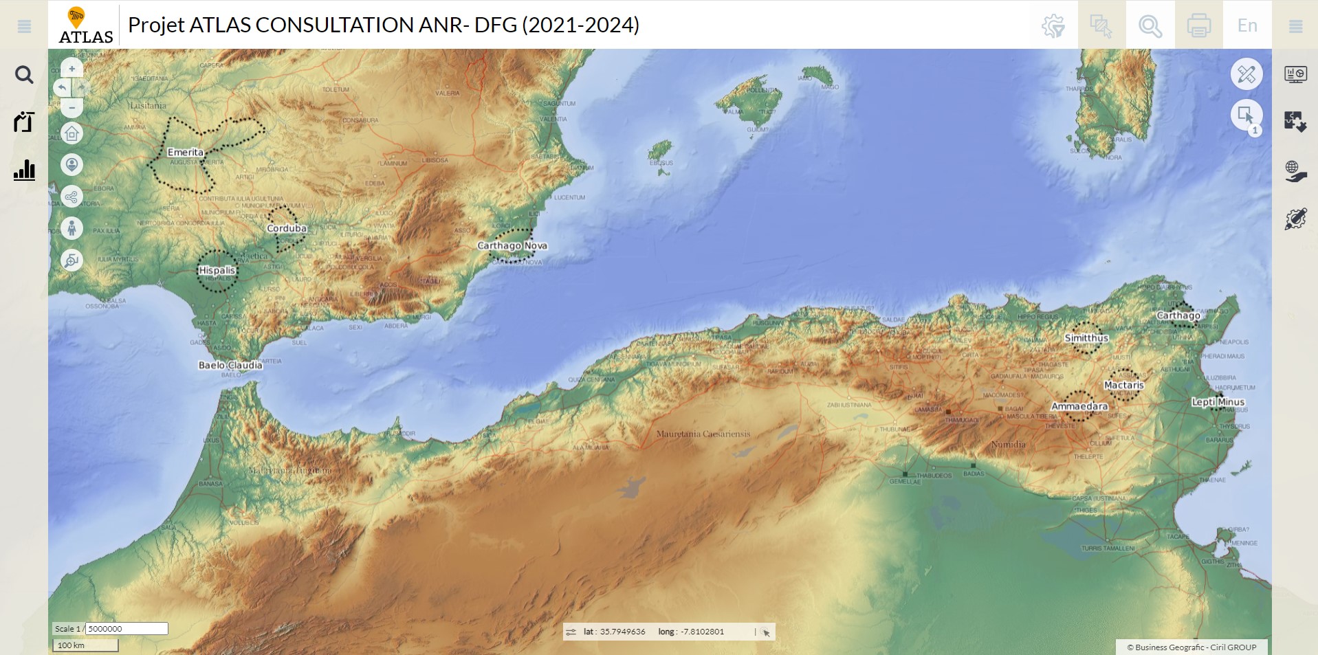
Coordinator: F. Pouget // Participants: P. Houten, A. Lasheras, all members of the project.