One of the objectives of the ATLAS project is the production of a travelling exhibition that will be shown at the Hamburg University Library, the National Archaeological Museum of Madrid (MAN), the Conjunto Arqueológico de Baelo Claudia Museum (Cadiz), the Casa Árabe Córdoba and the Institut National du Patrimoine (Tunis). Going beyond the strict framework of scientific research, this part of the project is more about valorisation and presentation to the public by innovative means using new three-dimensional technologies. That said, the processes implemented for such productions require a constant dialogue between specialists in ancient built heritage and the service providers responsible for the production of 3D content and the design of the immersive and interactive exhibition. The launch of this new stage officially took place this autumn and it is the French company ICONEM, specialised in the digitisation of cultural heritage sites and monuments and in the production of immersive digital experiences for the general public, which will be in charge of translating the archaeological data into 3D.
It is in this context that Titien Bartette, a doctor in archaeology from the University of Aix-Marseille, a specialist in ancient architecture and lapidary decoration and an expert in 3D technologies applied to cultural heritage, joined the ATLAS project team in September. His role will be precisely to ensure this dialogue, the transmission of archaeological data and their translation into three-dimensional terms, positioning himself at the hinge of these two worlds, that of the sciences of antiquity and that of advanced 3D technologies.
About the 3D modelling project
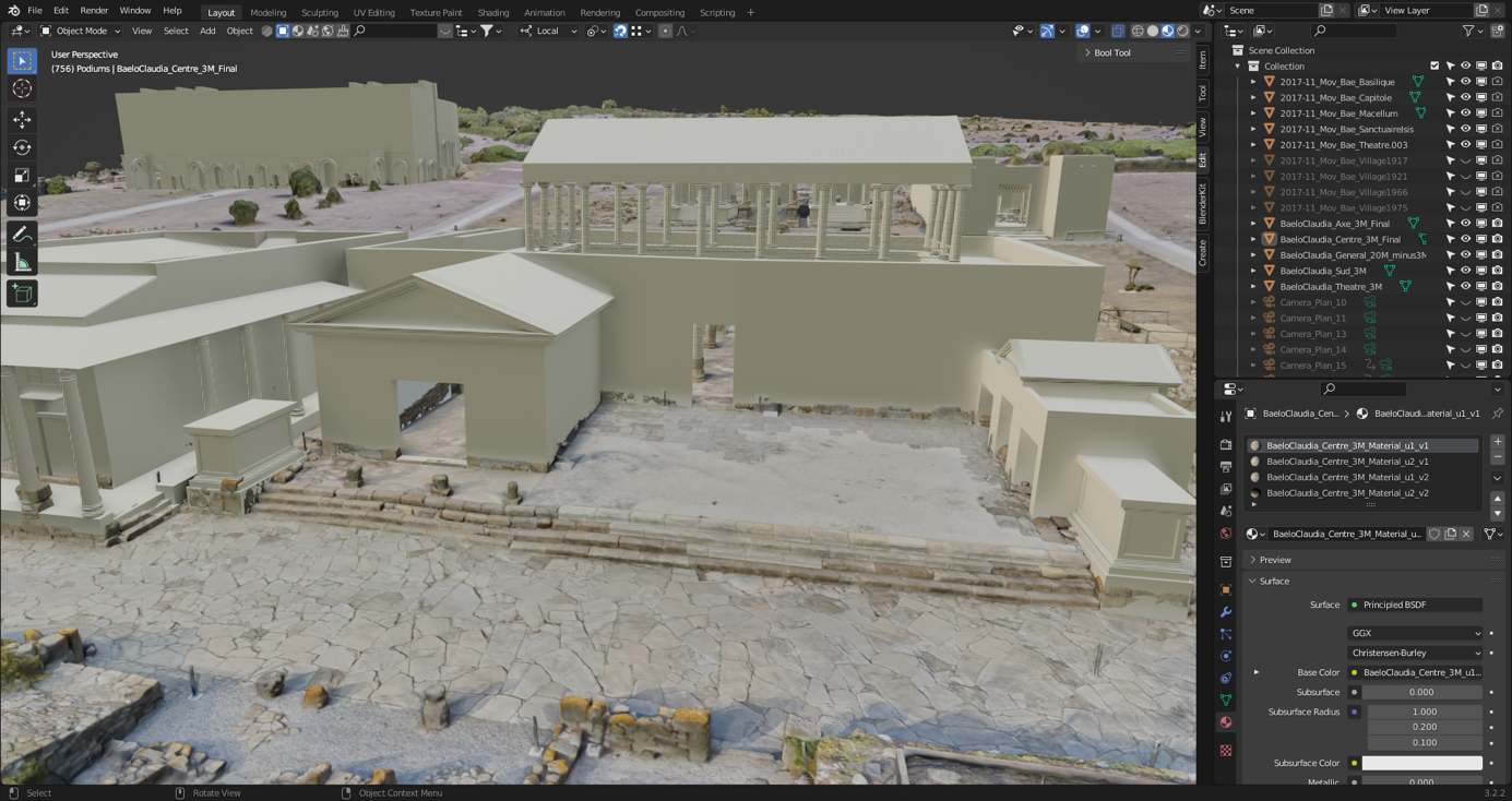
Prior to the development of the exhibition and user experiences, the project involves an important phase of three-dimensional production, namely capturing and modelling. These two digital datasets are then merged to allow for a repositioning and visualization of the rendered ensembles directly on the actual terrain. The project will focus on four cities, Baelo Claudia, Merida, Carthage and Makthar, and will highlight a number of monuments or ensembles that are emblematic of the sites or of current research.
This multi-scalar concept represents a challenge from the point of view of data management and 3D technology, since on-site recordings imply adapted procedures and methods, but the solutions implemented for modelling also differ according to the expected level of detail. Indeed, we reason and proceed differently at the scale of a city, a district or a monument. Furthermore, we are confronted with the obstacles of the heterogeneity of architectural ensembles, of the accessibility of the source data, and of the scientific discourse and the narrative aimed at in this innovative popularisation exercise. To overcome these obstacles, we have set up a meticulous production protocol adapted to the different cases.
From data to 3D models
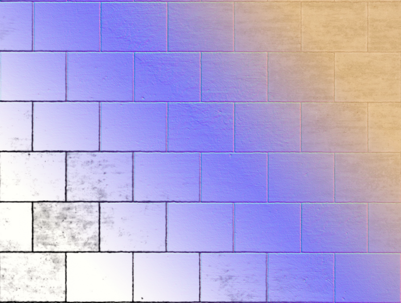
The workflow includes the preparatory phases of rendering, which are the collection of graphic data and the production of any missing data, followed by their homogenisation. In parallel, the hypotheses are compared and possibly tested on the 3D models. From this point of view, the experiment also becomes a field of experimentation on the contribution of the model to archaeological and architectural reflection. Finally, we are building up collections of references for questions of textures and realistic renderings by seeking relevant elements of comparison. This mainly concerns materials, rock types and their particular grain, but also certain decorations, attributes and even site-specific environments.
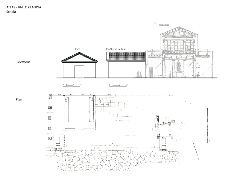
As previously mentioned, the 3D production itself concerns, at this stage, two distinct aspects: the digitisation of the sites and the 3D restitution. The digitisation is done by drone and/or on the ground depending on the object in question. Generally, it is the combination of these two approaches that guarantees a satisfactory level of detail for global coverage. The 3D modelling work is therefore the translation into volume of the traditional architectural graphic documentation, to scale and detailed. For undocumented ensembles, there is therefore a prior ad hoc production of plans, elevations, sections, axonometries or evocations, depending on the case.
The amount of three-dimensional data produced in this context is considerable, and therefore requires adequate optimisation processing to guarantee its proper management and interoperability. In practice, optimisation consists of a series of processes that make the model suitable for multiple uses in different applications and media, such as animation, web, augmented reality and virtual reality. It allows the creation of a set of rich realistic textures at a lower cost in terms of data and file size. This is the ultimate step in the production of 3D models, the creation and application of accurate textures that faithfully reproduce the materials, their appearance and behaviour (colour, reflectivity, roughness, etc.).
What’s next?
At this stage, the Baelo Claudia dossier is already in production and is due to be completed shortly. It focuses on the transformation of a district over the centuries, highlighting the processes of reuse and reoccupation of spaces in late antiquity. We will see how the public monuments of the Early Empire were able to change over time. Baelo Claudia was previously digitised in its entirety by ICONEM in 2017, as part of the Bringing the City of Baelo Claudia to Life project (see video below) celebrating the centenary of the excavations carried out there. The current work will thus enrich an already existing 3D graphic dataset.
In parallel, the first steps have already been taken on the Mérida dossier, which should be completed by the end of the year. This time, we will focus on one or two emblematic monuments of late antiquity and on their insertion in the urban fabric. As the modelling progresses, the questions of graphic production will begin to arise, i.e. the scripting, production of deliverables and their deployment. In the meantime, the workshop on 9 and 10 November at the University of La Rochelle will be an opportunity to present in more detail the methodology implemented and the state of progress through certain examples.