Augusta Emerita, capital OF THE OUTERMOST WEST
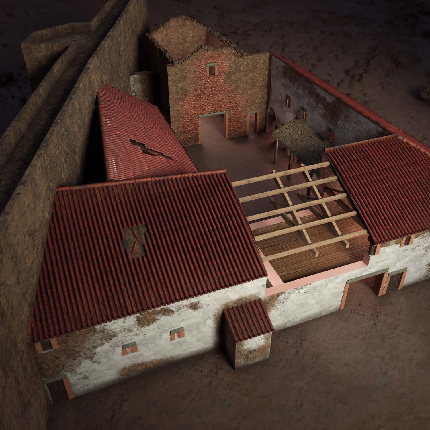
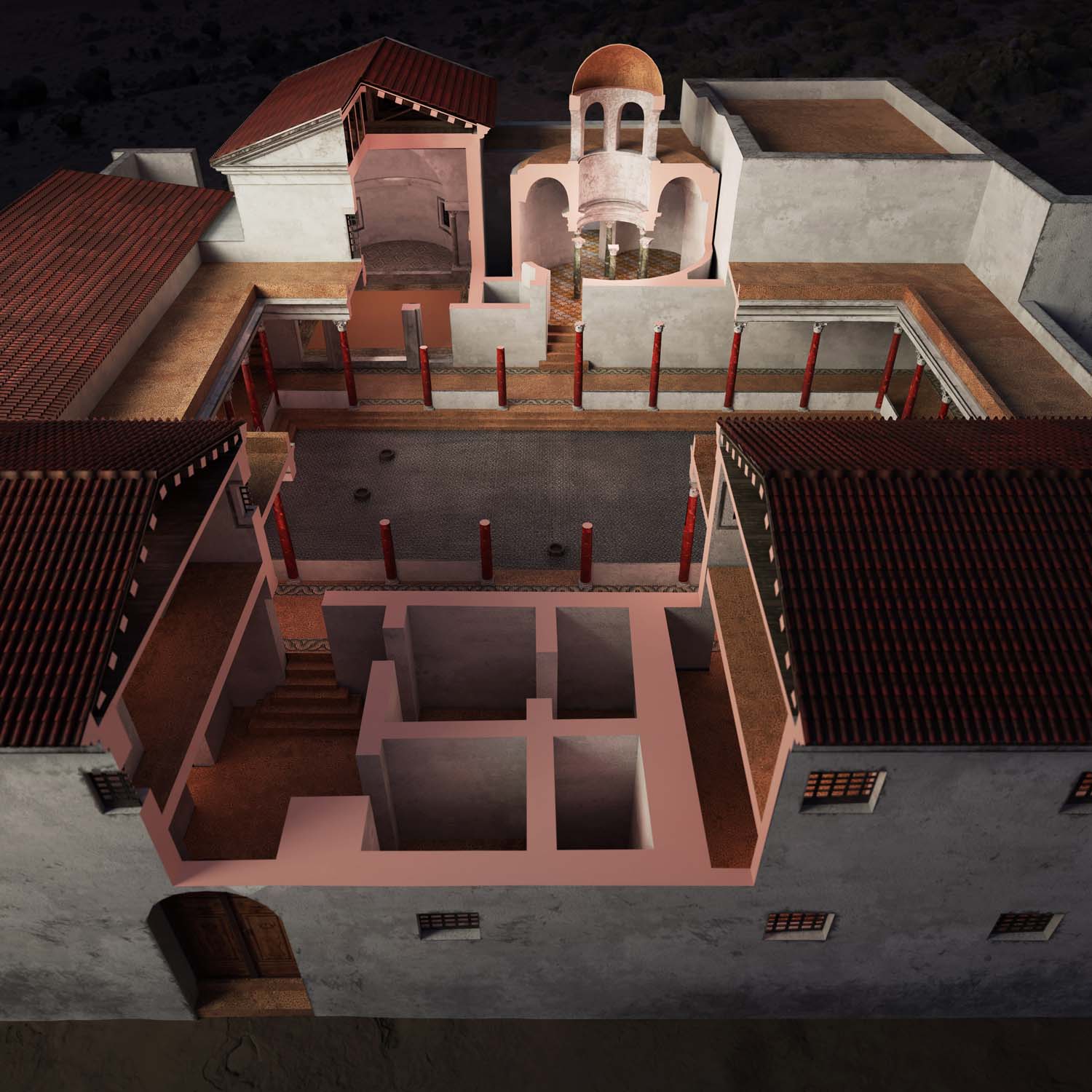
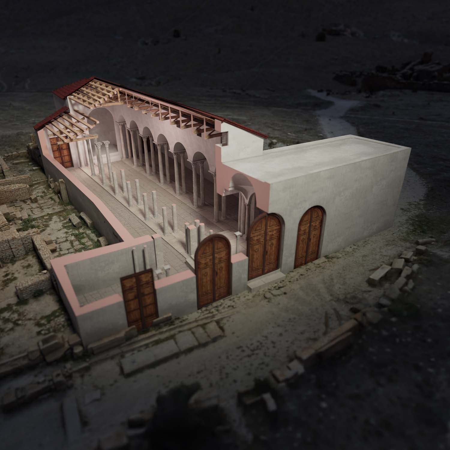
Following Diocletian’s administrative reforms, Augusta Emerita was designated as the capital of the dioecesis Hispaniarum. Emerita was the westernmost provincial capital of the empire, and the administrative centre of a territory that covered an area of almost 20,000 km2. At the time that Isidore of Seville dominated intellectual and cultural discourse, and Toledo’s position as capital of the Catholic Visigothic empire was being consolidated, the bishops of Emerita recalled its singularity: a foundation ex novo by Augustus. Its monuments were a testament to this, with marble temples and porticoes, which in the 5th century began to be occupied by private dwellings; a theatre, amphitheatre and circus – which was still in use in the 5th century! – when the north-eastern suburbs of the city underwent Christian urbanisation. It was here that the Basilica of Santa Eulalia was built, dedicated to memorial worship and pilgrimage, where the people of Emerita buried their dead ad sanctam. Around 200 m to the east of the complex, a xenodochium was built to care for the sick and pilgrims. The so-called Vitas Sanctorum Patrum Emeretensium included an indeterminate number of churches and monasteries; according to the records of the general councils in Toledo, the metropolitans of Mérida were, if not in first place, at least among the first three to sign the decisions. The bishop’s activities were not limited to ecclesiastical matters, but also included the construction of secular buildings. In particular, he was involved in the restoration of the bridge over the river Ana (now Guadiana) and the town walls. After the conquest of the city in 713, the “wonders” of Mérida continued to impress poets and travellers with their beauty.
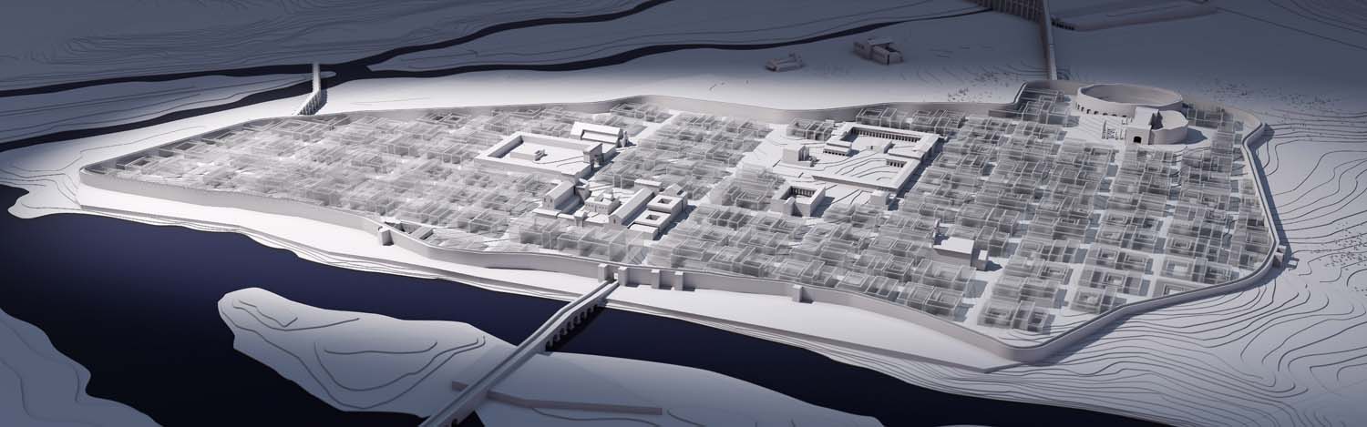
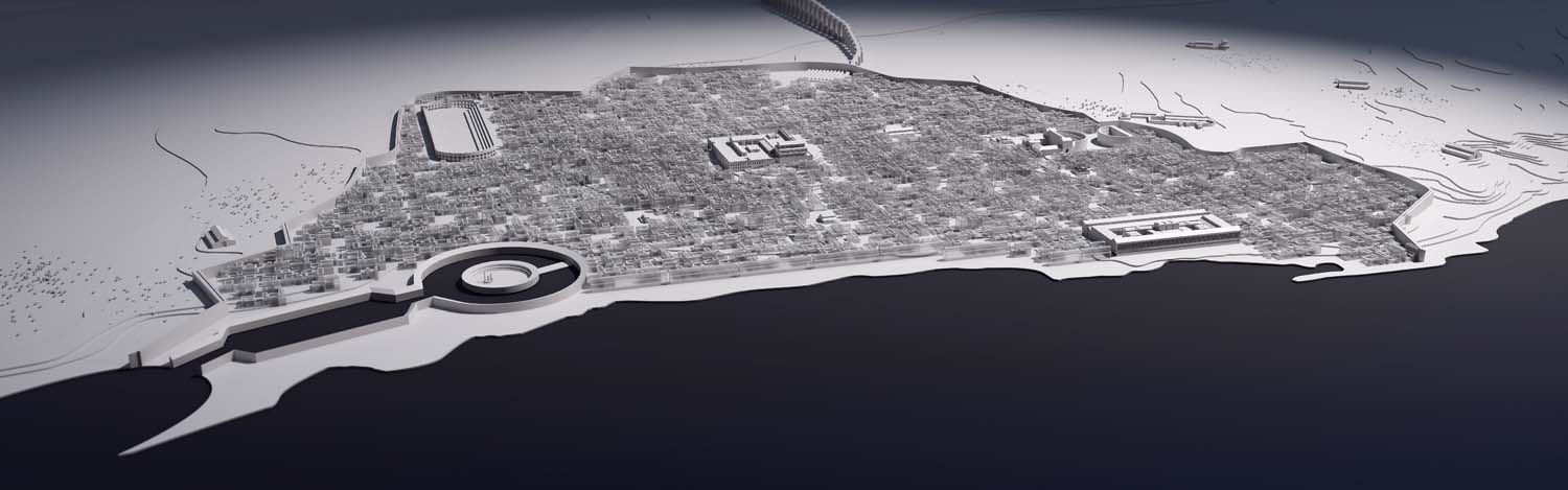
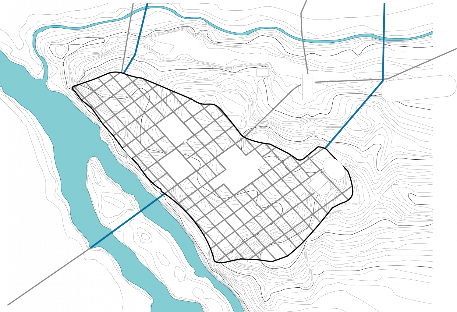
“Invisible Cities” reveals the difficulties involved in representing an object of which only a few remarkable features are known. The position of the main monuments, the limits of the city, the plan of the main streets and access roads all help us to sketch out the image of the urban layout, which normally are beyond our grasp.
The map of Mérida gives an idea of how the city was organised and helps to put the main late monuments into context. Nevertheless, this representation must be seen as the expression of a tentative hypothesis, which can be captured with the immaterial nature of the rendering. The choice of transparency for the built-up areas, of which the exact nature still escapes us, makes it possible to signify urban density while avoiding inventing buildings and urban planning that are merely the fruit of our representations or imaginations.
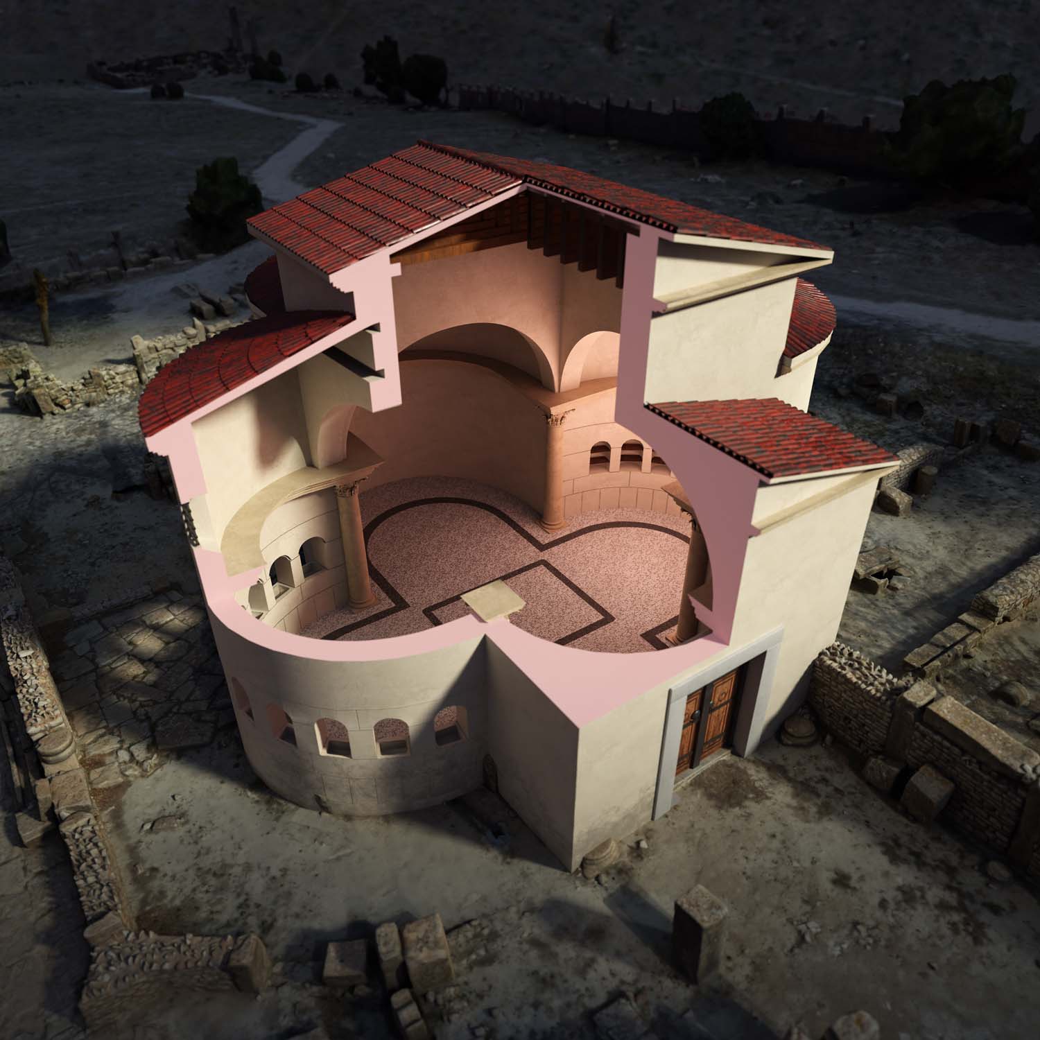
The 5th century was a turning point in the history of Mérida, but the archaeological data available usually provides only chronological ranges for the construction, use or abandonment of monuments, which seldom perfectly coincides with the 5th century. The choice whether to represent, or not, certain monuments at this given time has therefore involved scientific arbitration.
© Iconem (T. Bartette)
Suggested bibliography
Alba Calzado, Miguel, Sastre de Diego, Isaac (2020), « Mérida tardoantigua: hacia un nuevo modelo de ciudad. Under the martyr’s influence: Merida during Late Antiquity (iv–vii d. C.) », in André Carneiro, Neil Christie et Pilar Diarte-Blasco (éd.), Urban Transformations in the Late Antique West. Materials, Agents, and Models, Coimbra, Imprensa da Universidade de Coimbra, coll. « Humanitas suppl. », pp. 203–230.
Read online
Arce, Javier (2002) Mérida Tardorromana (350-580 d. C.), Mérida: Museo Nacional de Arte Romano, coll. « Cuadernos Emeritenses » (22).
Notice Museo Nacional de Arte Romano
Panzram, Sabine (forthcoming), « Augusta Emerita, Hauptstadt der Lusitania und der Dioecesis Hispaniarum – Eine Neugründung ist erfolgreich », in Christoph Eger et Trinidad Nogales Basarrate (éds.), Augusta Emerita. Roms Metropole in Spanien, Mainz am Rhein, Nünnerich-Asmus Verlag, coll. « Xantener Berichte » (47).